|

|
Walking
Scotland
End
to End
|

|
Long
Distance Walking Routes
-
from the Scottish Borders
via
Glasgow and Fort
William to Cape Wrath
- Coast
to Coast across
Scotland
1. Scotland
End to End - Route Maps
2.
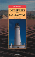
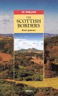
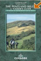
Scottish
Borders (  Thumbnail
Gallery
) Thumbnail
Gallery
)
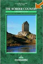
3. Southern
Upland Way 
8.
Fort William
to Cape Wrath
(  Thumbnail
Gallery ) Thumbnail
Gallery )
9. Great
Glen Way
This long distance walking route
covers 73 miles ( 117km )
from Fort William via Loch Ness to
Inverness.
It takes 5 to 6 days to walk the whole route.
However
it may be done in short sections over a longer period.
10. Ayrshire
Coastal Path
(  Thumbnail
Gallery ) Thumbnail
Gallery )
An
‘Ayrshire Coastal path’ linking Glenapp Kirk with
Skelmorlie
along the
shoreline of the Firth of
Clyde.
The path connects 101 miles of beaches and cliff-tops
along
the Ayrshire coast.
It is hoped that it will be linked with
the Southern
Upland Way
and the West
Highland
Way to create a long distance pathway across Scotland.
11. Fife
Coastal Path
A footpath that runs from
North Queensferry to Tayport at the Tay Bridge.
The path runs
for 82 miles ( 132km ) along the coastline of Fife
passing through many
seaside villages.
It takes around six days to complete.
12. Speyside Way
A
route that follows the River Spey through some of the
most beautiful scenery of Banffshire,
Morayshire and
Inverness-shire. It begins in Aviemore and ends at Buckpool harbour in
Buckie
- a distance of some 65 miles.
There is a spur
leading to Tomintoul bringing the total distance to some 80
miles ( 122 km ).
The main walk is a
57-mile route from Portavadie on Loch Fyne
in the West to Inveruglas on
Loch Lomond in the East.
15. Cateran
Trail
A scenic circular walking
route of some 64 miles ( 103km )
in the Heart of Perthshire
and the Angus Glens.
16.
Borders Abbeys Way
A route linking
the four abbeys of Kelso, Jedburgh, Melrose and Dryburgh.
It
includes the towns of Hawick and Selkirk.
The full route is some 68
miles ( 109km ) in length.
A 62
mile ( 100km )
trail between the Scottish
Borders town of Melrose and Lindisfarne ( Holy Island )
off the coast of Northumberland in England.
18.
North Highland Way
This
proposed coastal route would run for 115 miles from John O’Groats
to
Cape Wrath in the north-westerly tip of Sutherland
taking in Dunnet
Head, Holborn Head, Strathy Point and Skerray.
One
of the features of the far north is the outstanding sea-cliff
landscape.
19. Firth
of Clyde Rotary Trail
The
Firth o Clyde Rotary
Trail ( FoCRT ) runs from the Mull of Galloway
to Milngavie via Greenock and the Erskine Bridge.
The route
comprises the Mull of Galloway Trail,
The Ayrshire Coastal Path and the
Clyde Coastal Path.
The
route links the Ayrshire Coastal Path
to the
West Highland Way
to complete a designated long distance trail from
Mull of Galloway
at the southernmost tip of Scotland to the most
northerly at Dunnet Head.
20. John
Muir
Way
A
long distance path starting on the east coast in Dunbar,
the birthplace
of John Muir, running through the Central Belt of
Scotland
to Helensburgh on the Firth of Clyde in the West.
This famed coast-to-coast walking and cycling path spans central Scotland,
linking Helensburgh on the Firth of Clyde with John Muir’s birthplace of Dunbar on the Firth of Forth.
One of Scotland’s Great Trails, the route encapsulates the deep love that Muir, the writer, explorer and a
conservationist who founded the US National Park system, had for the great outdoors.
Tackle it in one 134 mile ( 216 km ) odyssey - or split it up into shorter sections
as you take in beaches and coastline, castles, lochs, hills, woodlands, old railway lines, canal
towpaths, Roman forts, the Antonine Wall and nature-packed habitats.
21. Annandale
Way
A
literary trail from Moffat to Newbie Barns on the Solway Coast.
22. Berwickshire
Coastal Path
From
Cockburnspath to Berwick upon Tweed.
23. Dava
Way
This
trail from Granton on Spey to Forres follows Victorian
highland ailway lines.
24. Fomartine
& Buchan Way
A
cultural trail from Dyce to Fraserburgh and Peterhead.
25. Kintyre
Way
A
trail with seaviews from Tarbet to Southend.
A
maritime trail from Forres to Cullen.
A
trail along the river through Burns country from its source in Glenbuck
Loch
to its outlet to the Firth of Clyde at the harbour in Ayr.
28. Three Lochs Way
A
trail around Loch Lomond from Balloch via the Arrochar Alps to
Inveruglas.
29. West
Island Way
A
trail around the Isle of Bute from Kilchattan Bay to Port Bannatyne
30. Strathkelvin
Railway Path / Thomas Muir Trail:
31. East Highland Way
The
East Highland Way is a new long distance walk that connects Fort William
with
the ski and mountain resort of Aviemore.
It
also connects with other long distance walks:
the West Highland Way, Great
Glen Way
and Speyside
Way.
32. Arran
Coastal Way
- a challenging and rugged long
distance route running for some 100km
around
the coastline of the Isle of Arran
This challenging-yet-rewarding 65-mile ( 105 km ) circular route showcases the
best of Arran’s rugged coastal charms with a smattering of history thrown in.
It is ideal for a week-long walking holiday but equally can be broken down into smaller sections to be
enjoyed on a series of day trips.
The stretch from Brodick to Sannox ( 7.5 miles / 12 km ) offers the option of passing through Merkland Wood or,
depending on your fitness level, climbing to the summit of Goatfell ( 2,867ft / 874m ).
Sannox to Lochranza ( 9 miles / 14.5 km ), meanwhile, is often hailed as a favourite section by walkers keen to
spot marine life such as dolphins and basking sharks.
Further along the route, Whiting Bay to Lamlash ( 6 miles / 10 km ) takes in Glenashdale Falls, as well as passing
a Viking grave and Iron Age hill fort.
33. Stevenson
Way
- A wilderness walk of over 230 miles
( 370km ) across the heart of Scotland.
based on the book "Kidnapped" by
Robert Louis Stevenson
34. Great
Trossachs Path
- A 30 mile long route running
between Callander in the east and Inversnaid
on Loch Lomond in the west, taking in scenery, loch shores, hill
slopes,
mature woodlands, wildlife and history.
The
Scottish National Trail
This uses existing long distance
trails and established walking routes
to link Kirk Yetholm in the
Borders with Cape
Wrath
in
the north west corner of Scotland.
Trail
Etiquette:
References:
Recommended
Books:
Maps of
Scotland:
|