|
Bearsden & DistrictMugdock Country Park |
  |
| |
Bearsden & DistrictMugdock Country Park |
|
Photographs of Mugdock Country Park
- partly traversed by the West Highland Way
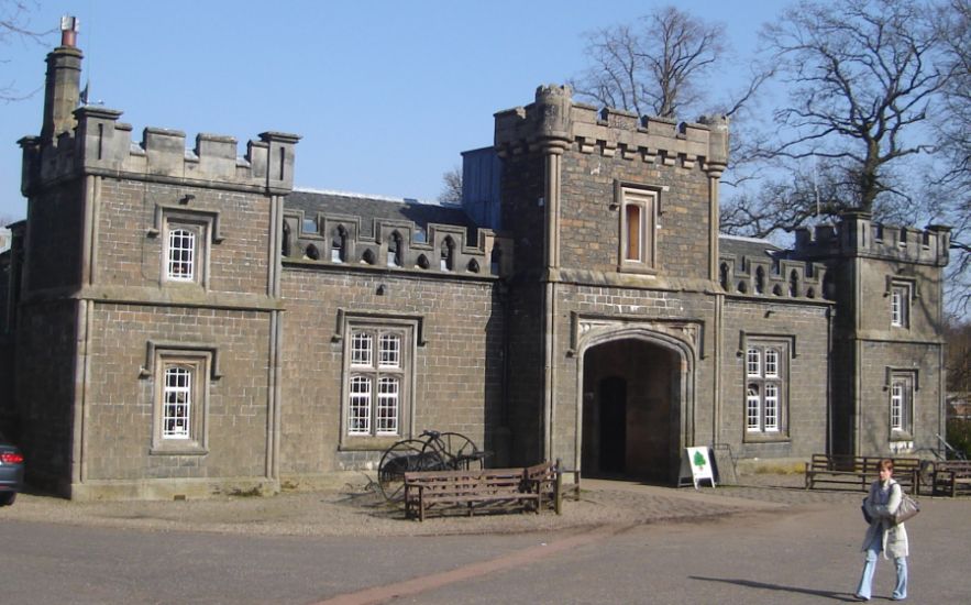 Craigend
Stables
|
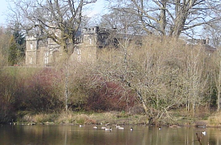 Craigend
Stables
above Craigend Pond |
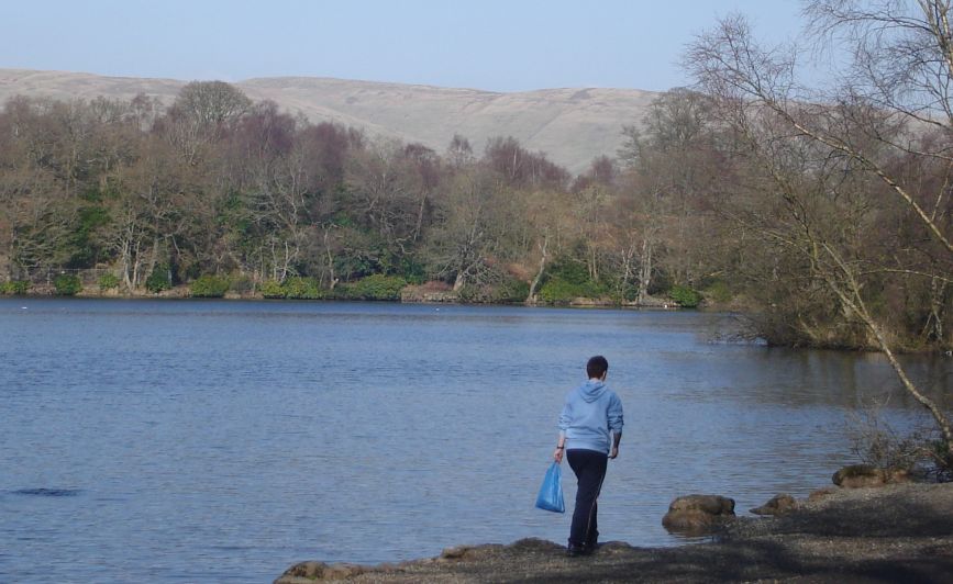
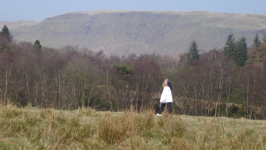 Campsie Fells
from Mugdock Country Park |
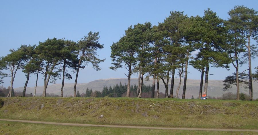 Scots
Pine Trees
in Mugdock Country Park |
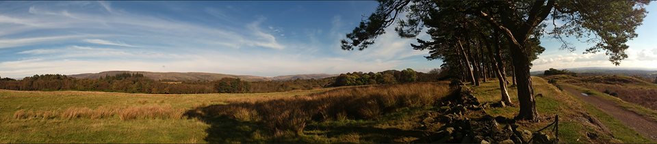 Khyber
fields
in Mugdock Country Park |
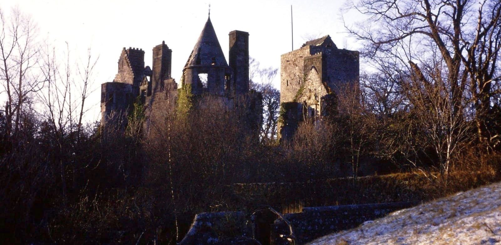
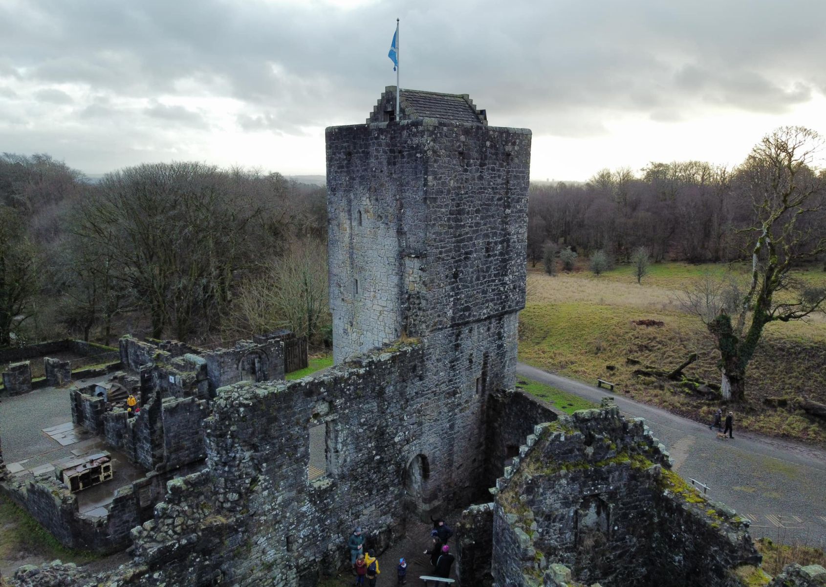
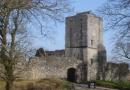
 Mugdock
Castle
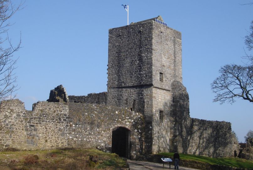
Mugdock Castle was the stronghold of Clan Graham. The original castle was built in the mid-14th century. It comprised four towers around a courtyard with high walls. The main gate was in the middle of the south wall. The castle stood on a mound of volcanic rock on the edge of Mugdock Loch. |
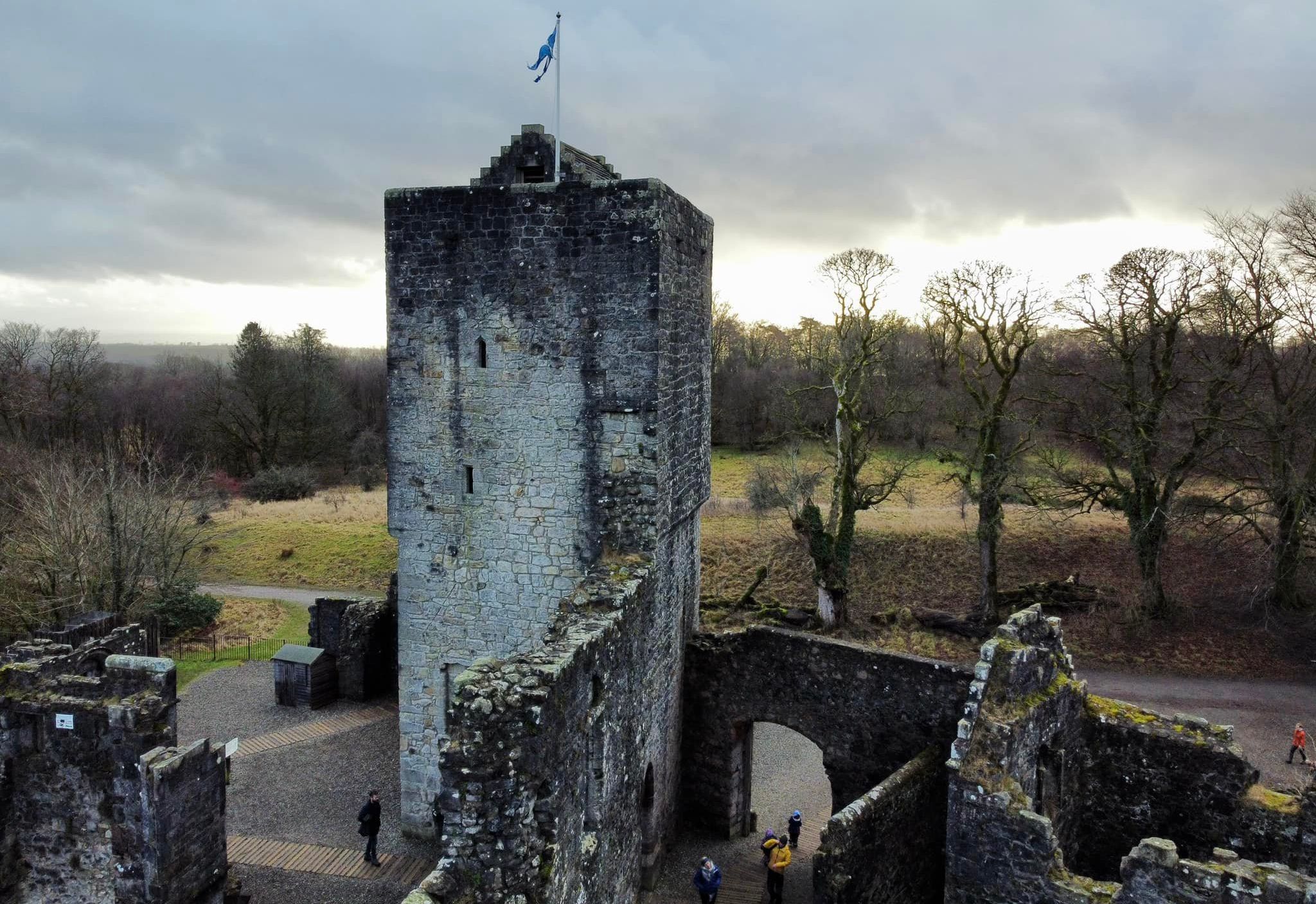
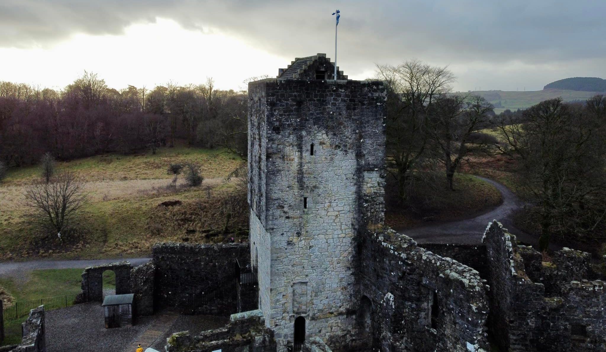
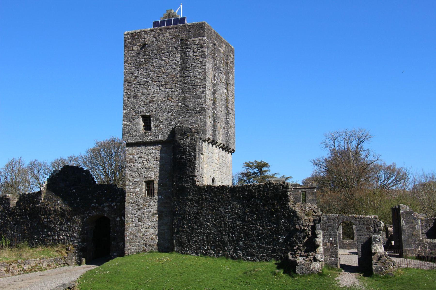
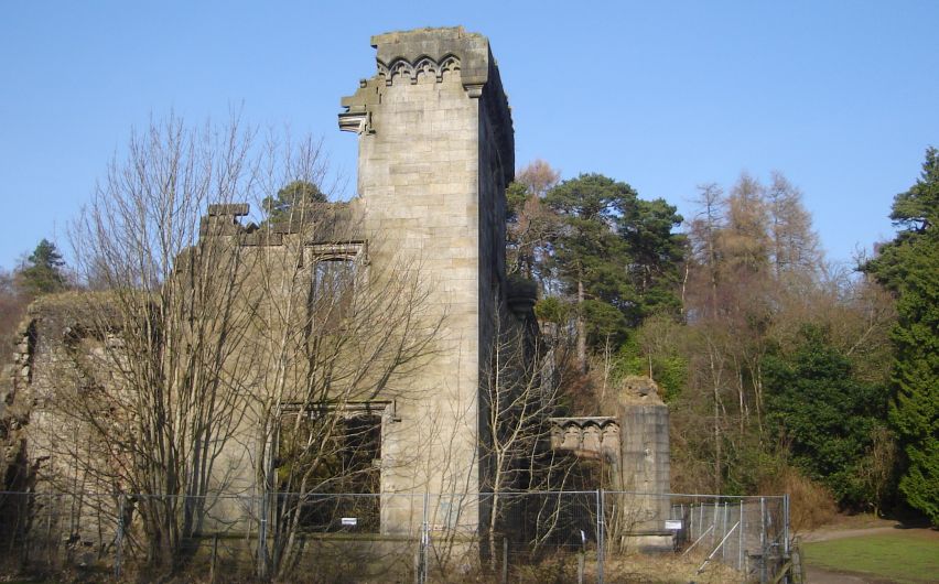
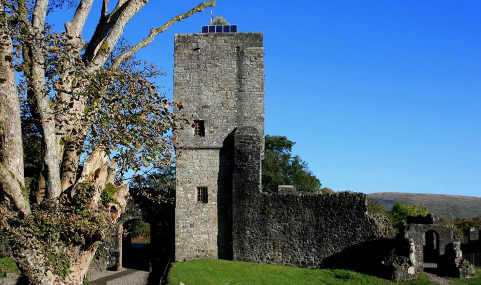 Mugdock
Castle
The south west tower, connecting curtain wall, and the remains of the north west tower - the remains of the original stone castle that was completed in 1372. |
|
now demolished |
|
now demolished |
|
|
|
|
|
|
|
|
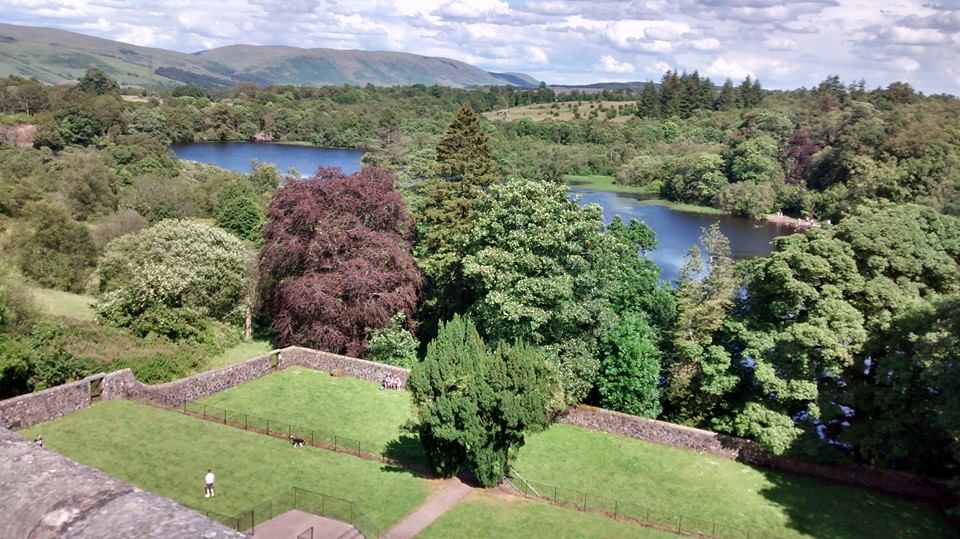 View
from Mugdock Castle
|
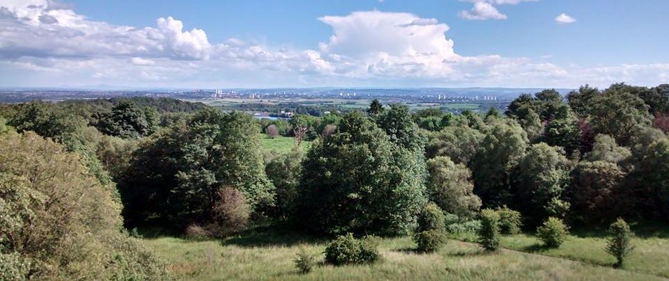 View
from Mugdock Castle
|
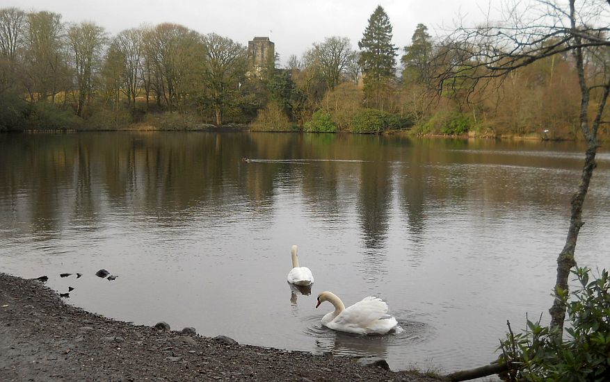 Swans
in Mugdock Loch
beneath Mugdock Castle |
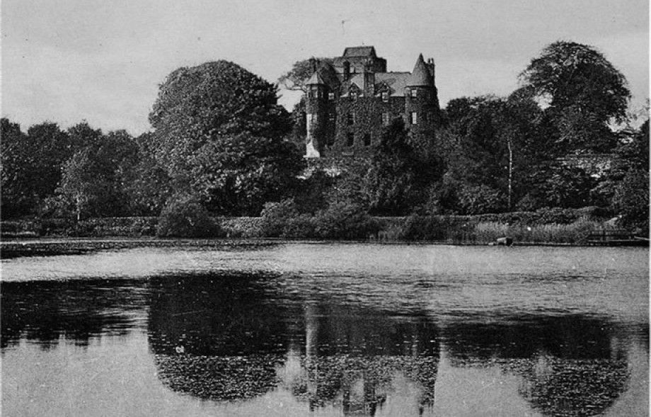
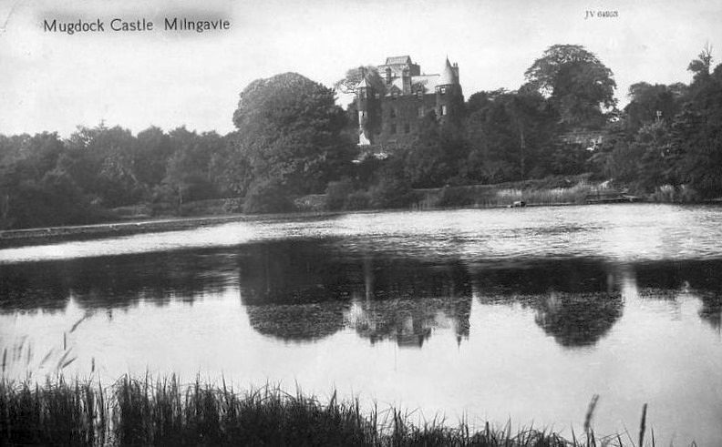 Mugdock
Castle - old photo
|
 Mugdock
Loch
|
 |
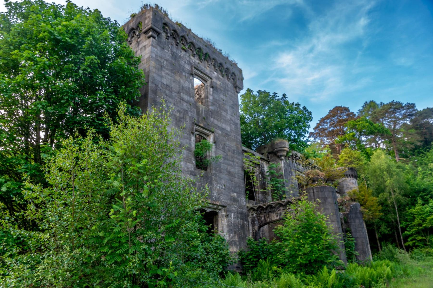 |
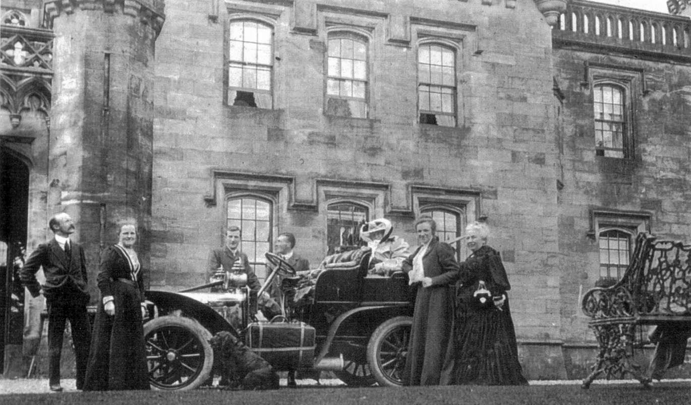
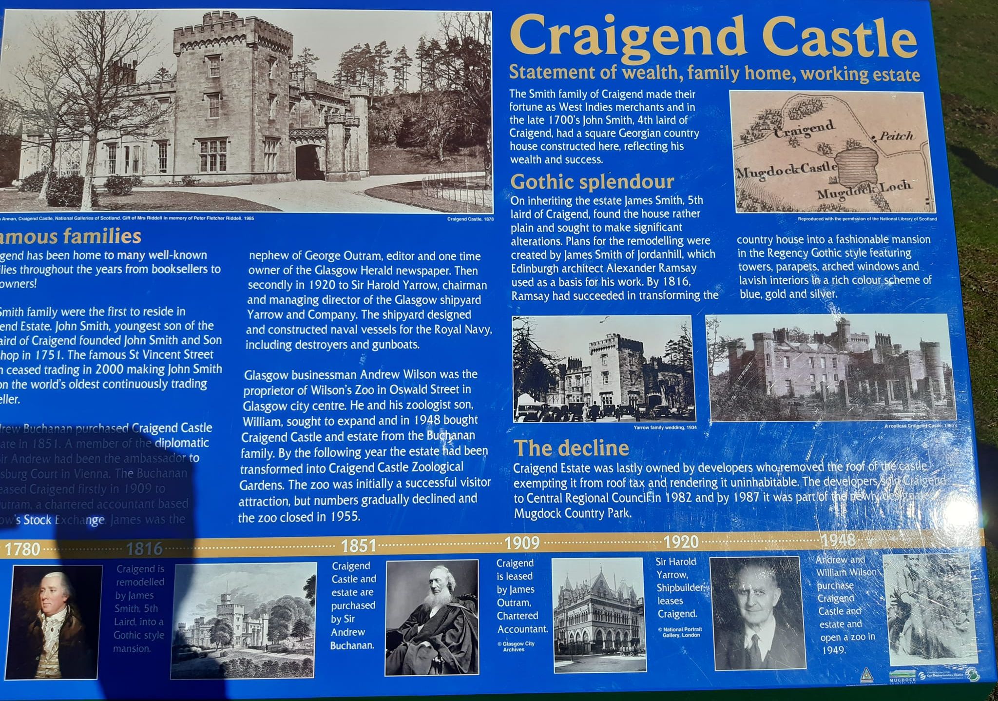
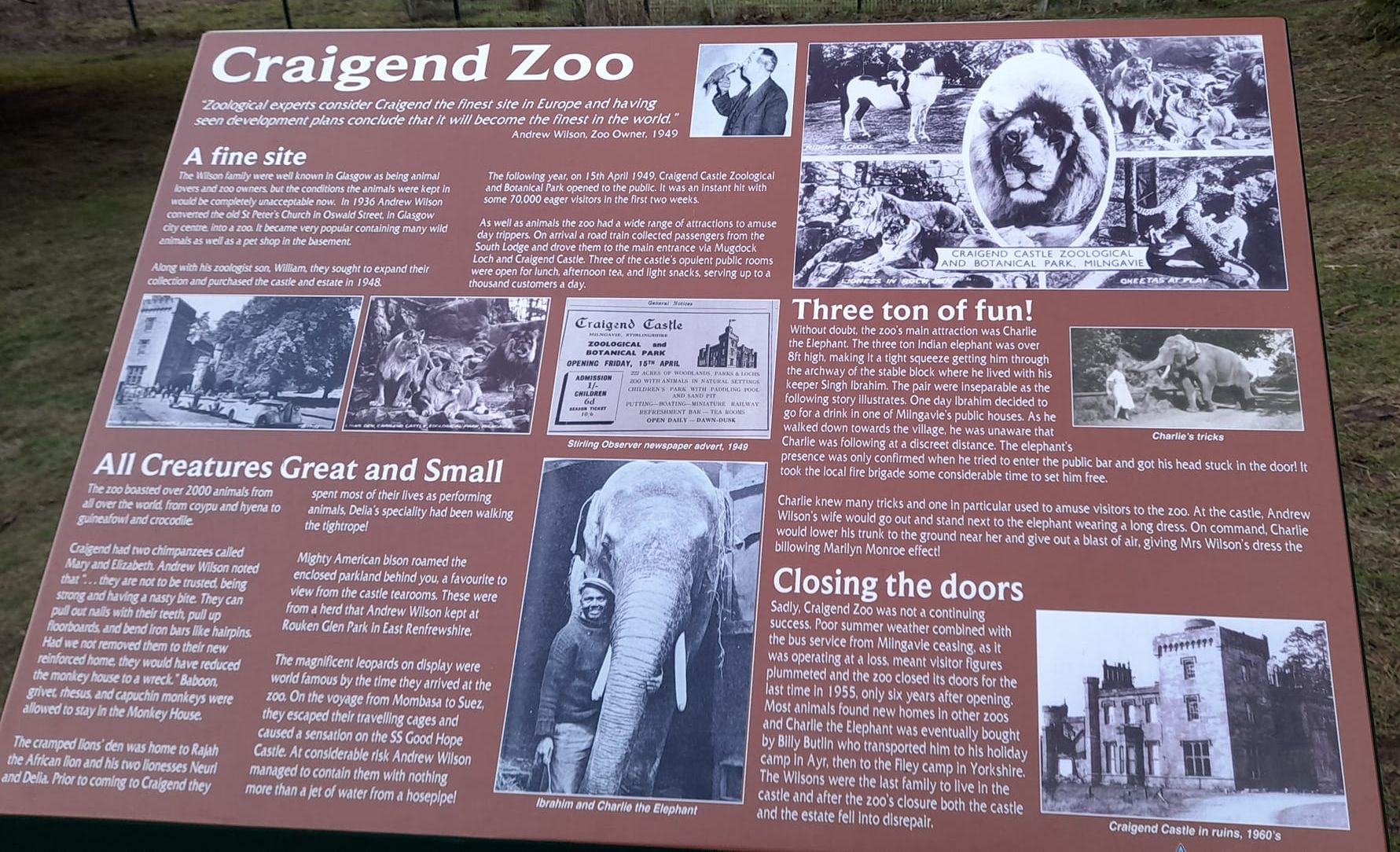
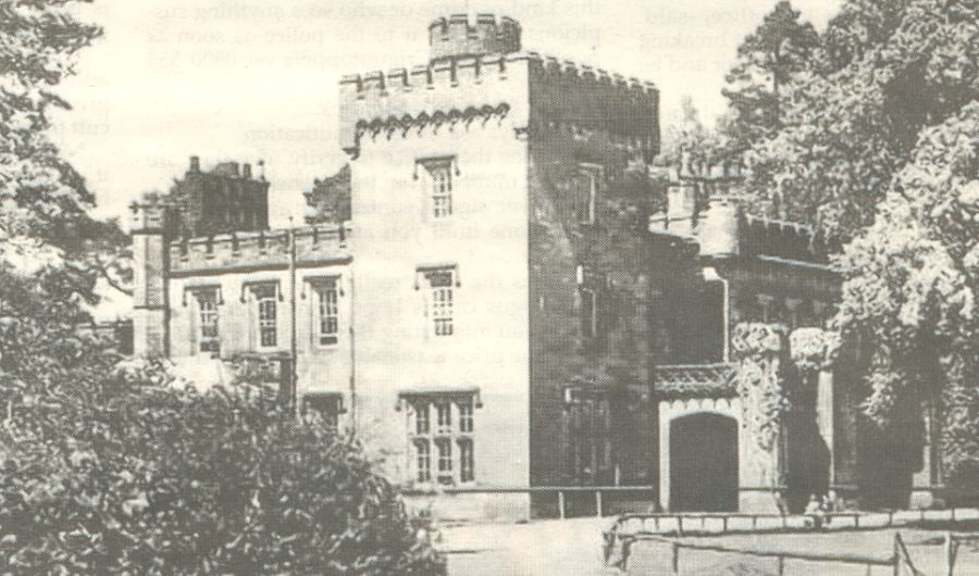 Craigend
Castle as it was in the
1950s
A plain house was originally built by John Smith ( of John Smith & Son, booksellers ). His son, James, subsequently incorporated this house in the ornate mansion shown in the photograph. This mansion was designed by Alexander Ramsay in what is described as Regency Gothic style. |
|
|
|
|
|
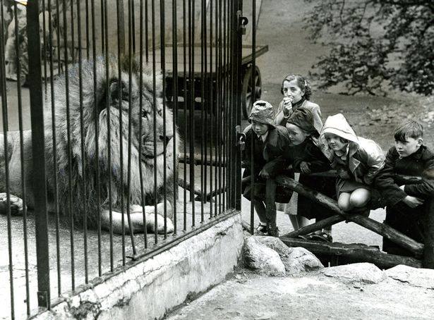
William Wilson and his son, the proprietors of a miniature zoo in Oswald Street, opened a new zoo at Craigend in 1949 with various exotic creatures including an elephant, lions, monkeys and crocodiles. It failed to attract significant numbers of visitors and closed in 1954. |
|
|
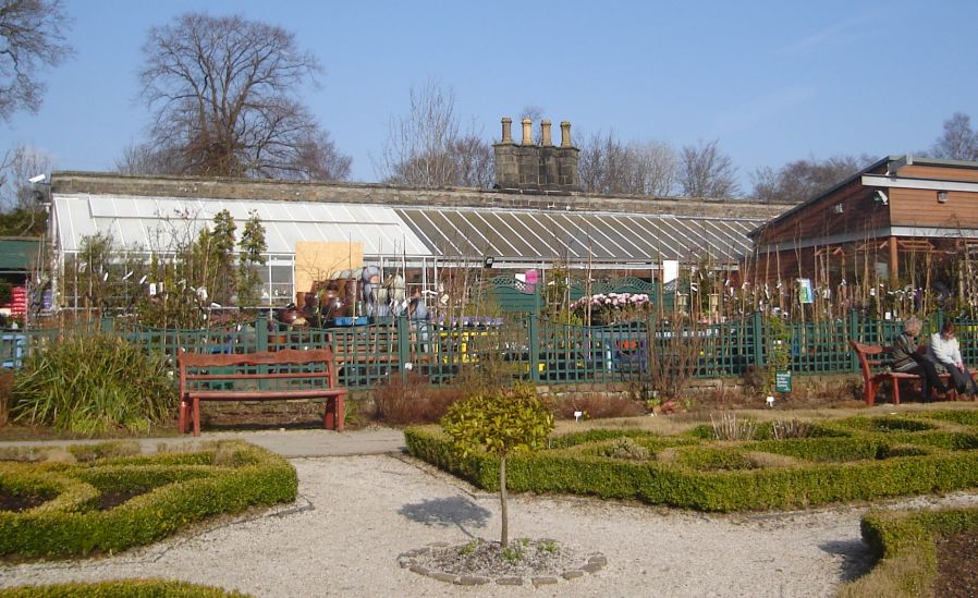 Victorian
Walled Garden
|
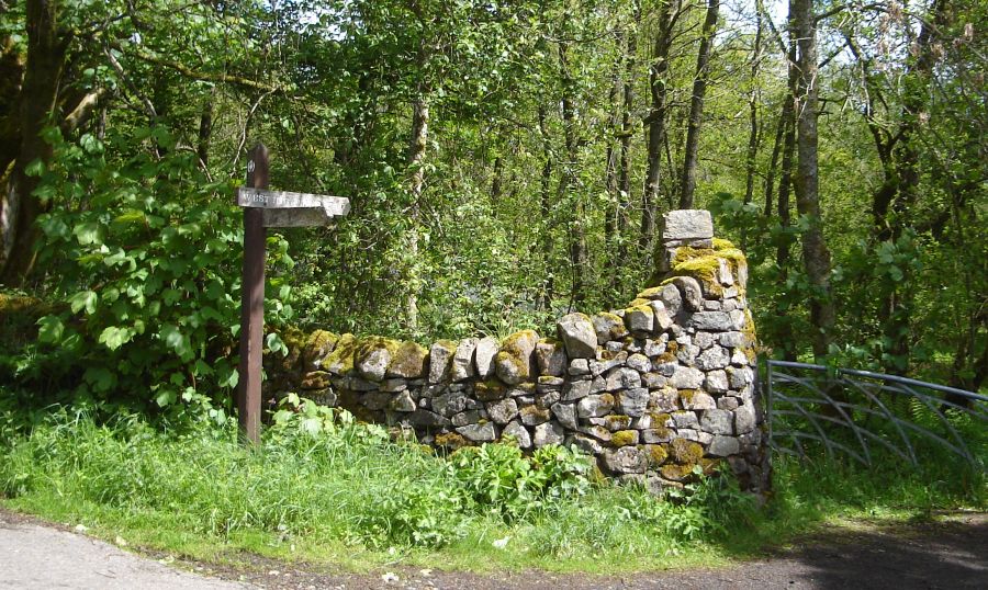 West Highland Way
signpost
at exit from Mugdock Country park at the Khyber Pass |
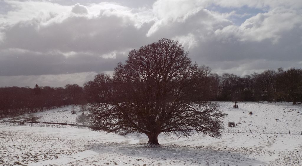
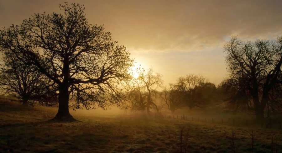 Winter
sun in Mugdock Country Park
Photo by Rick Adam ( https://www.flickr.com/photos/rickadam/6314078923/ ) |
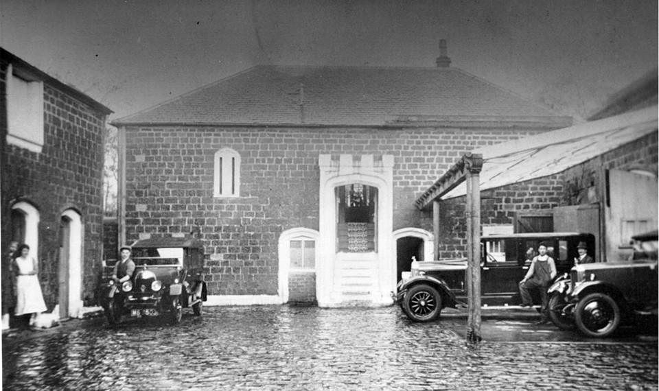 Old
photograph of the courtyard
in Mugdock Country Park |
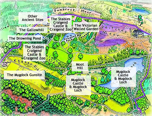
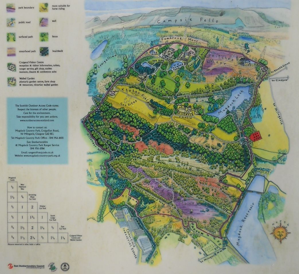 Map of
Mugdock Country Park
( Note:- Click here or on above for large format copy ) |
 Map of
Mugdock Country Park
( Note:- Click here or on above for large format copy ) |
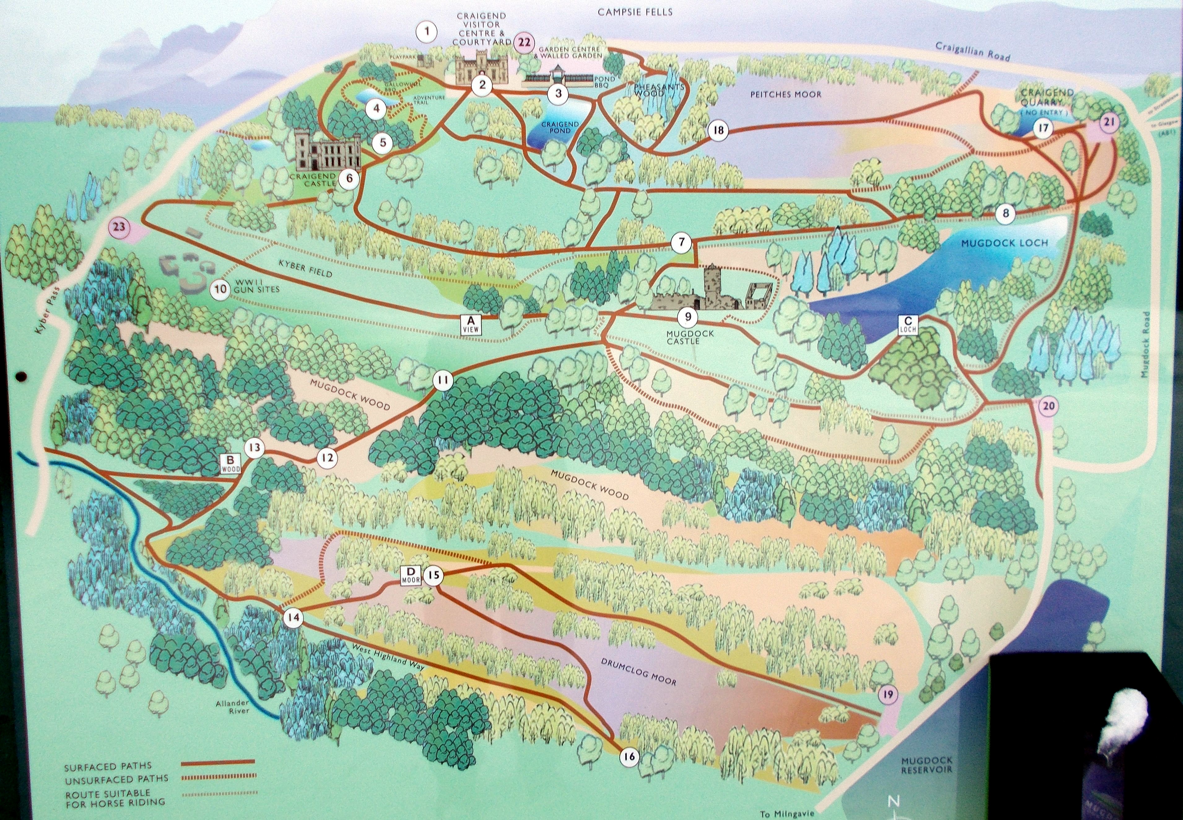
 Map of
Mugdock Country Park
|
 Map of
Mugdock Country Park
|
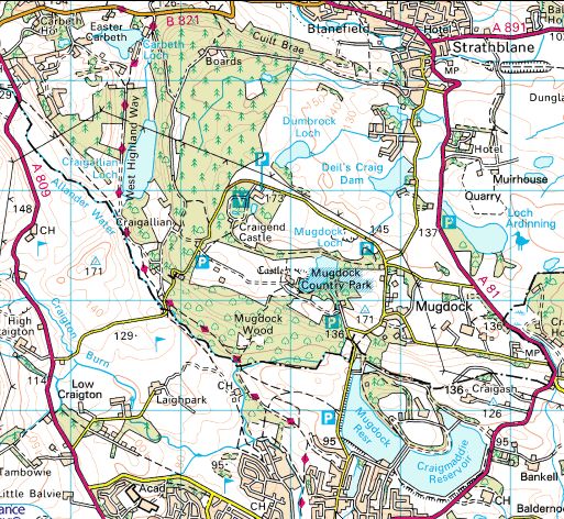 Location
Map for Mugdock Country
Park
|
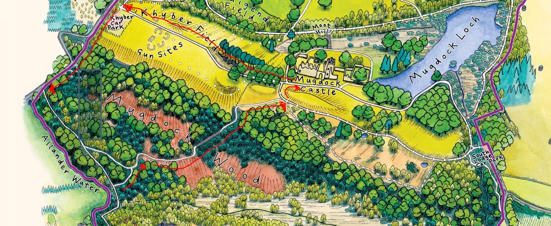
 Map
and Walking Route for Mugdock
Country
Park
|
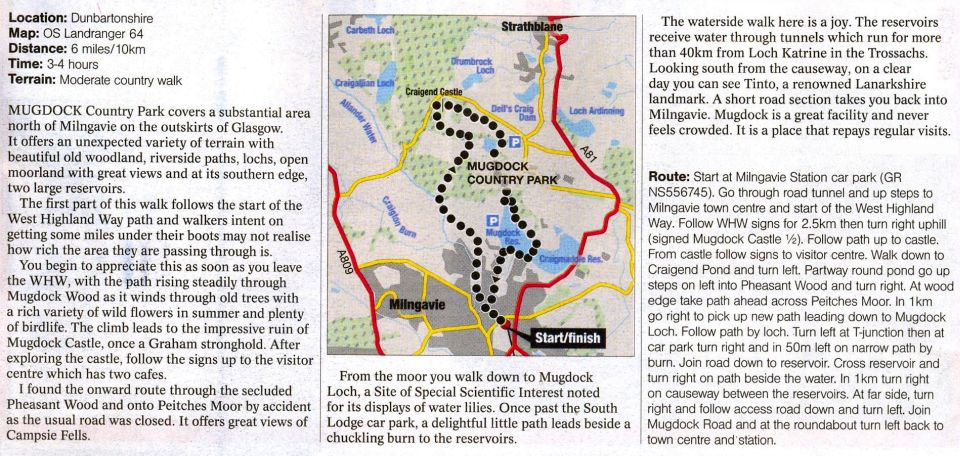
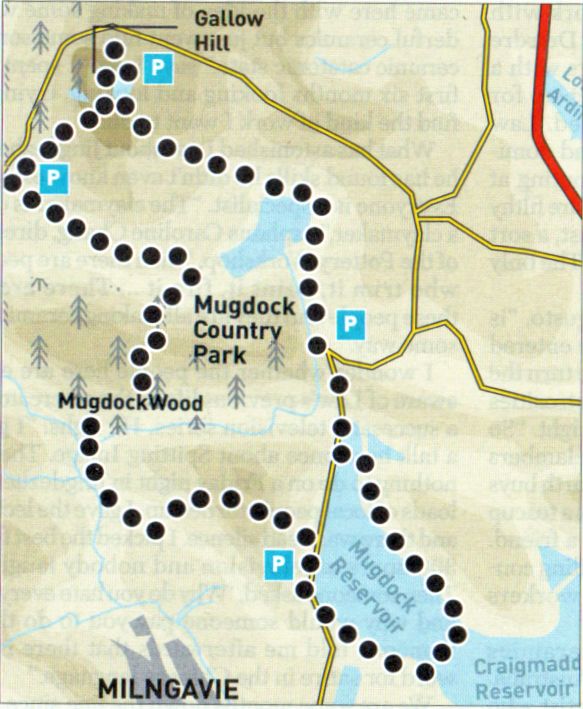 Route
Map for Mugdock Country Park
& Mugdock Reservoir |
MUGDOCK COUNTRY PARK WALK - ROUTE DESCRIPTION:
MUGDOCK COUNTRY PARK & MUGDOCK RESERVOIR WALK - ROUTE DESCRIPTION:
 ::
West
Highland Way
::
West
Highland Way 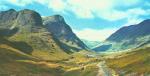 :: Dumgoyne
& Campsie Fells
:: Dumgoyne
& Campsie Fells 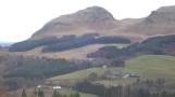
Glencoe | Ben Nevis | Knoydart | Isle of Skye | Isle of Arran
The Eastern Highlands | The Central Highlands | The Southern Highlands | The NW Highlands


Google
Analytics