  |
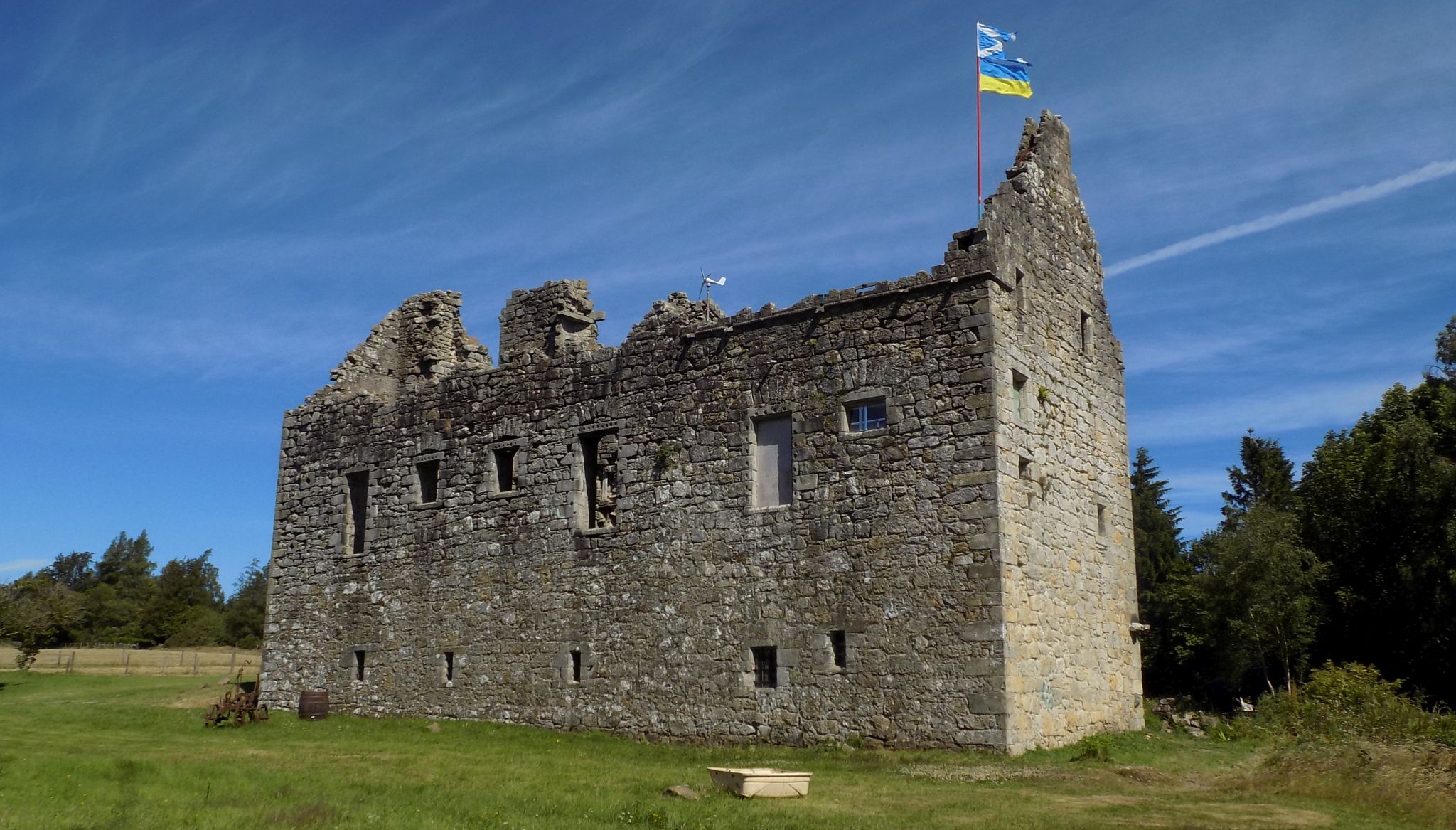
Scottish CastlesTorwood
Castle
|
  |
| |
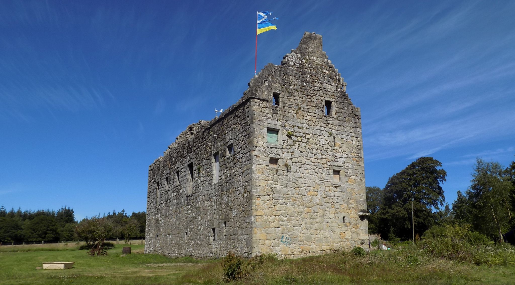
Scottish CastlesTorwood
Castle
|
|
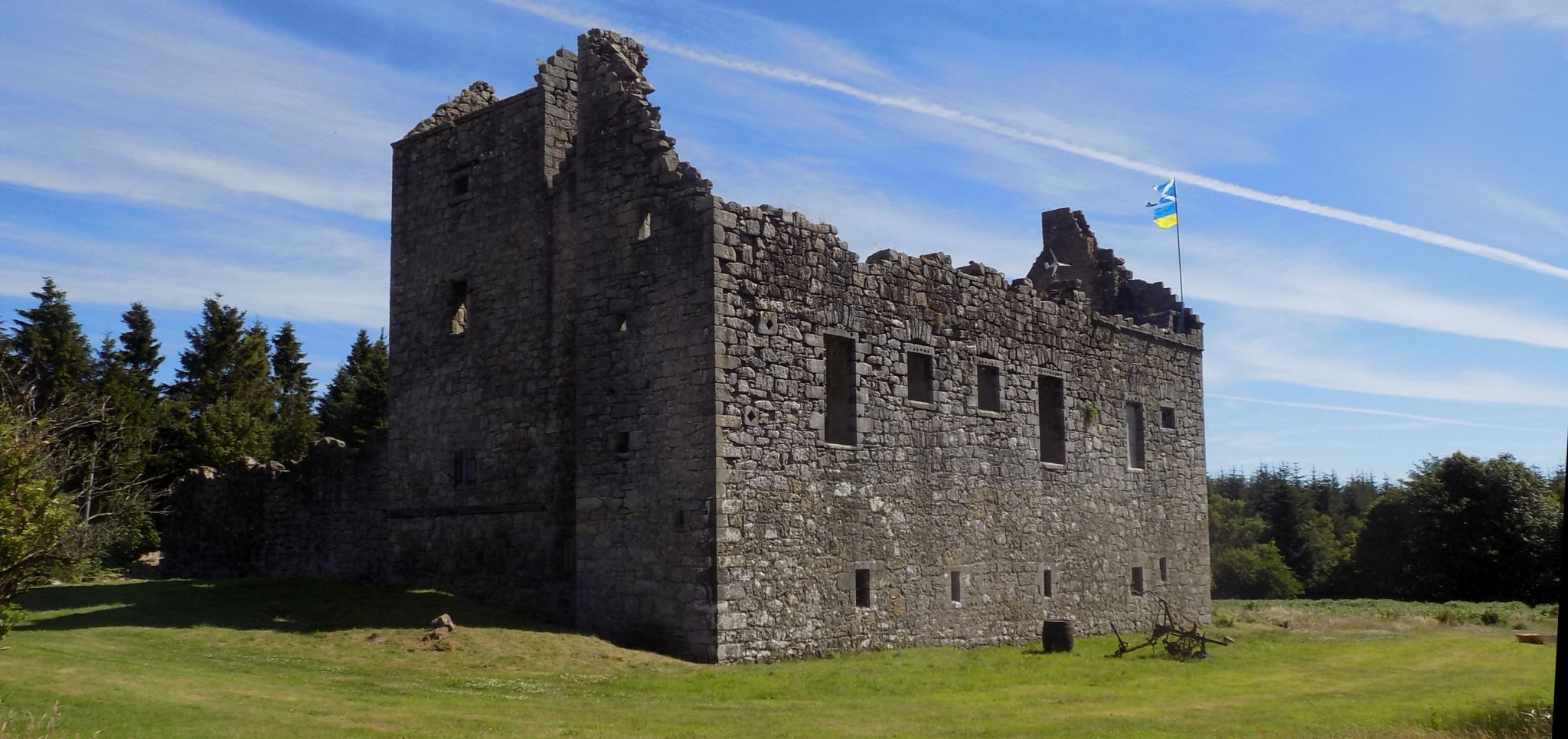
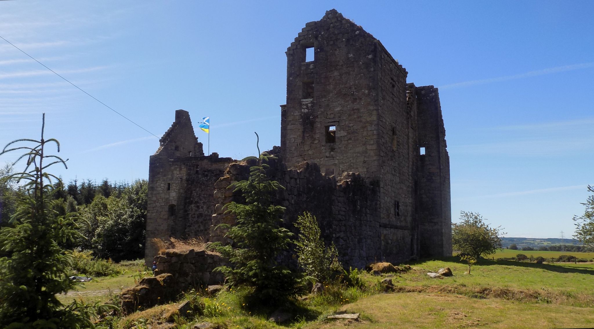
 Torwood
Castle
|
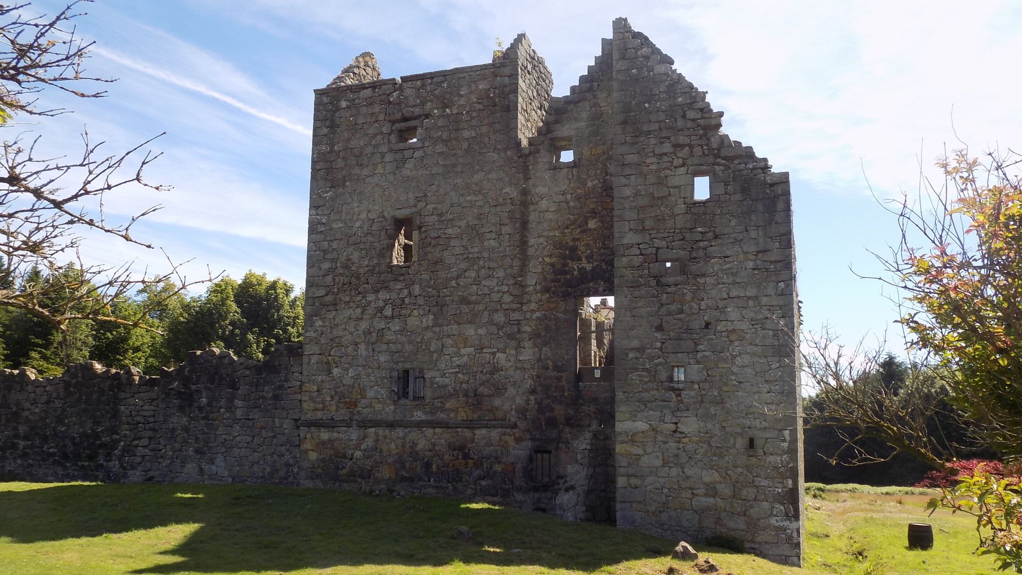
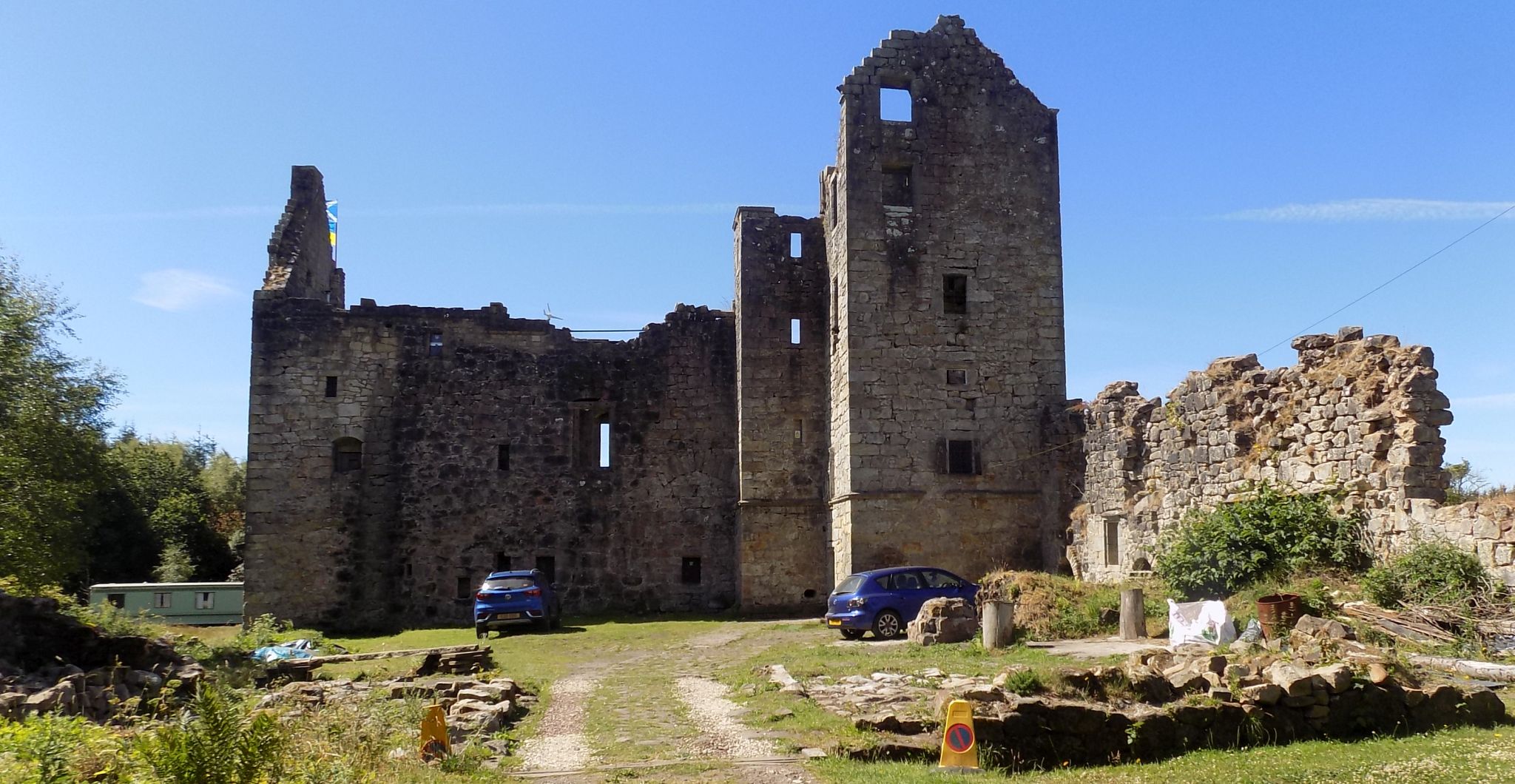
 Torwood
Castle
|
 Torwood
Castle
|
 Torwood
Castle
|
 Torwood
Castle
|
 Torwood
Castle
|
 Torwood
Castle
|
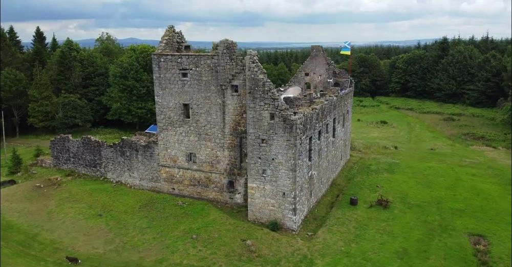
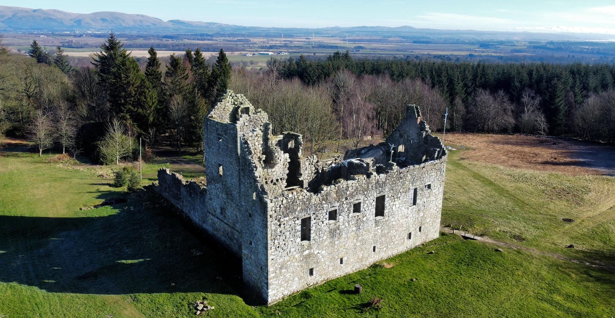
 Aerial view of Torwood
Castle
|
 Aerial view of Torwood
Castle
|
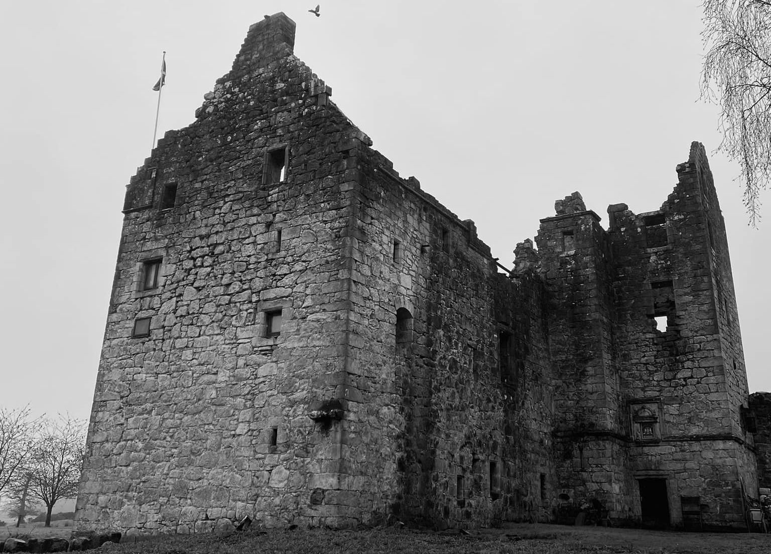 Torwood
Castle
|
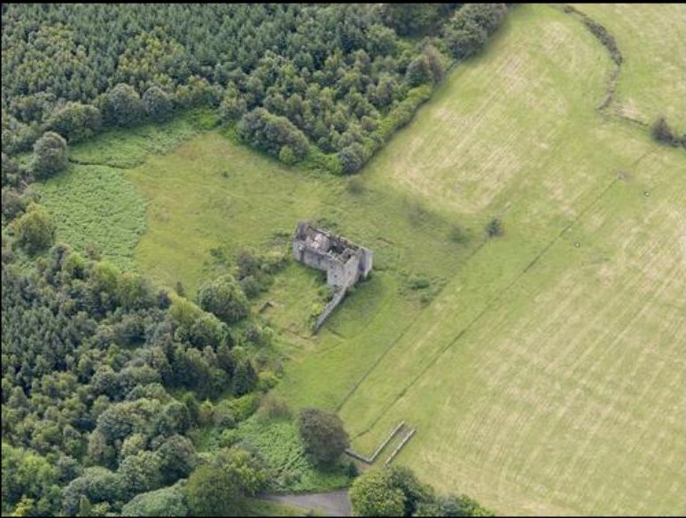
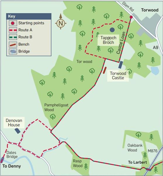 Map of
Torwood Castle
|
TORWOOD CASTLE - ROUTE DESCRIPTION:-
ACCESS INFO:
Bus: For further information on bus times, numbers, routes, etc call Traveline on 08712002233 or visit www.traveline.org.uk
Parking: Available on Glen Road. See map.
Distanace: 2.5 miles / 3km
Path information: Rough farm track and natural woodland tracks that may be muddy in places.
Facilities Toilets, shops, cafes and parking available in Denny Town Centre.
Route A;
Finding your way
1 From Glen Road in Torwood follow the Right of Way sign up a rough track called Castle Loan for around 600m until you come to Torwood Castle.
2 Before the entrance to the castle grounds, turn right and make your way through the wooden kissing gate.
3 Follow this track until you see a metal self closing gate leading to a narrow path along the field edge on your left.
This path leads down to Denovan Road and into Denny.
4 Almost directly opposite the metal self closing gate is a narrow woodland path that leads up a gentle slope through Pine woodland to Tappoch Brooh.
This path is not signposted but takes a semi circular route through the pine woodland and exits back at the beginning of Castle Loan.
5 Follow the narrow track through the woodlands.
The lower reaches may be very muddy but once the path climbs into the pine woodland it is usually dry.
On reaching the highest point of the woodland keep your eyes open for a stone structure on your left hand side.
In summer the Broch is difficult to see as it is usually covered in bracken.
It is much easier to spot when the vegetation has died back.
If you start heading downhill again without seeing the Broch then you have gone too far.
8 Once you have explored the stone walls and remaining staircase of the Broch head downhill underneath the canopy
of conifers until you reach a small wooden boardwalk bridge that crosses a ditch.
Once across the boardwalk, you will be on Castle Loan. Only a few hundred yards from your start point on Glen Road.
Route B
This route is around 4 miles / 6.4km from Glen Road, Torwood to Larbert.
A longer route back to Larbert is to follow the narrow country path that leads down the side of Pamphellgoat wood.
You can access this path by turning right at the castle.
Go through the wooden kissing gate and follow the track until you come to a metal gate on your left.
Follow the path south until you come to another gate.
From here the route is well signposted.
Turn left and follow the track back towards Larbert.
The track exits behind Forth Valley Royal Hospital on Old Denny Road near North Broomage Roundabout.
Glencoe | Ben Nevis | Knoydart | Isle of Skye | Isle of Arran
The Eastern Highlands | The Central Highlands | The Southern Highlands | The NW Highlands


