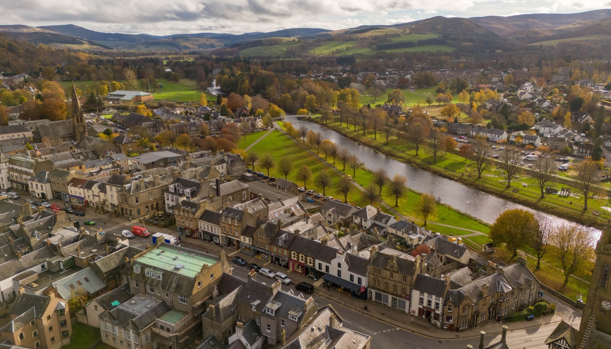
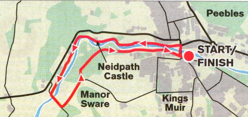
High Adventure: Accounts and photographs of walks, climbs and overland travels around the world


Photographs of the Town of Peebles on the River Tweed

 in the Borders Region of Scotland


The Town of Peebles on the River Tweed in the Borders Region of Southern Scotland

The Town of Peebles on the River Tweed


Footbridge over the River Tweed at Peebles

 Peebles on the River Tweed


The Old Parish Church in Peebles

The Old Parish Church in Peebles

The Gothic style church was built between 1885 and 1887


Road Bridge over the River Tweed at Peebles

Road Bridge over the River Tweed at Peebles


Road Bridge over the River Tweed at Peebles

Road Bridge over the River Tweed at Peebles


Road Bridge over the River Tweed at Peebles

Road Bridge over the River Tweed at Peebles


River Tweed at Peebles

River Tweed at Peebles


River Tweed at Peebles

River Tweed at Peebles


Old-style building in Peebles

Old-style building in Peebles


Building in Peebles

                                                                                                 Building in Peebles


Building in Peebles

                                        Building in Peebles                                                         


Hills above Peebles from the River Tweed in the Borders Region of Southern Scotland

Hills above Peebles from the River Tweed

Glensax Circuit


Peebles Hydro Hotel in the Borders Region of Southern Scotland

Peebles Hydro Hotel

Peebles Hydro is an early 20th-century country house hotel and spa resort.

It is one of two hydropathic hotels left in Scotland,

the other being Crieff Hydro in Perthshire.

The hotel opened in 1881 but was burned down and rebuilt in 1907.

It served as a hospital for injured service personnel during World War II

Peebles Hydro is a category B listed building


Neidpath Castle at Peebles

                                        Neidpath Castle at Peebles

Neidpath Castle is an L-plan rubble-built tower house

overlooking the 
River Tweed about 1 mile (1.6 km) west of Peebles


Neidpath Castle at Peebles

 Neidpath Castle at Peebles


Neidpath Castle at Peebles

Neidpath Castle at Peebles


Location Map for Neidpath Castle at Peebles

Location Map for Neidpath Castle at Peebles


NEIDPATH CASTLE WALK - ROUTE DESCRIPTION:

Location: Borders
Map: OS Landranger 73
Distance: 4 miles ( 6km )
Time: 2 hours
Terrain: Riverside and woodland oaths

This walk may be short on distance but it is 
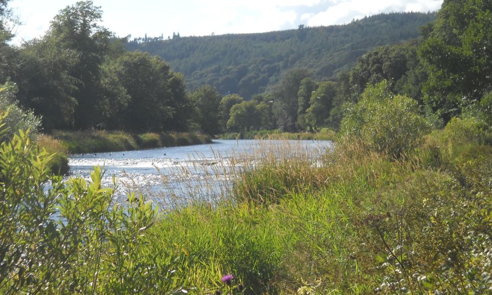
certainly not light on quality. Riverside walking is always pleasant and the stroll by the Tweed out of Peebles is no exception. At first, while crossing Hay Lodge Park, it can be fairly busy but as soon as you get on to the rockier section the crowds thin
out. Near the end of the park is the point where the riders in the annual Riding of the Marches cross the river, fiags and banners waving 
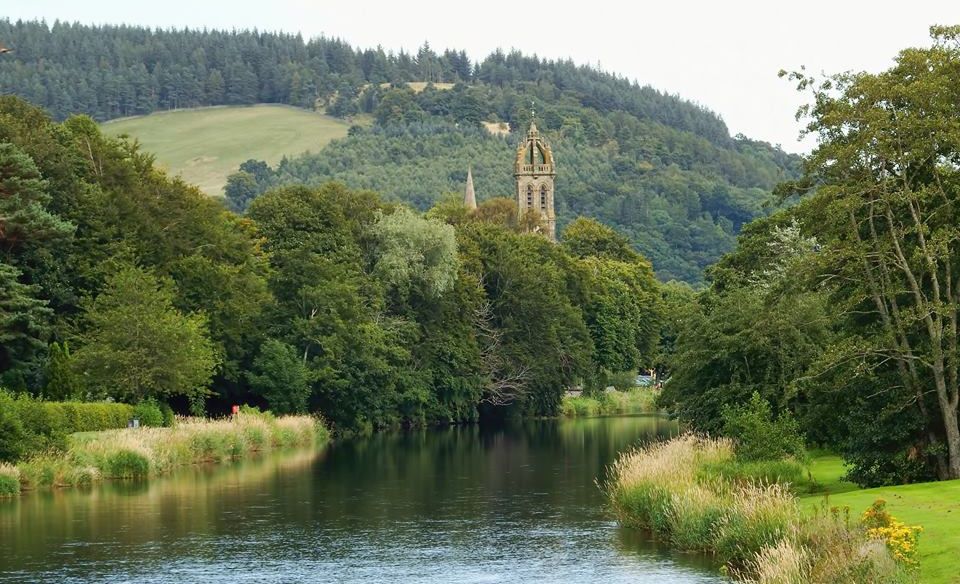
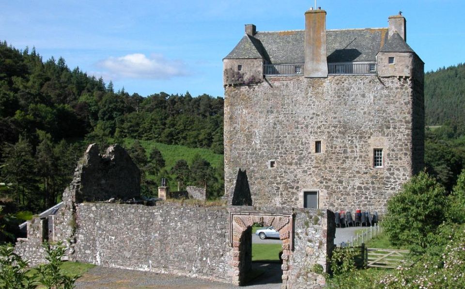
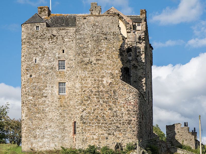
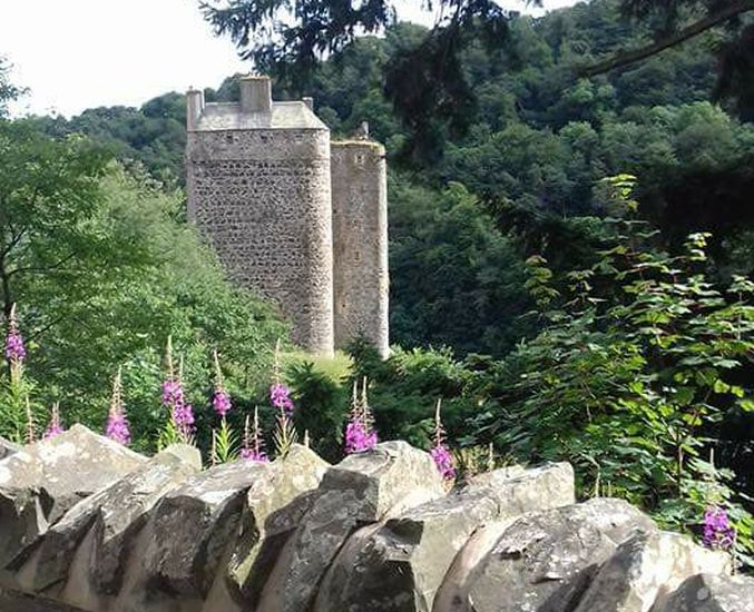
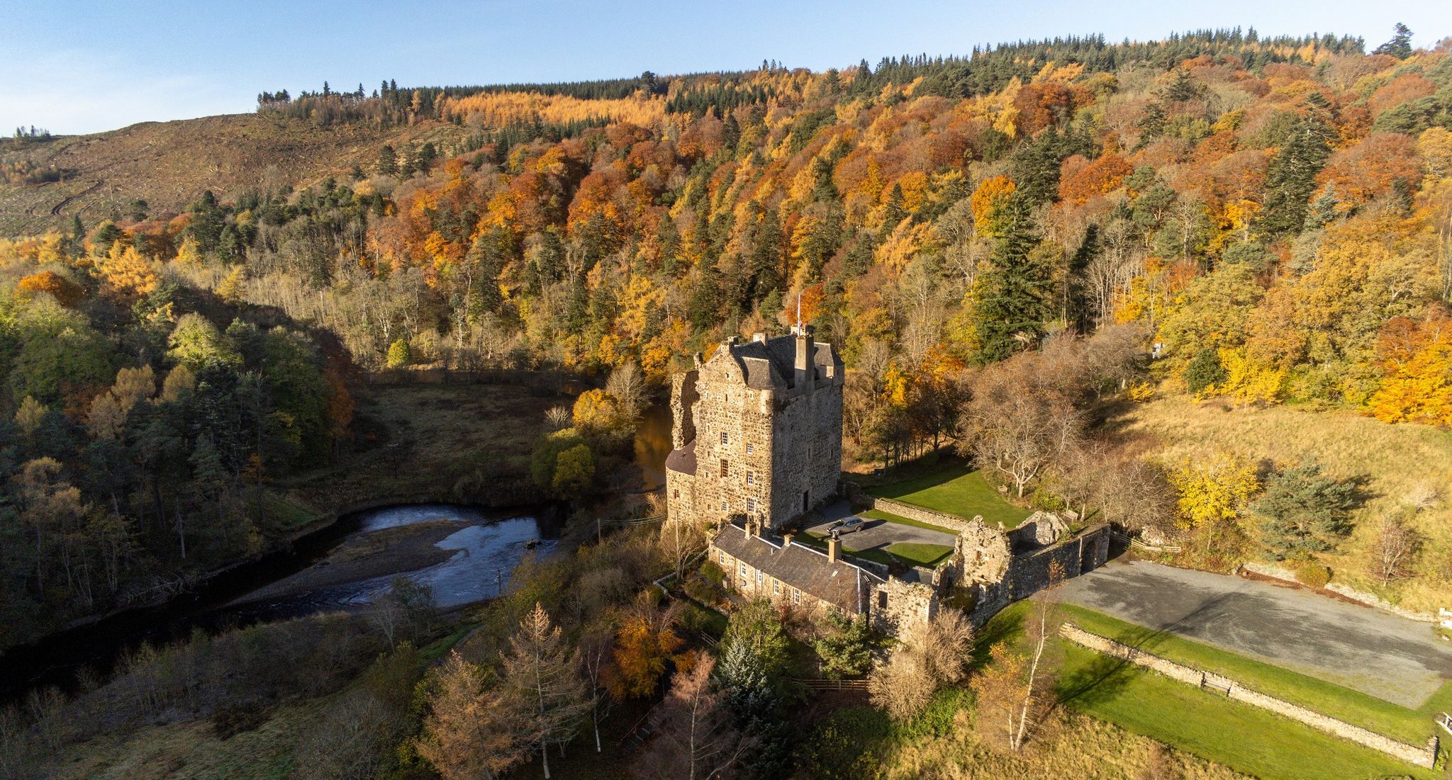
— a great sight if you are there at the right time. High above towers Neidpath Castle, a stronghold typical of many in the troubled lands of the Borders. It dates to the 14th century but was largely re-modelled in the 17th century by the Earl of Tweeddale. Ownership later passed to the Earls of Wemyss and
March who still hold the castle today. It is not open to the public but can be booked for weddings and events.
Beyond the castle the path goes through or just below beautiful woodland with a rich variety of species including oak, ash, larch, beech and alders. You pass under an old railway viaduct ( built 1864 ) which is a superb piece of civil engineering, constructed as it is on a skew. You may see dippers in the river and, if you are very lucky, even a kingfisher.
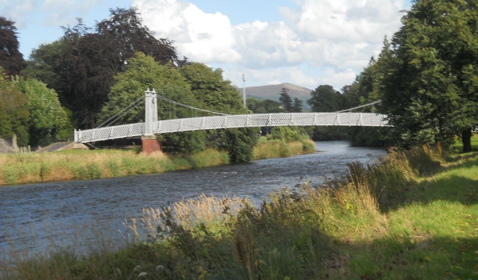
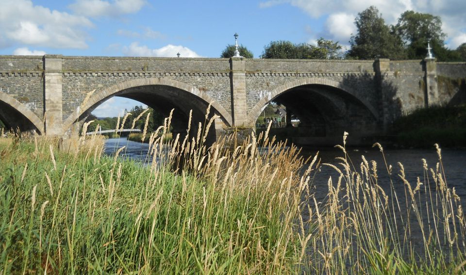
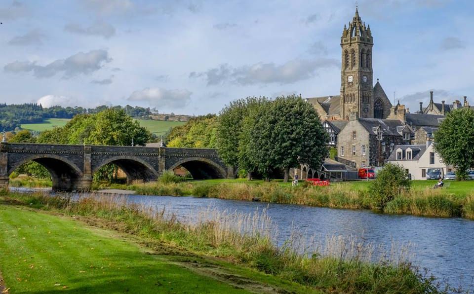
The Tweed is crossed by the 1883 Manor Bridge and shortly afterwards you cross the Manor Water by a venerable stone bridge dating to 1702.
This was called a stipend bridge because it was built with monies provided by a vacant parish. It is now happily closed to vehicular traffic.
You will see notices here about this being the upper limit for salmon fishing. The Tweed is a noted salmon river but upriver from here the fish travel to their spawning grounds before starting the long journey back to the sea.
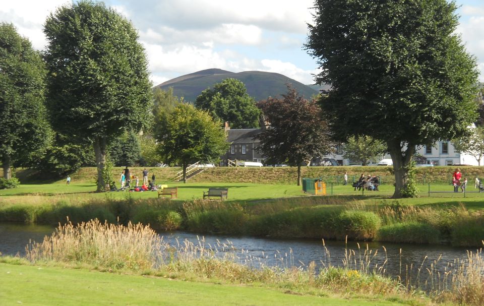
A steep climb up the brae known as the Manor Sware follows, with compensations in the ever-expanding view looking back. Massed hills rise to the south and west while below the stately river flows through the centre of the picture.
The walk then enters South Park Wood, which again has many fine old trees and is a lovely place to stroll through with dappled sunlight forming patterns on the path. A downhill section leads you to the top of a railway tunnel. Long since closed, this tunnel was used to store works of art for safety during the Second World War.
Before long you are back with the Tweed - and no doubt more people enjoying the surroundings.
The Fotheringham Bridge, gifted to the town by a former “guiterbluid” ( Peebles-born ) who lived most of his life in South Africa, leads across the river, but this walk stays on the south bank for the final stroll 
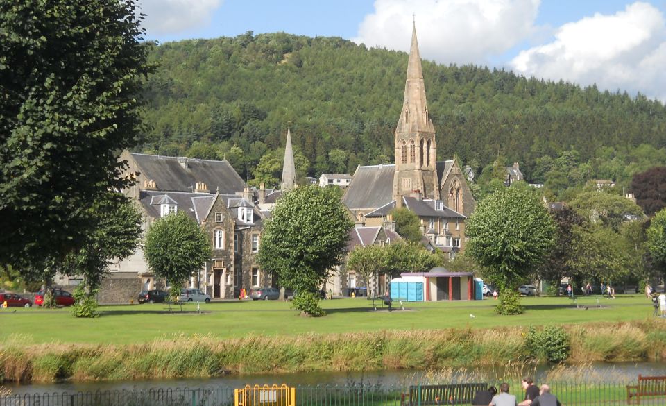
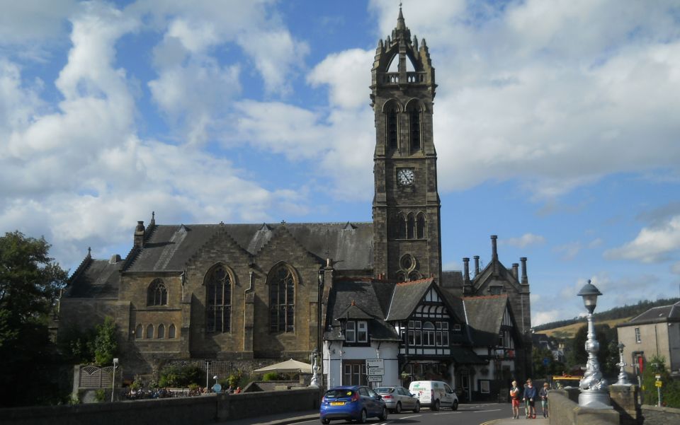
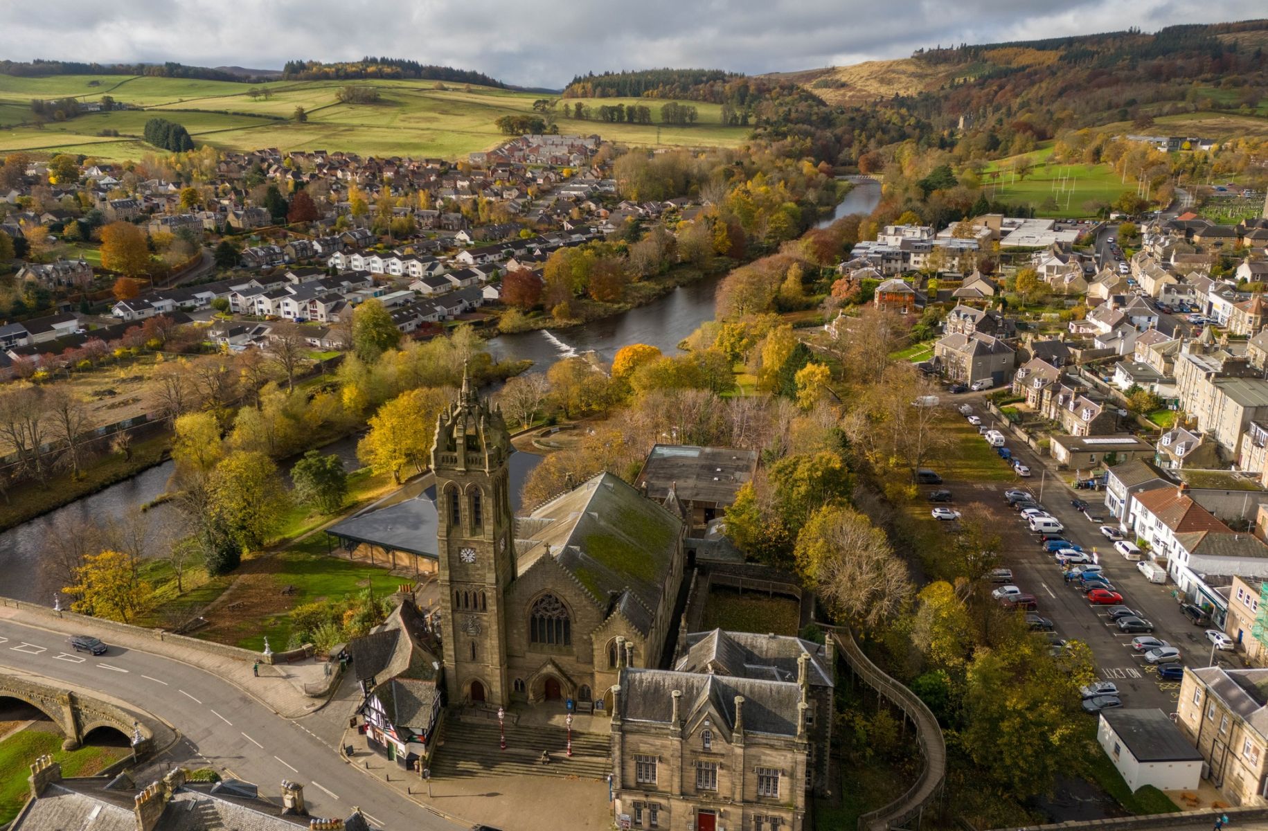
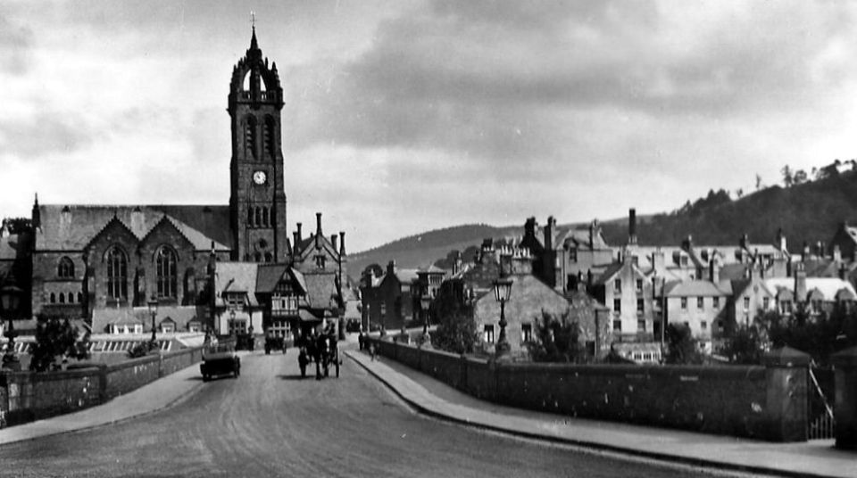
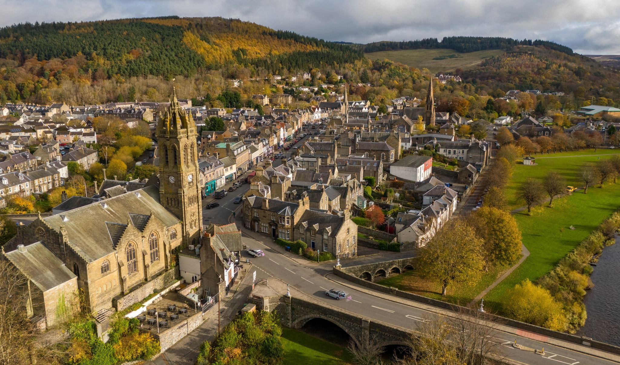
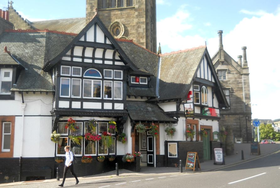
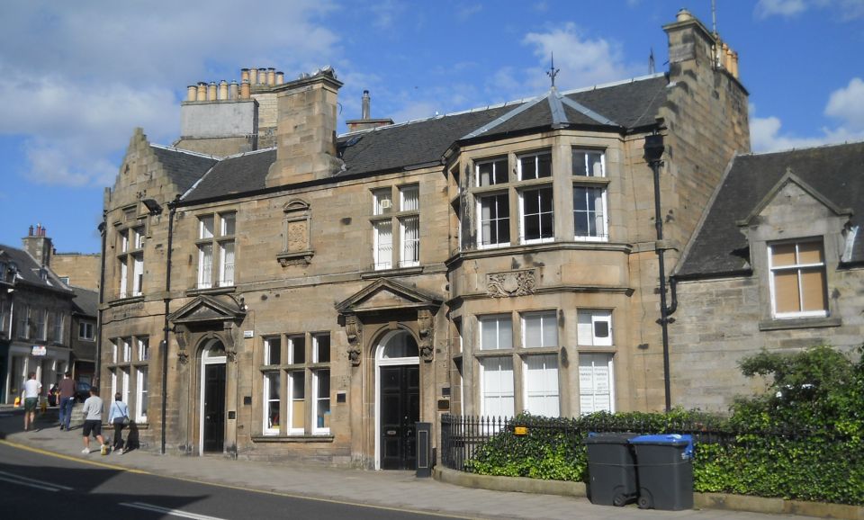
back to the car park. lt’s a short walk up to the High Street which has plenty of cafes and bars as well as a variety of independent shops. It's a great place to spend a leisurely day.


Route:
Start and finish at Kingsmeadows car park, Peebles (GR: NT252403 ).
Walk back to the Tweed Bridge, cross the river and TL past the swimming pool on to the riverside path.
Walk through Hay Lodge Park and continue on a rockier section below Neidpath Castle.
Continue under the old railway viaduct and up to a road.
TL, cross the Tweed and TL again across the Old Manor Brig.
Walk up Manor Sware.
Opposite the car park ( with view indicator ) TL on a small path that drops down to a broader path in the woods.
TR and follow path round the hill, eventually dropping down to run above the railway tunnel and then on the left embankment.
When the embankment levels out TL down to the river and TR on riverside path back to the car park.
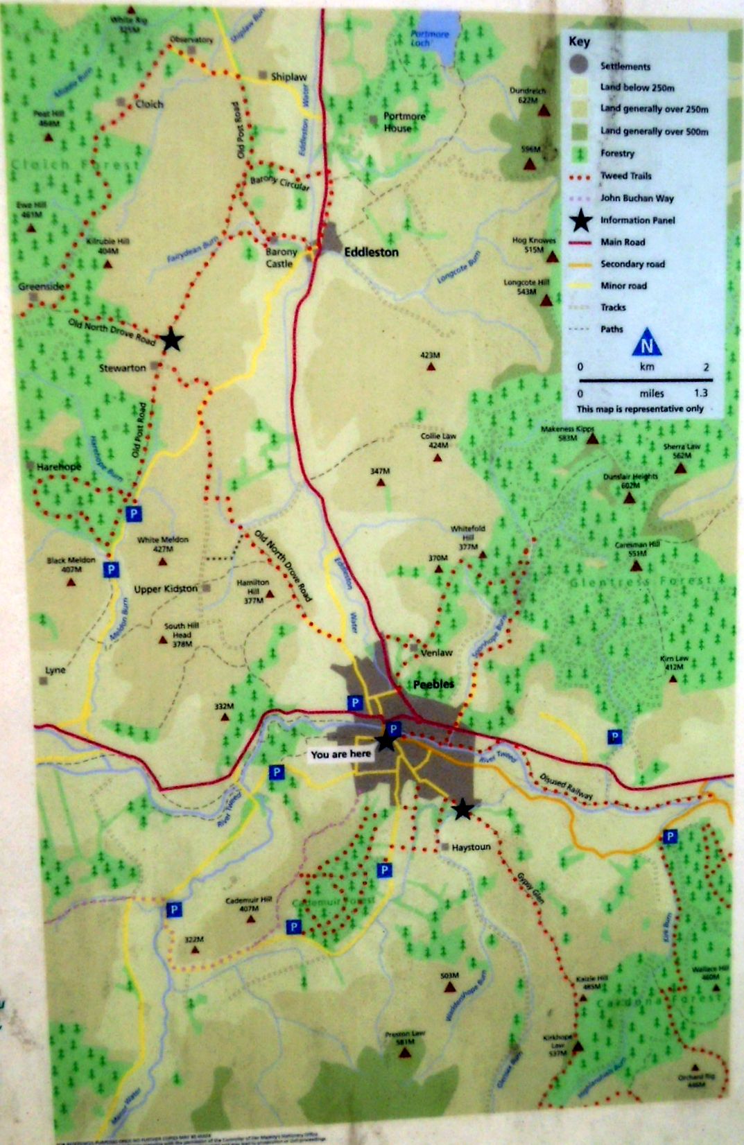
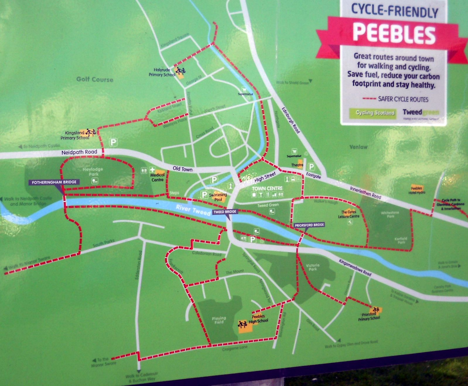
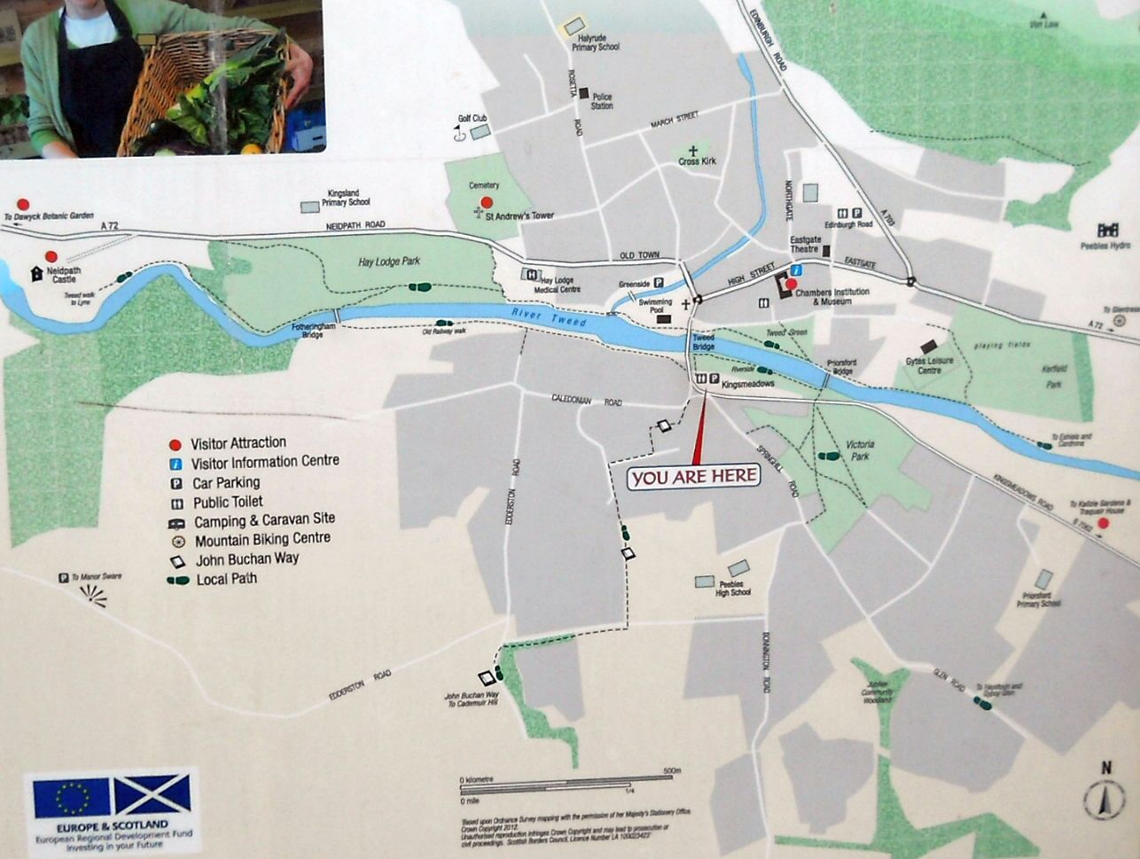


Map of Peebles

                                        Map of Peebles                                                

( Note: Click here or on above for large format copy )   


Map of Peebles

Map of Peebles 

( Note: Click here or on above for large format copy )   


Map of Peebles

Map of Peebles

( Note: Click here or on above for large format copy )   


Map of Peebles

Map of Peebles

( Note: Click here or on above for large format copy )   


 Peebles & Glensax Gallery Photo Gallery

Scotland Walks :: Scottish Borders :: West Highland Way


Scotland Index :: Scottish Peaks

Southern Highlands :: Central Highlands :: NW Highlands :: Eastern Highlands

Skye :: Arran :: Glencoe :: Ben Nevis :: Knoydart

fb icon  google+ icon Linkedin icon  twitter


References:-


Climbing & Outdoors Gear:-


Site IndexWorldwide MountaineeringAdventure Travel


Maps:-


Western Scotland & the Western Isles OS Road Map Northern Scotland OS Road MapSouthern Scotland OS Road MapTorridon Map Kintail, Glen Shiel - Map Arrochar Alps - Map Glasgow Popular Hills - Map Ben Nevis Map West Highland Way - Map

Glen Shiel & Loch Hourn - OS Landranger Map An Teallach & Slioch - OS Explorer Map Creag Meagaidh & Loch Laggan - OS Explorer Map Gairloch, Ullapool & Loch Maree OS Map Ben Nevis & Glencoe OS Landranger Map The Munros Map


Travel & Guide Books:-


Southern Upland Way Southern Uplands Way Southern Uplands WaySouthern Upland Way Ochils and Campsie Fells  The Pentland Hills  The Border Country  Galloway Hills

Walking Through Scotland - From the Border to Cape Wrath Dumfries & Galloway - 25 Walks Scottish Borders - 25 WalksSt.Cuthbert's Way - Official Guide  Walking the Southern Upland Way Across Scotland on Foot  Walking Through Scotland - From the Border to Cape Wrath North to the Cape - Fort William to Cape Wrath

West Highland Way: Official GuideWest Highland Way: Rucksac Readers West Highland Way: TrailblazerThe West Highland WayWest Highland Way: Footprint MapWest Highland Way - Map West Highland Way - Map West Highland Way Wet Highland Way - Official Guide

Scotland - Lonely PlanetScotland's Highlands & Islands - Lonley Planet Scotland's Highlands & Islands - Rough Guide Highlands & Islands of Scotland - Hidden Places Rough Guide ScotlandScottish Highlands & Islands - Rough Guide Rough Guide: Scotland Lonely Planet, Walking in Scotland100 Hillwalks around Glasgow

50 Walks in Glasgow & SW Scotland 50 Walks in the Scottish Highlands & Islands 50 Walks in Edinburgh & Eastern Scotland 100 Walks in ScotlandVisit Scotland - Touring Guide Scotland: Where to Stay - Hotels & Guest Houses Scotland: Where to Stay - Bed & Breakfast Hillwalker: The MunrosHillwalker: The Corbetts

The Munros: Scottish Mountaineering Club The Munros and Tops The Corbetts - SMC Call of the Corbetts Munros & Corbetts Chart The High Mountains of Britain and Ireland Magic of the Munros The Munros - Scotland's highest mountains

Munro Almanac The Munros: Scottish Mountaineering Club Hamish's Mountain WalkThe Munros in WinterMy Scotland by Hamish MacInnes 50 More Routes on Scottish Mountains Scottish Mountains - 50 Classic Routes

The High Mountains of Britain and Ireland Scotlands 100 Best Walks Scottish Mountains - 100 Best RoutesBig Walks of Great Britain Classic Walks in Britain & IrelandScottish Hill & Mountain NamesClassic Mountain Scrambles in Scotland Classic Climbs - Central & Southern Highlands Scotland's Far North

Mountaineering in Scotland and Undiscovered Scotland by W.H.MurrayMore Wilderness Walks Wilderness Walks Wilderness Walks 2 - Video Pathfinder Guide: Skye and NW Highlands WalksPathfinder Guide: Fort William and Glen Coe Walks Rambler's Guide: Ben Nevis and Glen Coe

Torridon: A Walkers Guide Scottish Hill Tracks100 Best Routes on Scottish Mountains Landscapes of the Scottish Highlands & the Isle of Skye The Glens of Rannoch Glens of Trossach Scottish Glens: The Atholl GlensNorth to the Cape - Fort William to Cape Wrath

  Southern Highlands - MapNorthern Highlands Central Highlands West Highlands The Islands Central Highlands SMC NW Highlands SMC Central Highlands: Six Long Distance Walks Exploring Scottish Hill Tracks

Mountain Days & Bothy Nights Northern Highlands, Volume 1 - SMC Northern Highlands, Volume 2 - SMC Winter Climbs: Ben Nevis and Glencoe Loch Lomond & Trossachs WalksThe Grahams - Scotland's 2000ft Peaks The Book of the BivvyMountain Travellers Handbook

Geology & Landscapes of Scotland The Highland Geology Trail Weather for Hillwakers & Climbers Mountain Weather Guide to the Weather Weather: Collins Gem Hillwalking Handbook for Mountain Leaders Hillwalkers Manual Hillwalkers Guide to Mountaineering

First Aid on MountainsWalking the Munros Vol 2: Northern Highlands & CairngormsWalking the Munros Vol 1: Southern, Central & Western Highlands Scotland Travel Guide Lonely Planet Walking Through Scotland - From the Border to Cape Wrath Discovering Scotland - Atlas & Guide Britain's Best WalksBest Routes on Britain's Mountains

200 Challenging Walks in Britain & Ireland Scotland - The Wild Places - Colin Prior The Munro Show 1 & 2 - Muriel GrayFrontiers: The World's Best Hikes Great British Ridge Walks Torridon - Life & Wildlife in the Scottish Highlands

GPS for Dummies Wilderness NavigationNavigation for Walkers


Keep right on to the end of the road


Keep right on to the end of the road

Google Analytics


Google Analytics

extremetracking
 eXTReMe Tracker


extremetracking
Sitelock caingram.com
SiteLock
Sitelock
Sitelock caingram.info
SiteLock
Sitelock