|
MilngavieOlden Days
|
  |
|
MilngavieOlden Days
|
|
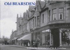
Old Photographs of Milngavie as it once was
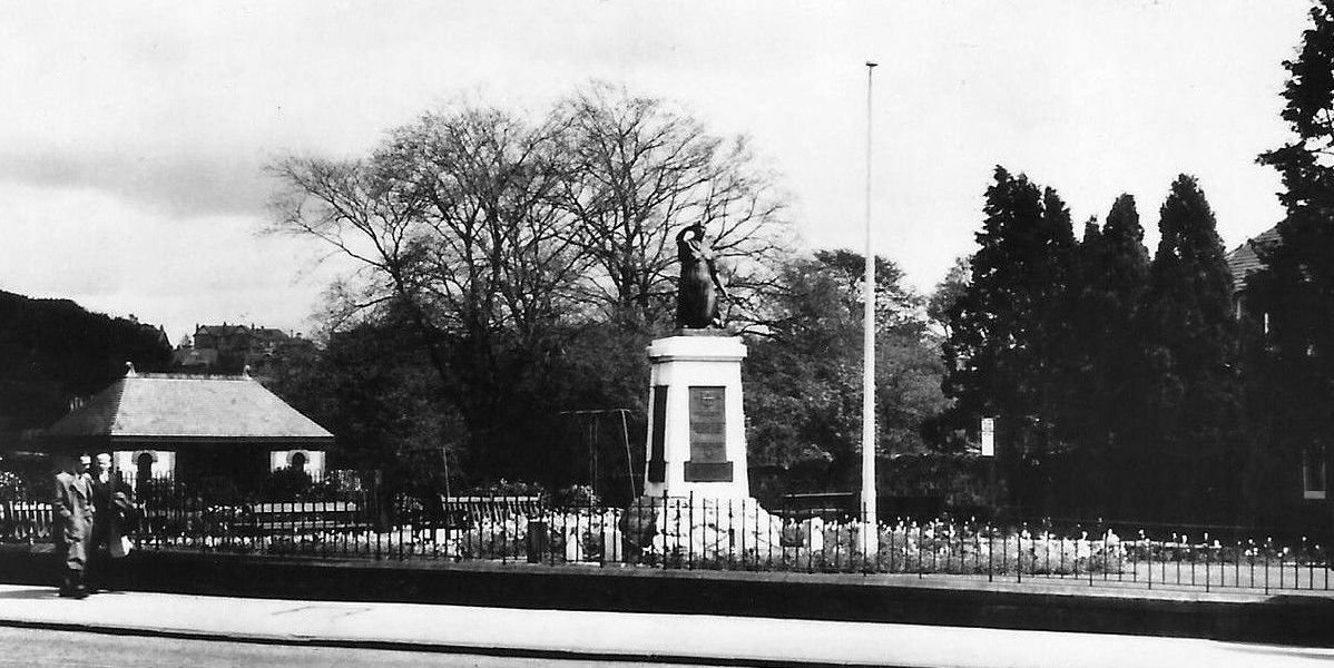
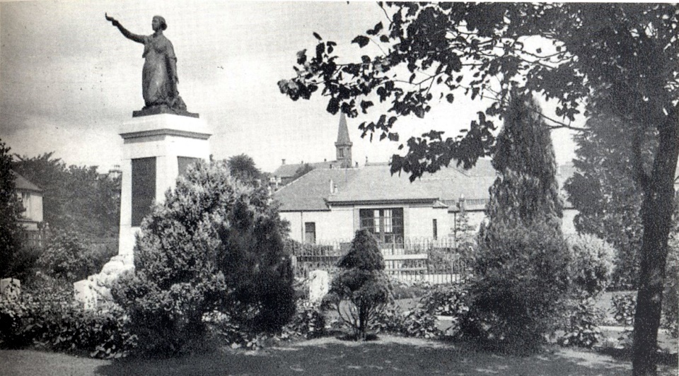 War
Memorial
at Milngavie Town Centre The memorial was erected in 1922 |
 War
Memorial
at Milngavie Town Centre The memorial was erected in 1922 |
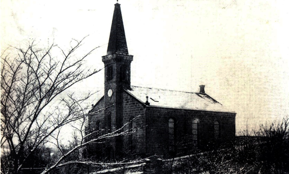 Milngavie's
first parish church
built in 1840 |
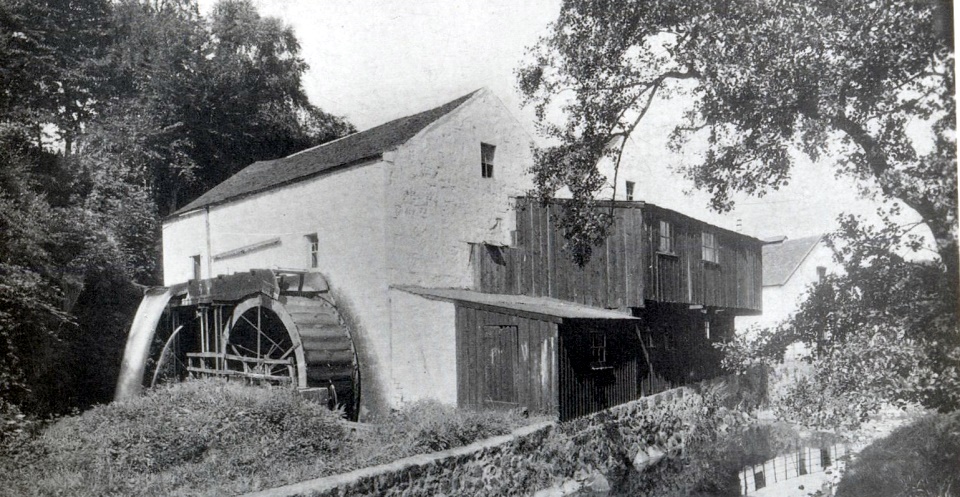 Gavin's
Mill in Milngavie
The village of Milngavie grew up on the banks of the River Allander where grain mills have been powered by the river since the fifteenth century. The village name may derive from the historic Gavin's Mill. Gavin's Mill dates from c1670 |
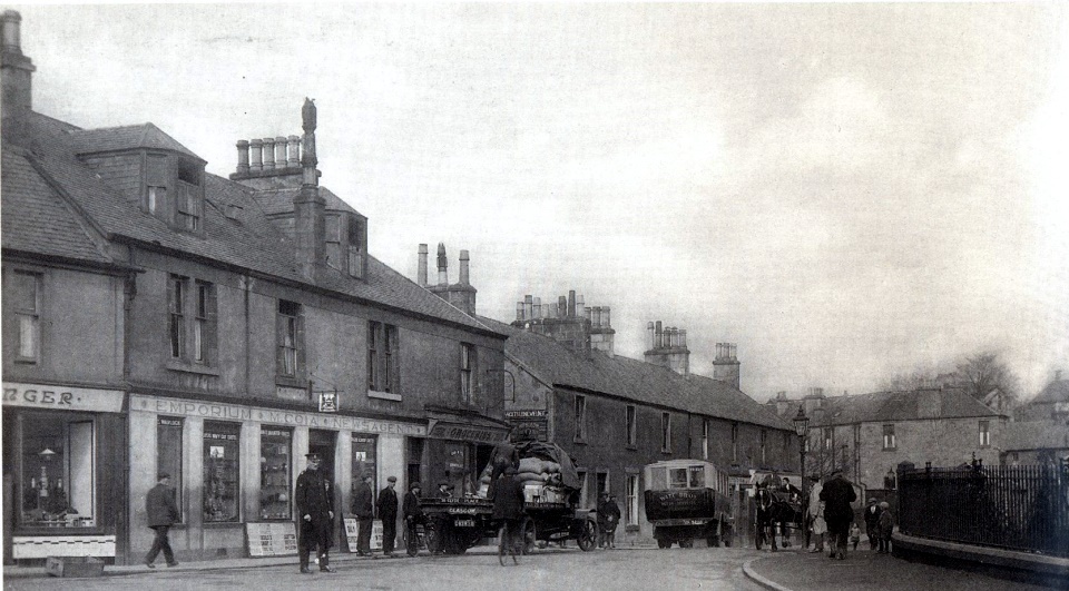
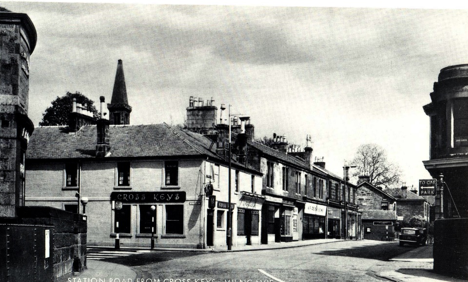 The Cross
Keys and Station Road
in Milngavie Town Centre |
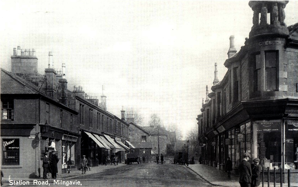 Station
Road in Milngavie
|
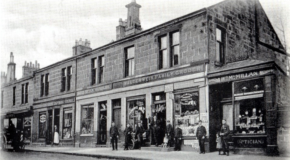 Shops in Station Road.
|
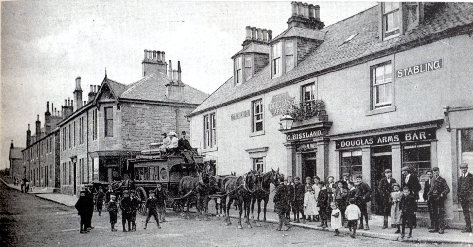 Douglas
Arms in Milngavie
|
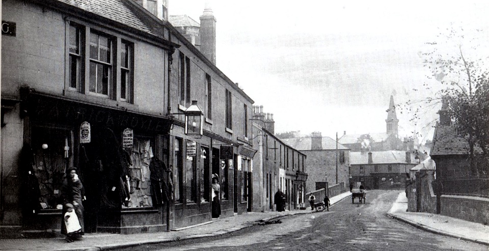 Douglas
Street in Milngavie
|
 Douglas
Street in Milngavie
|
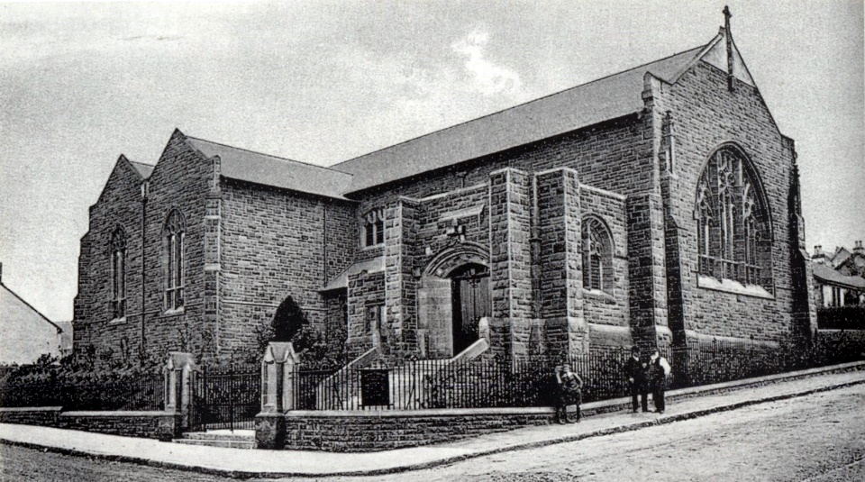 St Paul's
Church in Milngavie
The church was built in ‘Scottish Gothic’ style in 1906. |
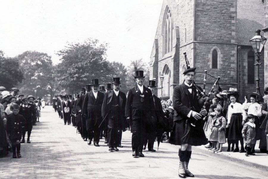 Funeral
procession in Milngavie
|
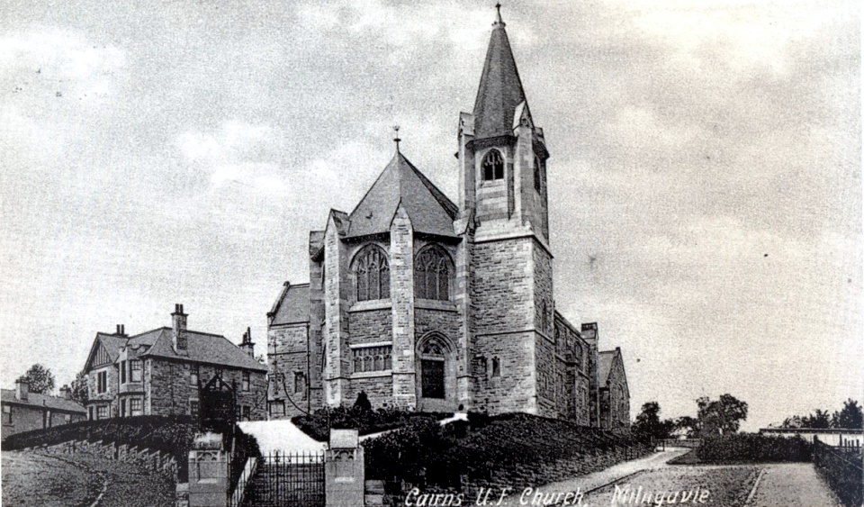 Cairns
Church in Milngavie Town Centre
A traditional church design built in 1903. Shows much gothic detail including tracery and trefoils also displaying influence of Scottish Art Nouveau. |
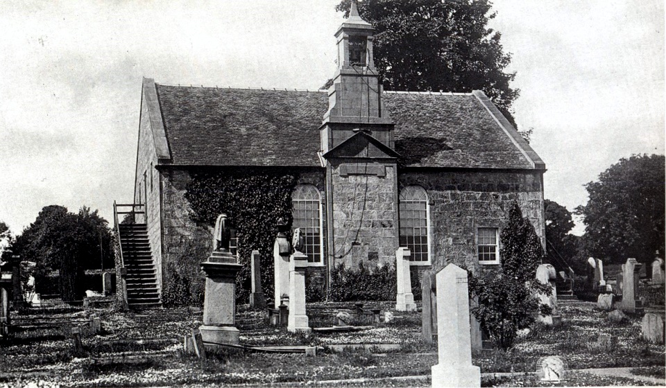 Baldernock Church on
outskirts of Milngavie
There has been a church on the site for at least a century and a half. |
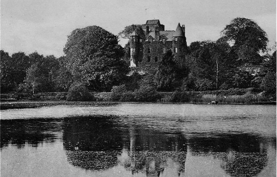
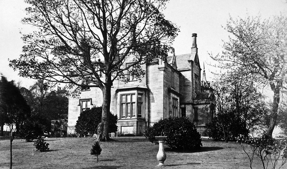
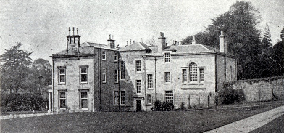 Craigmaddie
House on outskirts of Milngavie
Craigmaddie was held by the Galbraiths of Baldernock in
the middle ages,
and there are ruins of an old castle. Glasgow's Lord Provost, James Black, purchased the estate at the end of the 18th century and built a cottage there. He
subsequently built the mansion, which was extended by a subsequent owner. Henry Gordon, who acquired the estate in 1842, made
Craigmaddie the manor house for
the Dougalston estate and he, too, made
additions to the building.
In
1896 Glasgow Corporation built a service reservoir at Craigmaddie, beside the existing Mugdock Reservoir. |
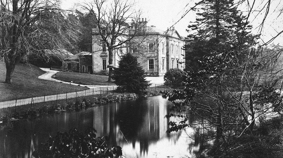 Craigmaddie
House in 1870
|
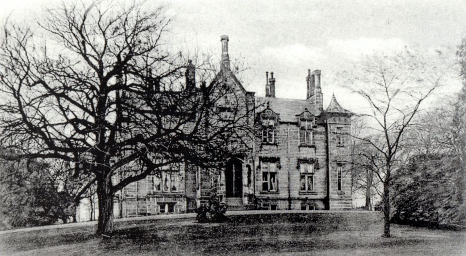 Clober
House
James
Macgregor, a Glasgow merchant, built the mansion in 1773 near
the site of an earlier house on the banks of the Allander Water.
His son-in-law, James Watt, had already embarked on his career as a civil and mechanical engineer. Watt was responsible for laying-out a bleachfield on the estate, supervising the creation of the water courses and the installation of machinery.
The mansion was extended in 1833 to
the designs of architect John
Baird.
It had been demolished by the 1960s when the Clober housing estate was built. |
 Clober
House in 1870
|
|
now demolished |
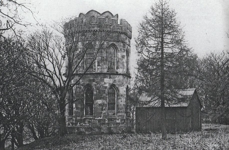 Smith's
Folly at Mugdock Country Park
Smith’s Folly which stands on a hill above the South Lodge car park at Mugdock Country Park. This was the start of a tree-lined avenue leading to the home of James Smith at Craigend Castle. The castellated tower or gazebo was built for him about 1816. The small octagonal tower had two storeys and was once finely decorated with Gothic windows and vaulting and trefoil decoration. The folly had no roof or floors but had a an open-sided staircase that wound its way to the top, from where the visitor could enjoy good views of Glasgow, as well as Dumgoyne and the Campsie Fells. The tower was repurposed as a watchtower for the nearby reservoirs during the war years. In the 1980s it was demolished due to becoming unstable and sadly only the base of the tower remains. In 1981 Royal Mail issued a 50p booklet of stamps with a picture of Smith’s Folly on the front but erroneously called it Mugdock Castle. |
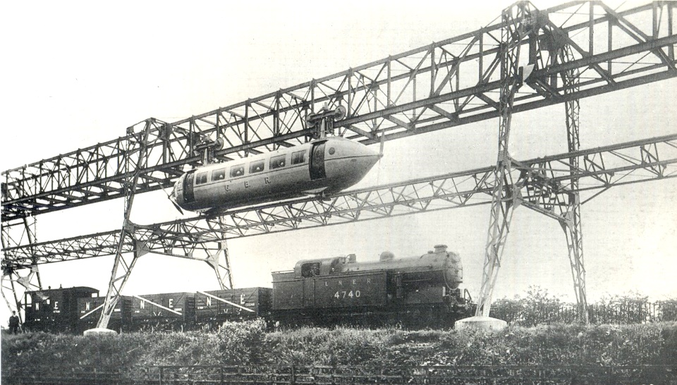 Bennie Railplane at
Milngavie
The railplane was invented by George Bennie ( 1891–1957 ). This was designed to move along an overhead rail by means of propellers. It was intended to run above conventional railways and separate fast passenger traffic from slow freight traffic. A prototype and 130 metre stretch of line was constructed outside Milngavie in the 1930s but Bennie was not able to obtain funds for further development. The line was demolished in the 1950s. |
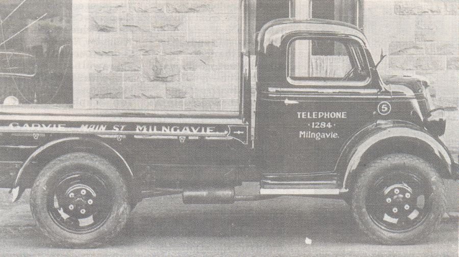 Garvie's Lemonade Lorry
in Milngavie |
|
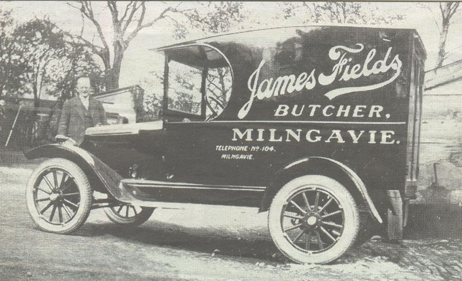 Fields' Butchers Van
in Milngavie |
|
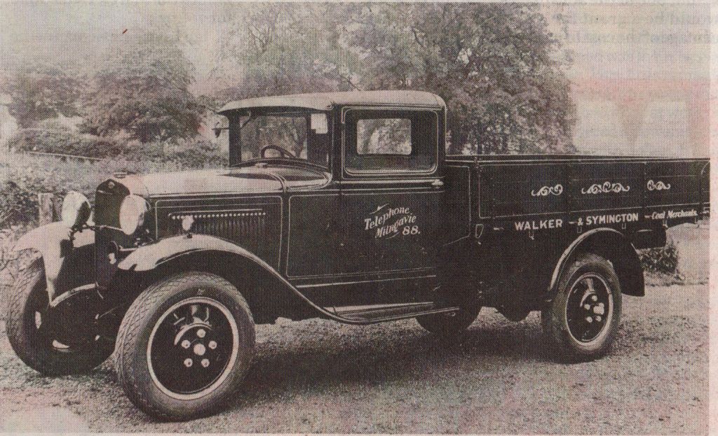 Walker / Symington Coal Lorry
in Milngavie |
|
 |
|
Glencoe | Ben Nevis | Knoydart | Isle of Skye | Isle of Arran
The Eastern Highlands | The Central Highlands | The Southern Highlands | The NW Highlands