( Note:-
Click here
or on above for large format copy )
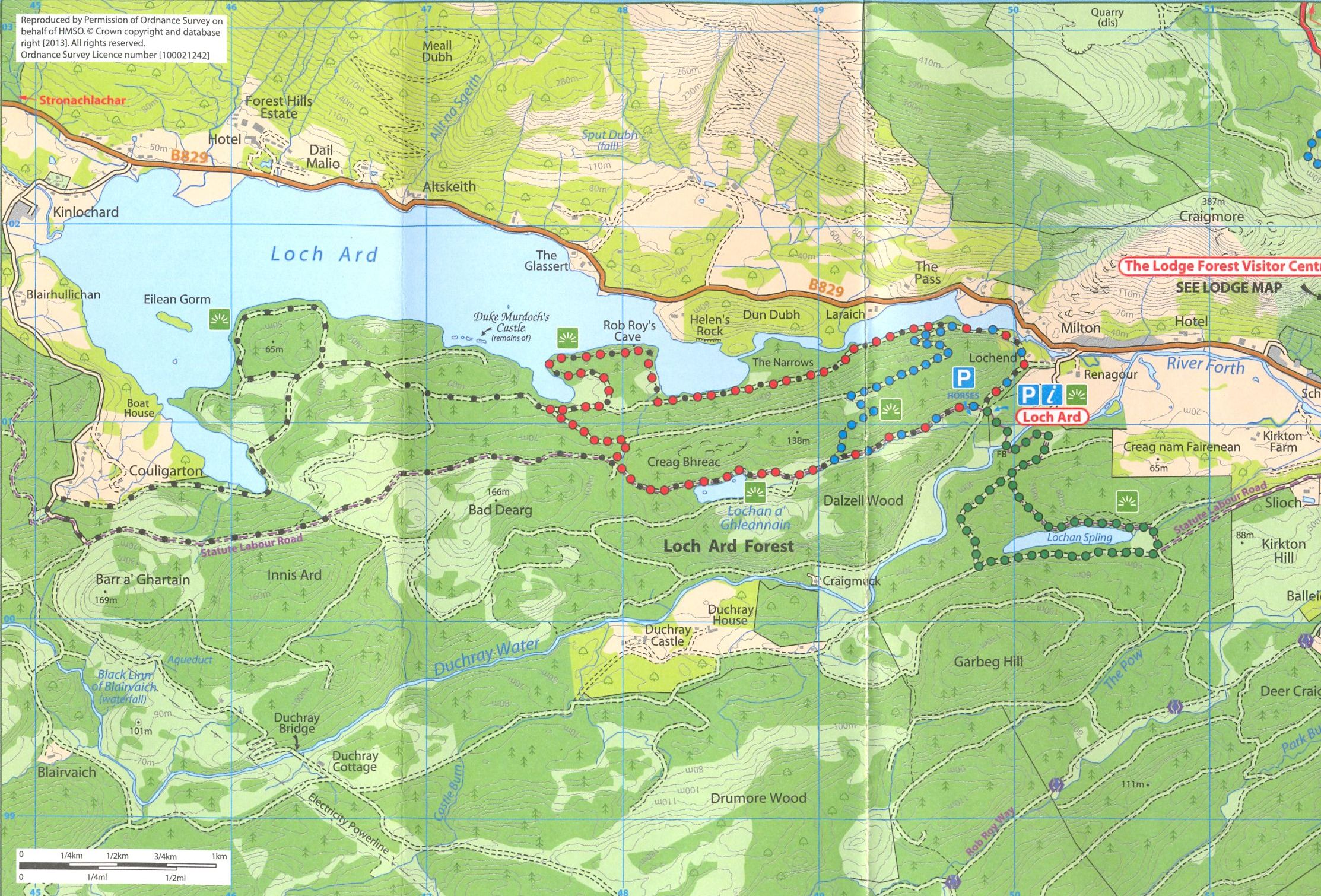
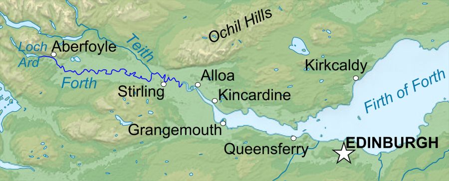
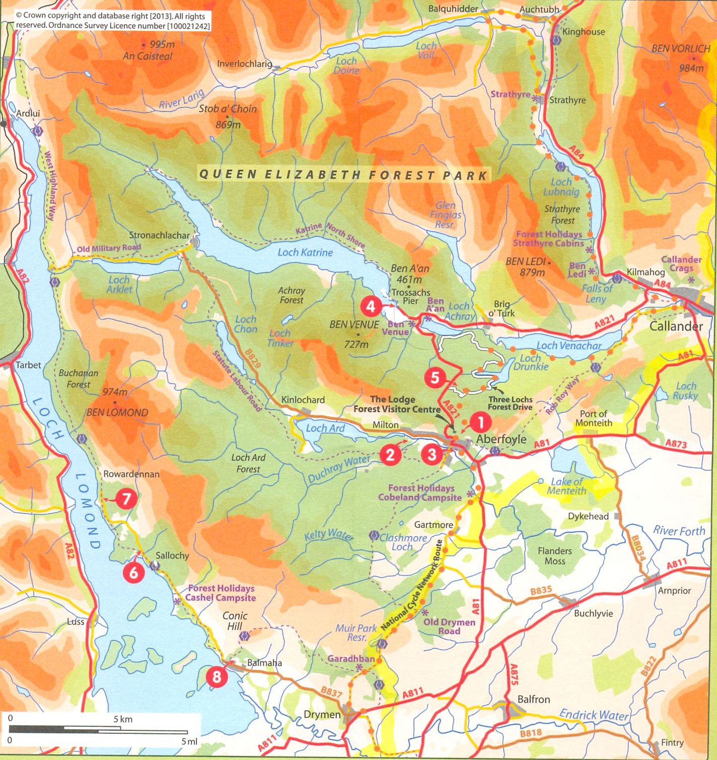
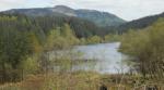
Map of
Loch Ard
( Note:-
Click here
or on above for large format copy )
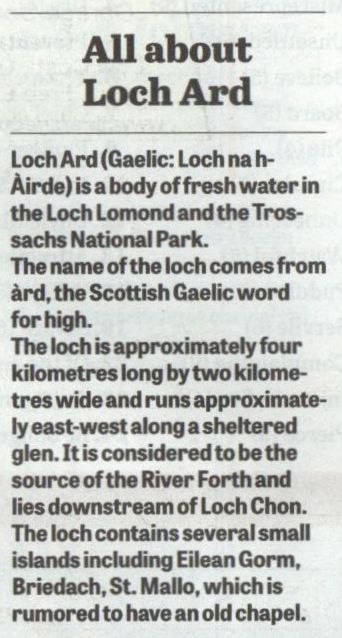
Loch
Ard info
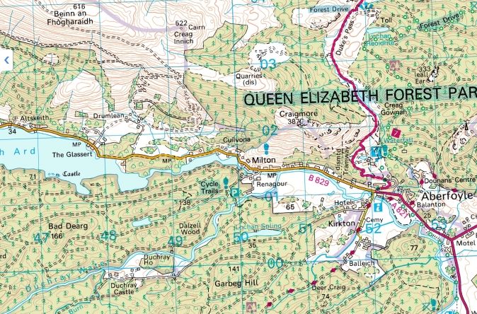
Map of
Loch Spling and Doon Hill
Route Description for Loch Spling:
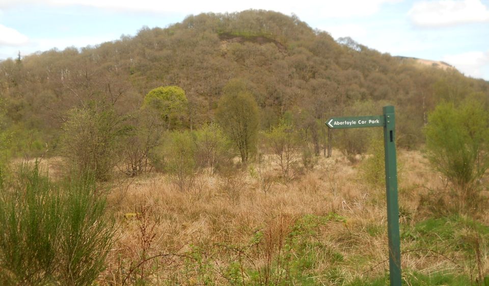
It is a 22 mile
drive from Milngavie
to the Milton car park. which is a
mile beyond Aberfoyle on the
road to Kinloclard.
To find it, take
the first road to the left beyond
Aberfoyle. The road curves downhill
and over the
infant River Forth which rises in nearby
Loch Ard. The spacious car park is
a few hundred
yards further on.
There are
several walking trails, all in
excellent condition, which radiate
from the carpark.
You can obtain a
leaflet which
describes the walks in the Queen Elizabeth
Forest Park,
at the Park office on right hand side of the
approach road into Aberfoyle
from the A81.
This walk is
short — 2.5 miles — and easy in
that none of
the slopes are steep. It begins in a footpath
through deciduous
trees before joining a wide metalled
track around the edge of conifer
plantations
which for the most part allow excellent
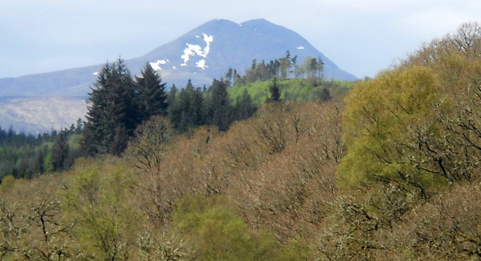
views of the surrounding hills
and glens.
The middle
section is around
Lochan Spling, a bonnie wee loch
surrounded by plantations and
faraway hills.
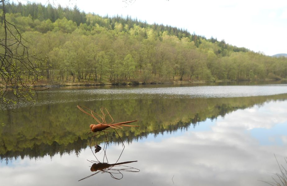
A feature of the
Lochan are the sculptures of a
giant pike and dragonfly which rise
out of the water.
They were
created by Rob Mulholland in 2008
as part of a
family sculpture trail. The return is through
more conifer
plantation before rejoining the early part
of the walk. Some features to
look out for:
in the first part you will be struck by the
mossy and lichen
covered branches of so many of the
deciduous trees, especially the oaks.
These lichens
are long hairy like unkempt beards and
evidence of the high rainfall
and pure air.
Afier the
footpath has become a metalled
track, it divides;
take the right hand branch from which
you will soon
espy the dramatic sculpture of an osprey on
top of a stout
wooden pole. lt is also the work of Rob
Mulholland.
On descending a
gradual slope there is a superb
view of Lochan
Spling just before a juntion where you turn
left.
You are now on
part of the Statute Labour Road
which was
built in the early 1700s by local labour who had
to contribute
a few days of labour All about Loch Ard each year to build
and maintain
the roads in their parish, under a statute of
the Scottish Parliament enacted
in 1669.
Statute labour
was ( unsurpringly
) unpopular and in 1878 it was replaced by a
system of tax-funded
road building.
This road was
constructed to link a military
garrison at lnversnaid on Loch
Lomond to Aberfoyle.
The soldiers were posted there to
banish from the district
robbers and cattle thieves - such
as Rob Roy!
At a further
junction of tracks you turn left
down the slope
and at the next junction turn left again.
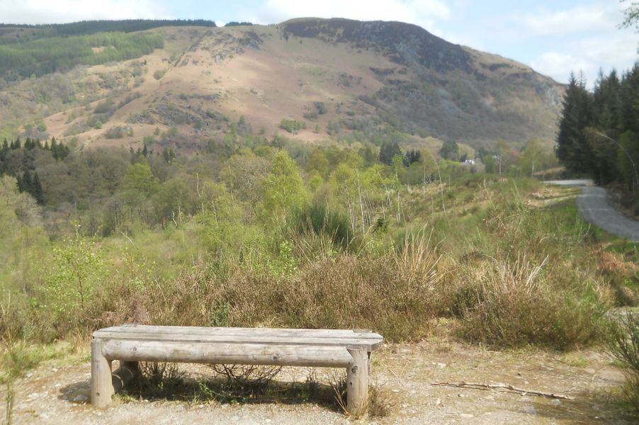
Here you find
yourself close
to Lochan Spling where there is a bench
with wonderful
views of the loch and the hills beyond. ln
front is the wire sculpture
of a giant pike, already referred to,
through which
you can see the shimmering reflections on
the 1och’s
surface. Further along the shore, is
the sculpture of a giant dragonfly. Here you leave the
loch and return
through a conifer plantation to the start
of the walk.
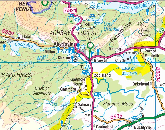
Map
and Route Description for
Doon Hill
Doon
Hill Walk - Route
Description:
This walk is a nice
leisurely four-mile route in the heart of the country around Doon Hill
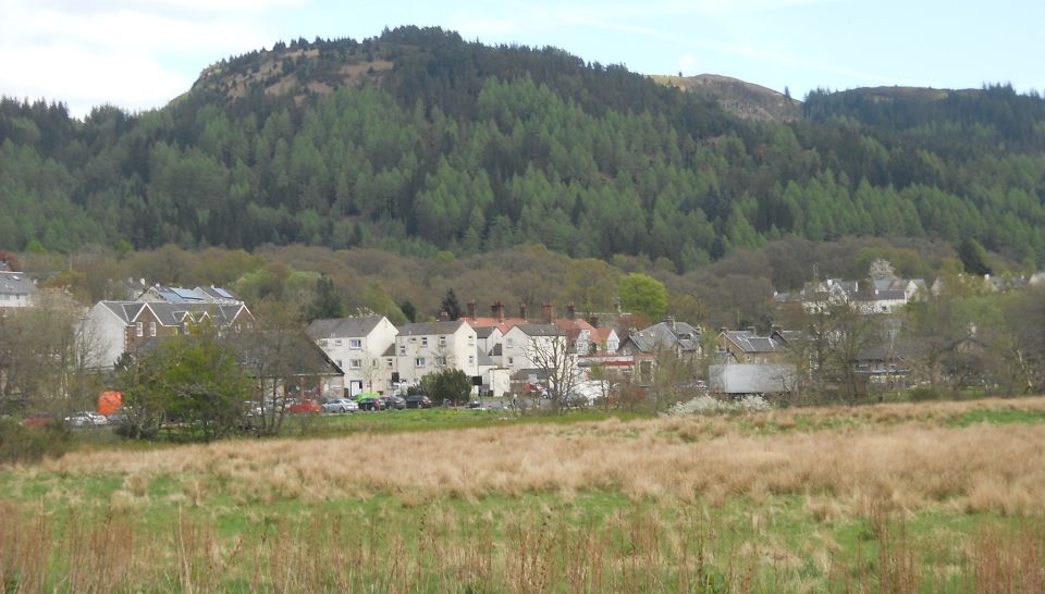
near the beautiful town of Aberfoyle.
It is part of the Doon Hill Fairy Trail which is associated with the
17th-century Gaelic scholar, the Reverend Robert Kirk, Minister of
Kirkton Church 1685-92, who investigated local fairy lore
and published his famous book,
“The Secret Commonwealth of Elves and Fairies”.
The walk starts at the Scottish Wool Centre Car Park in Aberfoyle,
passes through the Riverside Car Park and turns
left to cross the road bridge over the River Forth. At the bridge, it
is of interest to read the story on the “Poker Tree" Information Panel
which provides historical background to the area and is incorporated in
Sir Walter Scott’s novel “Rob Roy".
The walk continues along Manse Road passing Craigmore View housing
development on the right. At the gate to the cemetery on the lefi, pause
at the information panel which provides further details of
the ‘Fairy’ Minister Robert Kirk, and gives direction to his grave and
memorial stone carving located at the rear of the church.
Moving on, the walk swings left at the next junction and follows the
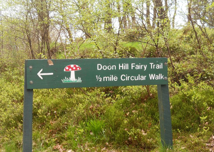
sign, “Doonhill Fairy Trail”.
It passes attractive cottages and after passing round a green gate
takes the 2nd path on the left, still following the sign, into a wood
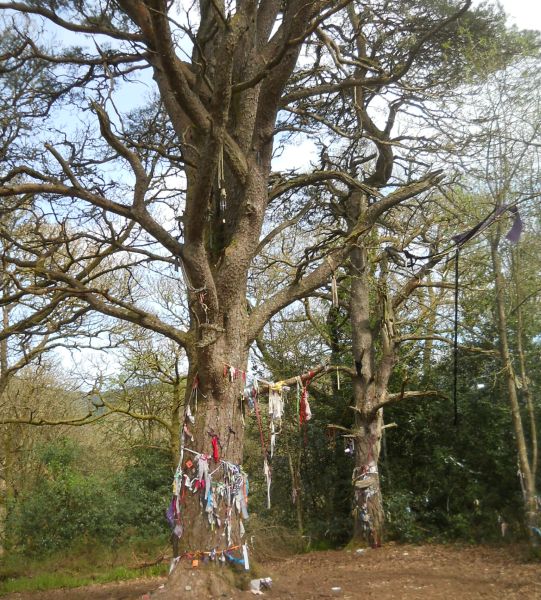
which winds up a steep hill and emerges onto a flat hilltop with paper
streamer “decorations” hanging from trees.
This hilltop is where Robert Kirk’s body was found dressed only in a
nightgown on 14th May 1692. His ‘murder’ has been fabled by the local
people, that due to his obsession with fairies and his revelations of
their closely guarded secrets, he annoyed the spirit people and they
took their revenge. The mature pine with streamers attached is thought
of as
“a doorway to an underground Fairy Queen’s palace where Robert Kirk's
soul is still held captive".
Leaving the top, the walk follows the path down the hill ( take care
there are steep sections ) and turns left at the bottom to continue on
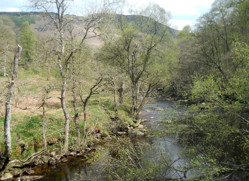
the existing path. lt crosses a flat bridge over a tributary of the
River
Forth and takes the left path at the next junction. Looking to the left
and over a field it is possible to see and be pleased at having
climbed to the top of the wooded Doon Hill.
At the next junction, the walk turns left and follows the sign,
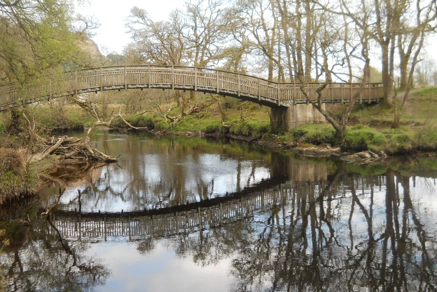
“Aberfoyle", onto a new path which crosses the arch bridge over the
Forth, a pleasant spot to stop and admire the water features. It
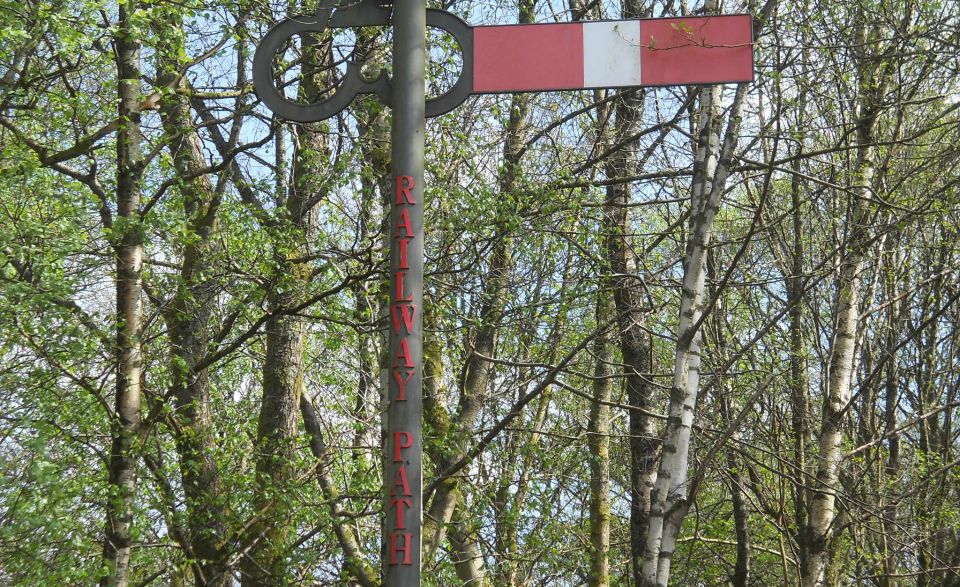
turns
left again onto the old railway track, now the N7 cycle track, passes
the Rob Roy Hotel on the right and then runs parallel on the tarmac
track
between the river and the main road.
From the tarmac track. have a look at the new Bike Park on the left
before passing the children’s swing park and the former railway
cottages and finally return to the Wool Centre where refreshments are
available.


 :: Loch Ard
Gallery
:: Loch Ard
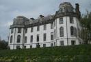
Gallery 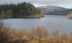 :: Gartmore
House
Gallery
:: Gartmore
House
Gallery