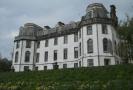
West Highland Way: Trailblazer Ochils and Campsie Fells

 The Trossachs

 Gartmore House Walk
West Highland Way - Map West Highland Way: Footprint Map
 

Photographs of a circular walk

 starting and finishing at Gartmore House

near
Aberfoyle

in the Trossachs Region

 of Scotland


Gartmore House on the outskirts of Aberfoyle

Gartmore House

on the outskirts of Aberfoyle

This is a country mansion house and estate

 built in the mid-18th century

for the Graham family on the site of an earlier house.

It is now a residential and conference centre.

It is a category "B" listed building


Scenery in the Trossachs

View from path to Crinigart Lodge


Crinigart Lodge

Crinigart Lodge on Gartmore Road


Signpost on Gartmore Road at track into Loch Ard Forest

Signpost on Gartmore Road

 at track into Loch Ard Forest


Loch Ard Forest

Loch Ard Forest


Cobleland Campsite


River Forth

River Forth


River Forth

River Forth


Doon Hill from Easter Park

Doon Hill


Footbridge over the River Forth

Footbridge over the River Forth


Entrance to Cobleland Campsite

Entrance to Cobleland Campsite

 on the Aberfoyle to Gartmore N7 cycle path


Gartmore Bridge over the River Forth

Gartmore Bridge over the River Forth


Gartmore Bridge over the River Forth

Gartmore Bridge over the River Forth


Gatehouse to Gartmore House


Duck pond at Gartmore House

Duck pond at Gartmore House


Map of area around Gartmore House

Map of Gartmore House 


GARTMORE HOUSE CIRCULAR WALK - ROUTE DESCRIPTION:


This 
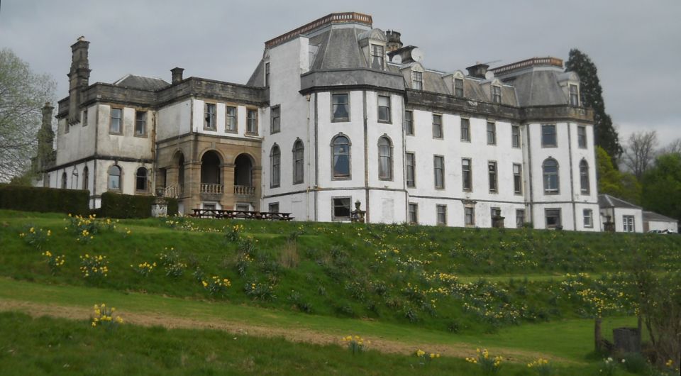
circular walk of four miles starts at the magnificent 18th century Gartmore House in the Loch Lomond and Trossachs National Park.
it was built in 1793 by William Adam for the Graham Family and since 2000 it has been established as Gartmore House Trust with charitable status.
It is used as a centre for residential conferences and activity holidays.
From the House the walk turns left at the crossing onto the driveway to the north and Gartmore village, passes by the outbuildings, “The Mews‘, 
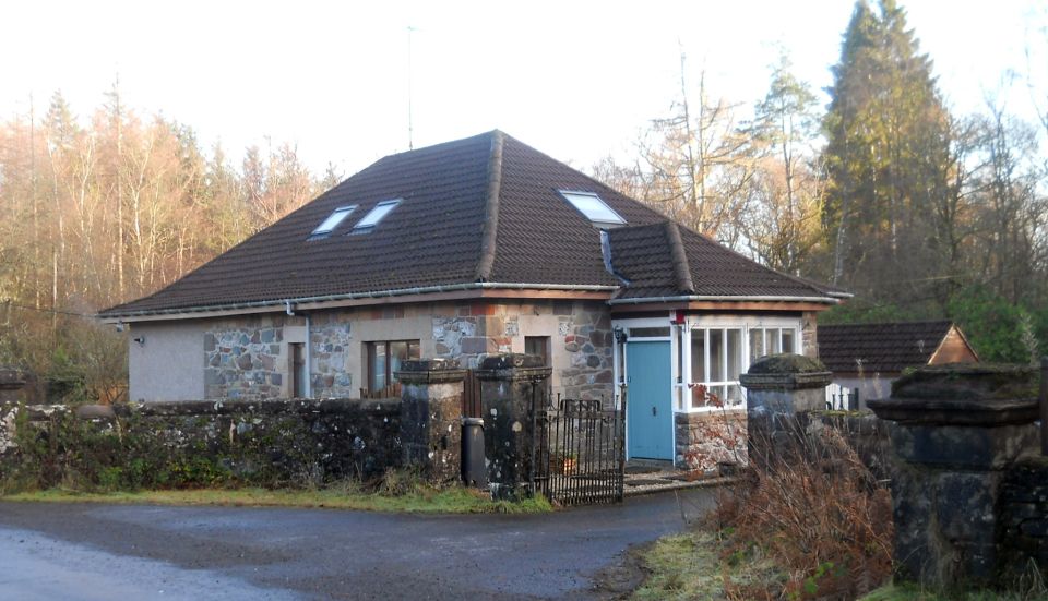
and at the white house turns right onto a gravel track to pass through a wood and exit at “Crinigart Lodge’ onto Gartmore Road. It tums right 
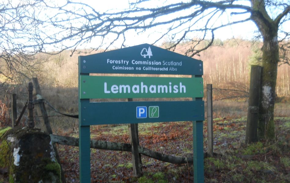
( take care of traffic ) and after passing farm sheds it enters a 
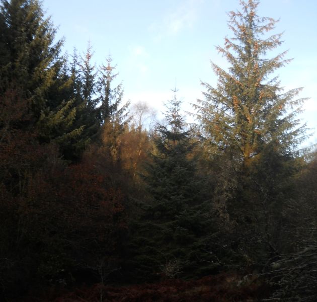
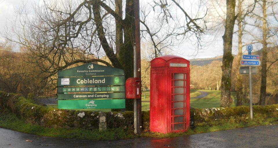
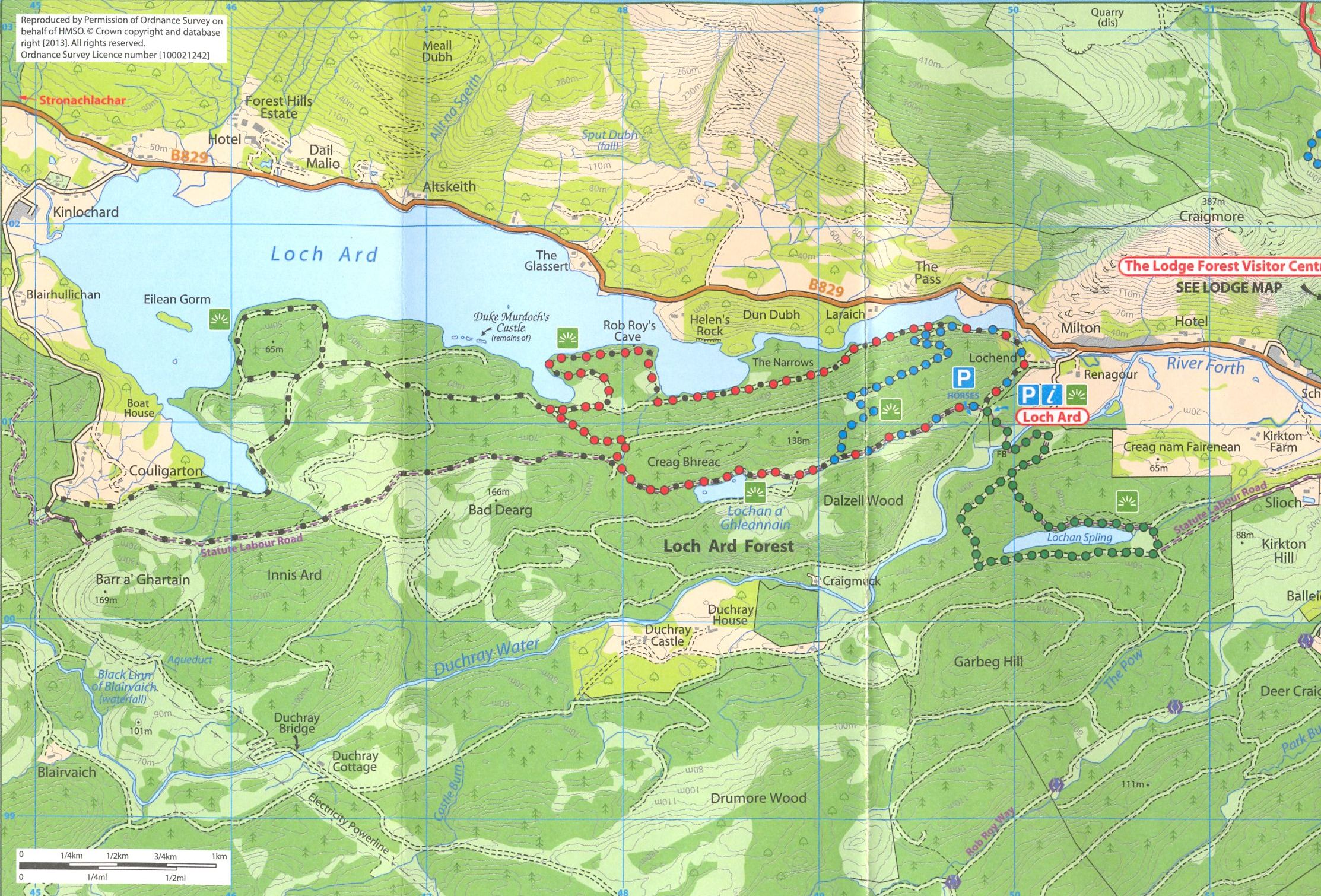
vehicle track on the left signed, “Lemahamish" and into Loch Ard Forest.
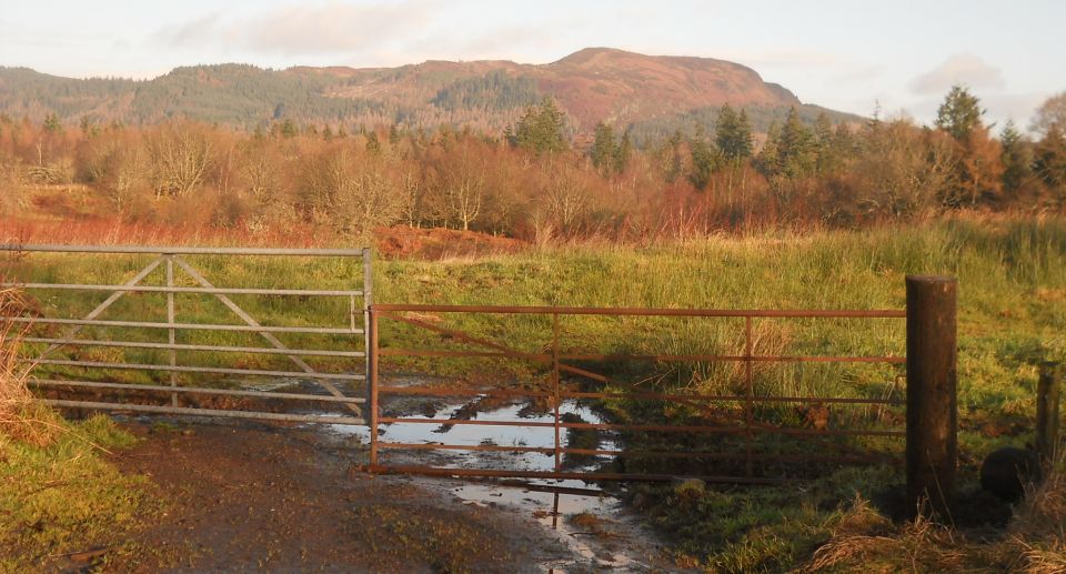
At the track junction and vehicle turning point, look out for the narrow path ahead into a wood. The path twists and turns and at the fork it is best to take the path on the right which continues through the wood and 
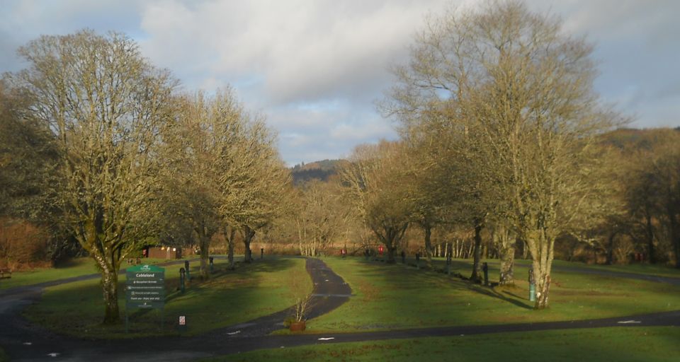
descends a set of steps into an open field with caravans. Taking the left path at the fork shortens the walk but involves crossing a stream overlarge stones which can be a problem if the stream level is high.
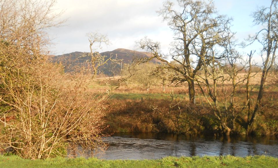
In the campsite, the walk turns left and at the “cycle” sign it turns right along the riverside and exits the Campsite onto an open green 
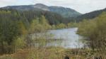
field beside the Lemahamish Pool part of the flowing River Forth.
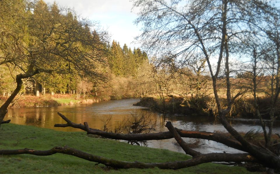
There is an option here to take the forest track or the preference is to continue along the river path, it being more interesting, ( take care as there are awkward tree roots ) and loop round onto the forest track. Turning right and after a short distance, the walk leaves the track and turns 
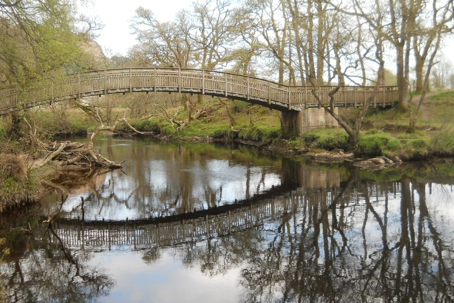
right onto a new path between fields which crosses a hump wooden bridge
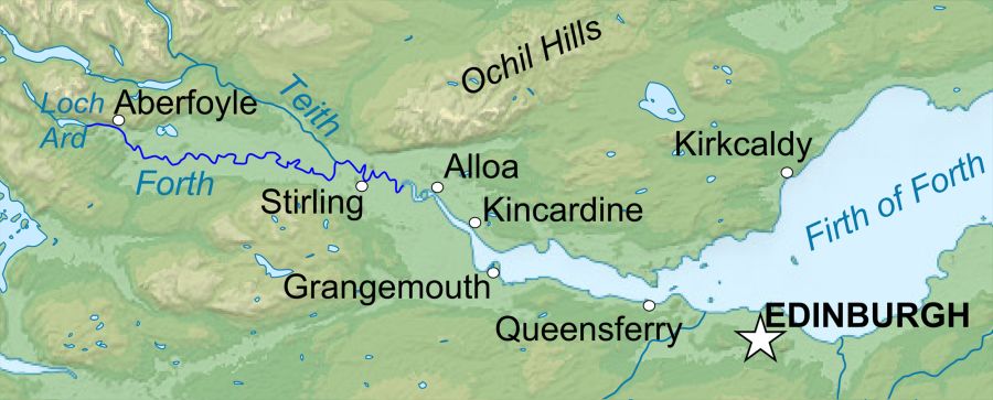
 over the Forth and onto the Aberfoyle - Gartmore N7 cycle path. It turns right, proceeds along this straight tarmac path to the Gartmore Road junction and tums right to pass the sign “Gartmore via Barbadoes 4" on the left.
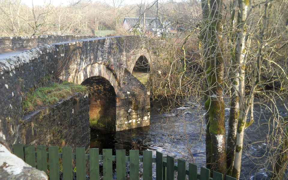
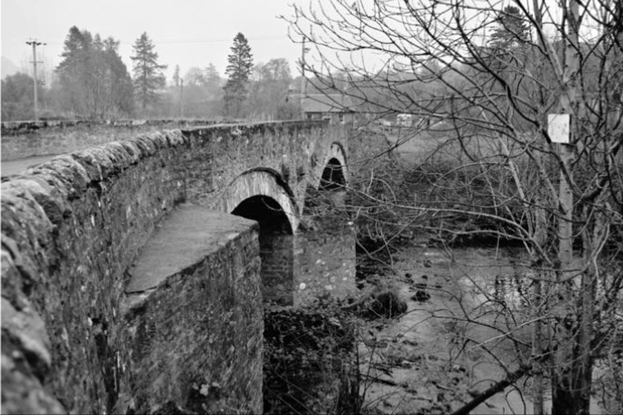
Pause on crossing the narrow road bridge over the downstream Forth, and view on one side, the campsite, and the above path entry point, and on the other, the high structured A81 Glasgow stone bridge.
After the crossing and with the entrance to the campsite on the right, the walk turns left and passes the “Riverside” cottage on the left before turning right onto the busy A81 Glasgow Road. Take care and best to walk on the grass verge for a short distance before turning right through the gates into the driveway to Gartmore House. This is a lovely driveway to walk along and passes the house on the left with its small boat pond and island summer house. Looking round there are picturesque views of the Menteith Hills and the Carse of Stirling, before it passes
the walled garden, which, presumably at one time, would be filled with vegetables and fruit trees and returns back to the house. Finally, on passing the house. there are some picnic tables to relax in and take in the splendour of its location.


Map of the River Forth

Map of the River Forth


Map of Aberfoyle and the Menteith Hills

Map of Aberfoyle

and the Menteith Hills


Map of Loch Lomond and Trossachs area

Map of Loch Lomond and Trossachs area

( Note:- Click here or on above for large format copy )


        Gartmore House Gallery Photo Gallery :: Loch Spling Gallery Photo Gallery

<< Back : Bearsden Walks Index : Next >>


Scotland Index :: Scottish Peaks :: Scotland Walks

Glencoe | Ben Nevis | Knoydart | Isle of Skye | Isle of Arran

The Eastern Highlands | The Central Highlands | The Southern Highlands | The NW Highlands


Adventure Travel : Worldwide Mountaineering : Site Index

fb icon  google+ icon Linkedin icon  twitter


Guide Books & Maps - Scotland:-


West Highland Way: Footprint MapWest Highland Way - Map West Highland Way - Map Western Scotland & the Western Isles OS Road Map Northern Scotland OS Road MapSouthern Scotland OS Road MapGlasgow Popular Hills - Map


Ochils and Campsie Fells

Glasgow Visitor Guide - Colin Baxter Itchy Insider's Guide to Glasgow Glasgow Footprint Pocket Guide Glasgow Insight Pocket Guide Glasgow Guide Pub Companion Glasgow Scotland's Highlands & Islands - Rough Guide Scotland - Rough Guide

Glasgow Insight Pocket GuideCollins Street Map of GlasgowGlasgow: Then & NowThey belonged to Glasgow Phillips Street Atlas of Glasgow & West Central Scotland Glasgow: The Photographic Atlas100 Hillwalks around Glasgow 50 Walks in Glasgow & SW Scotland

Visit Scotland - Touring Guide Scotland: Where to Stay - Hotels & Guest Houses Scotland: Where to Stay - Bed & Breakfast Rough Guide ScotlandScottish Highlands & Islands - Rough Guide Scotland - Lonely PlanetScotland's Highlands & Islands - Lonley Planet Great Glasgow StoriesGlasgow & Surroundings - Insight Guide

West Highland Way: Official GuideWest Highland Way: Rucksac ReadersWest Highland Way: TrailblazerThe West Highland WayWest Highland Way: Footprint MapWest Highland Way - Map West Highland Way - Map West Highland Way Wet Highland Way - Official Guide

Munro Almanac The High Mountains of Britain and Ireland The Munros: Scottish Mountaineering Club The Isle of Skye The Isle of Arran Wilderness Walks Ski Mountaineering in Scotland

More Wilderness Walks 50 Best Routes on Skye and Raasay Skye - W.A.PoucherMagic of the Munros Mountaineering in Scotland and Undiscovered Scotland by W.H.MurrayA Long Walk on the Isle of Skye

Classic Climbs - Central & Southern Highlands The Isle of Arran Lonely Planet, Walking in ScotlandPathfinder Guide: Skye and NW Highlands WalksPathfinder Guide: Fort William and Glen Coe Walks Rambler's Guide: Ben Nevis and Glen Coe50 Best Routes on Skye and Raasay - Chris Townsend


Google Analytics


Google Analytics

extremetracking
 eXTReMe Tracker


extremetracking
Sitelock caingram.com
SiteLock
Sitelock
Sitelock caingram.info
SiteLock
Sitelock