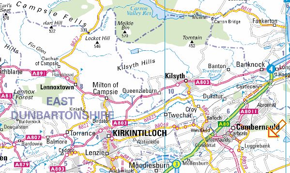
Location: Cumbernauld
Map: OS Landranger 64 ( GR 787733 )
Distance: 5.5 miles ( 9km )
Time: 2 hour 40 minutes
Terrain: tracks and paths Throughout the 20th
century Palacerigg farm colony provided work for unemployed
Glaswegians, who grew vegetables, dug peat and maintained the farm
infrastructure in return for food, lodgings and
return rail fares to Glasgow, plus a payment for their wives and
children.
Palacerigg became a country park in the mid-1970s and continues its
farming traditions as a rare breeds centre, and you can link many of
its paths to form a varied route with good views over Cumbernauld and
north
to the Campsies.
From the car park walk back along the access road and turn left on to a
gated track signposted "Laverock Trail, Treetop Way and Fallow Deer".
Beyond farm buildings turn right, before the signposted Laverock Trail,
on to a path beside the fence enclosing the field behind the buildings
and follow this round, keeping a sharp eye out for the Laverock Trail,
which joins from the left and crosses over at waymarks.
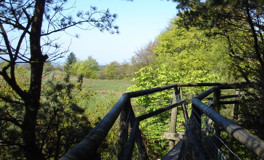
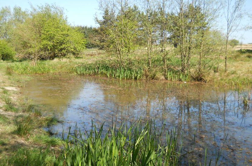
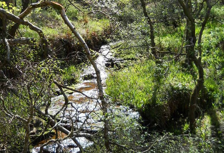
Follow the Laverock Trail across open ground and over a wooden
footbridge, then ascend left of a fenced enclosure to a vehicle track,
signposted right to Toddle Moor trail and picnic site. Go right to an
access gate,
from where a fence leads to a path across heather moorland via wooden
footbridges to a vehicle track lined with conifers.
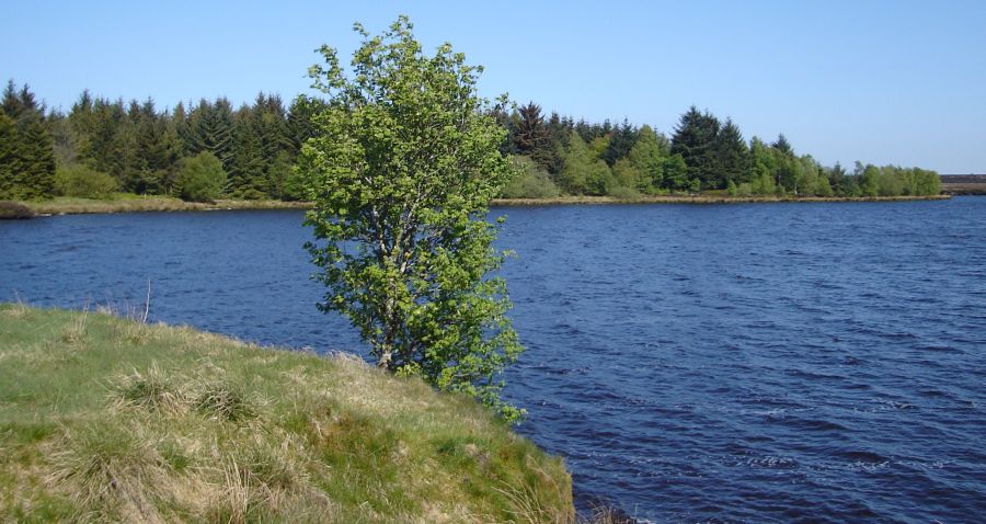
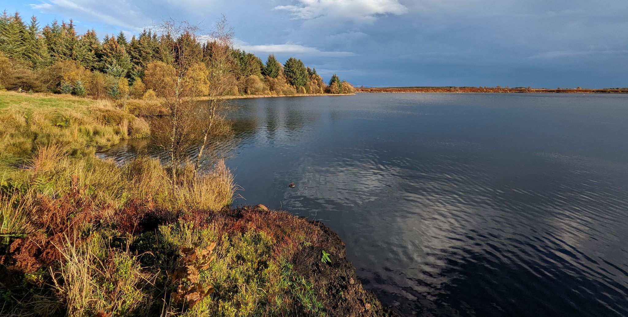
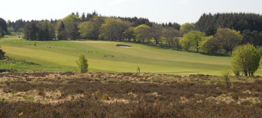
Turn left on to the track and follow it north to Fannyside Loch and
beyond, past a junction and across a fairway and two tees on the golf
course.
Watch out for golf balls from right or left. depending on direction of
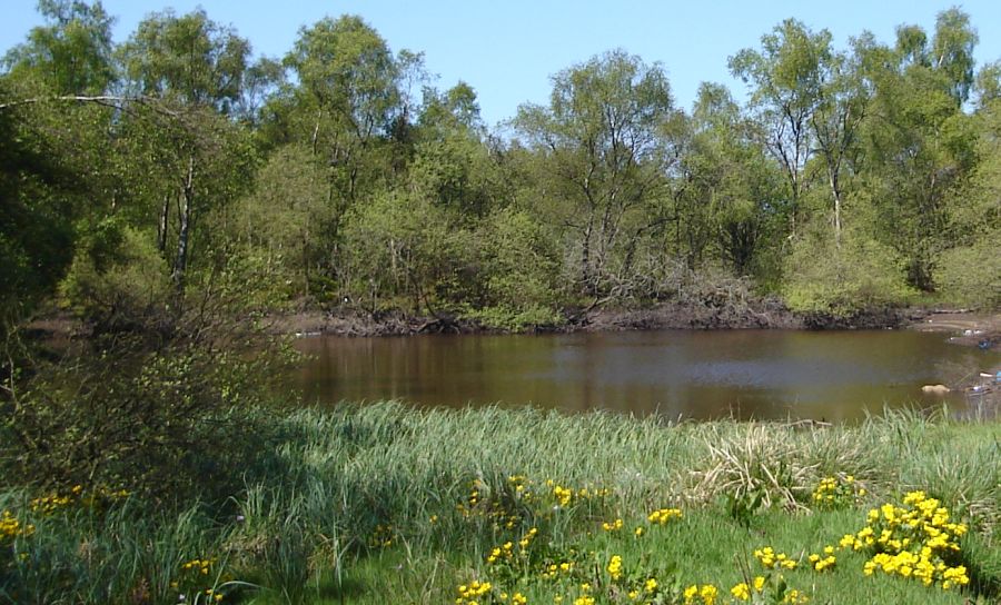
play. At the woodland strip turn right through an avenue of trees
between fairways and past a pond to join the main orbital track. Turn
left, then right at the Limekilns Pond on to a track signposted Forest
Woods and Abronhill.
Leave the park and enter the Scottish Wildlife Trust’s Forest Wood
reserve. Just beyond a pylon go left on to a track through woodland and
into open ground. At the jimction turn left and pass back under the
pylons
to re-enter the woodland and park. Just before the burn at the path’s
lowest point, turn right into Glencryan Wood and follow the path down
the east side of the burn towards the main road.
At the bottom, stay left over the lower gorge and round the embankment
above the road to re-enter the woodland and ascend to a junction. A
left turn leads through Woodland to a final descent, to exit Glencryan
Wood just
down from the burn mentioned earlier. A right turn leads to the main
orbital track which leads right to the service road. Turn left here
back to the farm and car park.
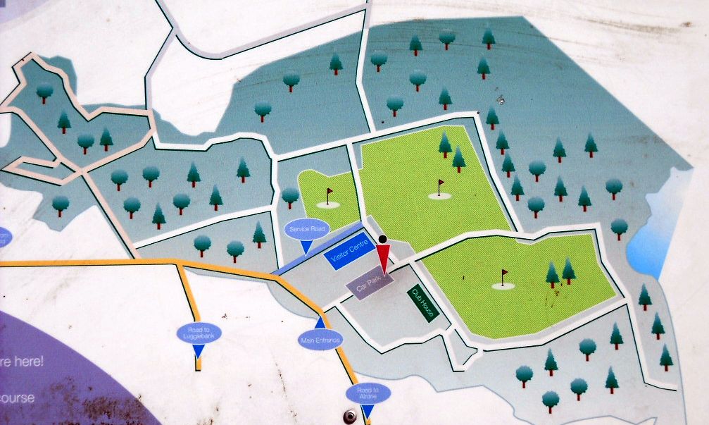
Walking
Route II Map
for Palacerigg
Country Park
PALACERIGG COUNTRY
PARK II- ROUTE DESCRIPTION:
Location: Palacerigg
Country Park,
Cumbernauld
Grade: Easy woodland walk
Distance: 4.5 miles / 7km
Time: 2 hours Covering almost 700
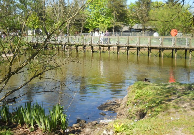
acres of disused farmland, Palacerigg Country Park offers a wonderful
‘lung’ for the people of Cumbernauld and the surrounding area. The park
was set up in 1974 by Cumbernauld Burgh
Council and its first director, who did so much to establish the park,
was the inspirational writer and naturalist David Stephen. He is
commemorated by a large mural in the visitor centre, the work of
Alasdair Gray.
David Stephen had very firm views about conservation and in many ways
was ahead of his time. He wrote a column called The World Outside for
The Scotsman for over 30 years and never pulled his punches. The mural
at Palacerigg carries the caption ‘the future of wild life depends on
man which becomes ever more true with every passing year. David Stephen
died in 1989 but Palacerigg remains as part of his enduring legacy.
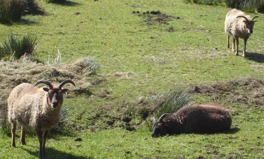
Having said that, the park is somewhat diminished from Stephen’s day.
Keen to give local people, and especially children, as full an
experience as possible, he set up a small zoo where you could see
wolves, wild cats and birds of prey. In time this became too expensive
to maintain but the park still features rare breeds of farm animals
including the
tough little Ronaldsay sheep and some exotic chickens called Scots
Dumpys!
The walk described here covers much of the park area and is especially
attractive in spring. Many thousands of trees have been planted at
Palacerigg but it is the older trees which might draw your
attention. The walk also features a couple of very attractive small
gorges, the second of which has pretty little waterfalls. The walk is a
combination of two
waymarked routes, red and blue, which are marked on the excellent free
map of the park available at the visitor centre. You can study
these routes while perhaps having a coffee in the café before you set
off. It has to
be said that some of the waymarking is not very clear but if you follow
our directions you shouldn’t go wrong.
All of the tracks are well made though sections can inevitably become
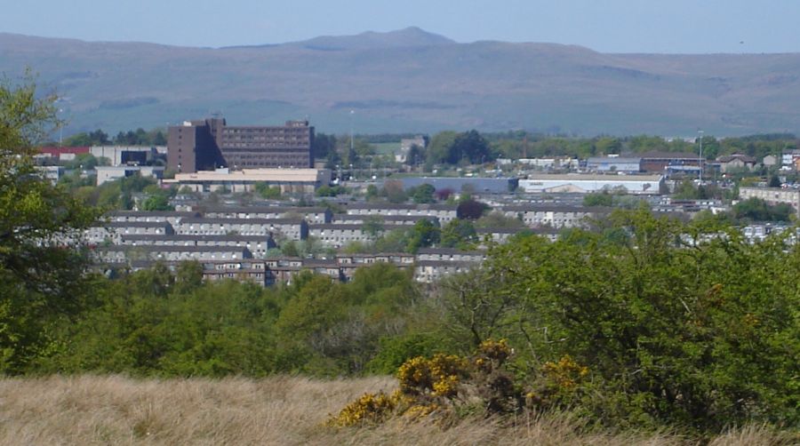
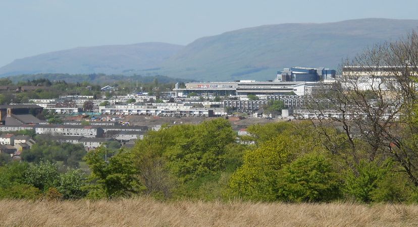
muddy after rain. Towards the end of the walk you get a good view over
the Fannyside Lochs and an interpretation shantytown called ‘the
colony’.
On your Way round the park you may well see roe deer and hear
woodpeckers yammering in the trees. There is in fact a good range of
wildlife, which would be sure to please David Stephen were he able to
return to the park today.
Considering how close it is to Cumbernauld, this walk is remarkably
quiet apart from a short section which runs close to an industrial
estate. One small niggle is the lack of any public transport to the
park, which
must be a deterrent. If this could be rectified more people could come
and enjoy David Stephen’s legacy, bringing them closer to nature. ROUTE PLANNER Map: OS 1:25,000
Explorer sheet 349 ( Falkirk, Cumbernauld & Livingston ).
Free
park map available at Visitor Centre.
Distance: 4.5 miles / 7km
Time: 2 hours
Start / Finish: Palacerigg Visitor Centre ( GR: NS787733 )
Public transport: None to the park.
Nearest is Cumbernauld Station, 3km away. Details from
www.travelinescotland.com
Information: Palacerigg Country Park, 01236 720047 or
www.northlanarkshire.gov.uk/palacerigg Route:
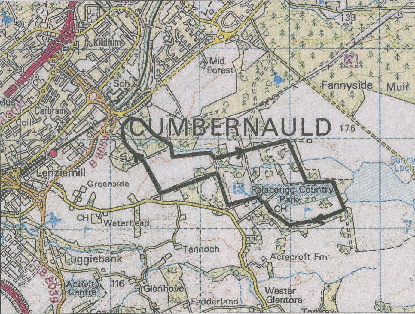
From the car park, walk left of the visitor centre and turn L on a
track.
In 800m just before a cattle grid turn R.
Keep left at next junction.
Turn R at Model Flying Club. At junction go ahead, slightly L ( red
marker ).
Follow main track above a small ravine then down to edge of industrial
estate.
Keep with path going R then uphill into woods, with ravine on R.
At next T-junction go R, keep L at fork and continue to T-junction with
Glenclyan Woods sign.
Turn L here on long straight track.
At corner of woods go R, through trees then with views of loohs to L.
Turn R at next junction and follow track past golf clubhouse back to
car park.