


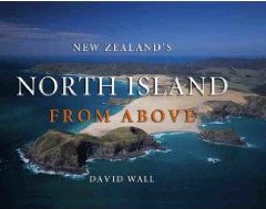
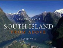
As a constituent of the “Seven Summits” ( the highest peaks of the seven continents ) the 3000 metre Mt.Cook in the South Island of New Zealand would present a far greater mountaineering challenge and be much more appropriate than the smaller, officially recognised but easily-accessible, 2000m Mt.Koskiuska of neighbouring Australia. The ice-falls of the Fox and Franz-Joseph Glaciers of the Southern Alps are among the steepest in the world and the savagely eroded terrain renders routes to huts as difficult and dangerous as the climbs to summits - it is standard practice to ferry parties in and out by helicopter. However the volcanoes of the North Island provide an alternative and different mountain experience.
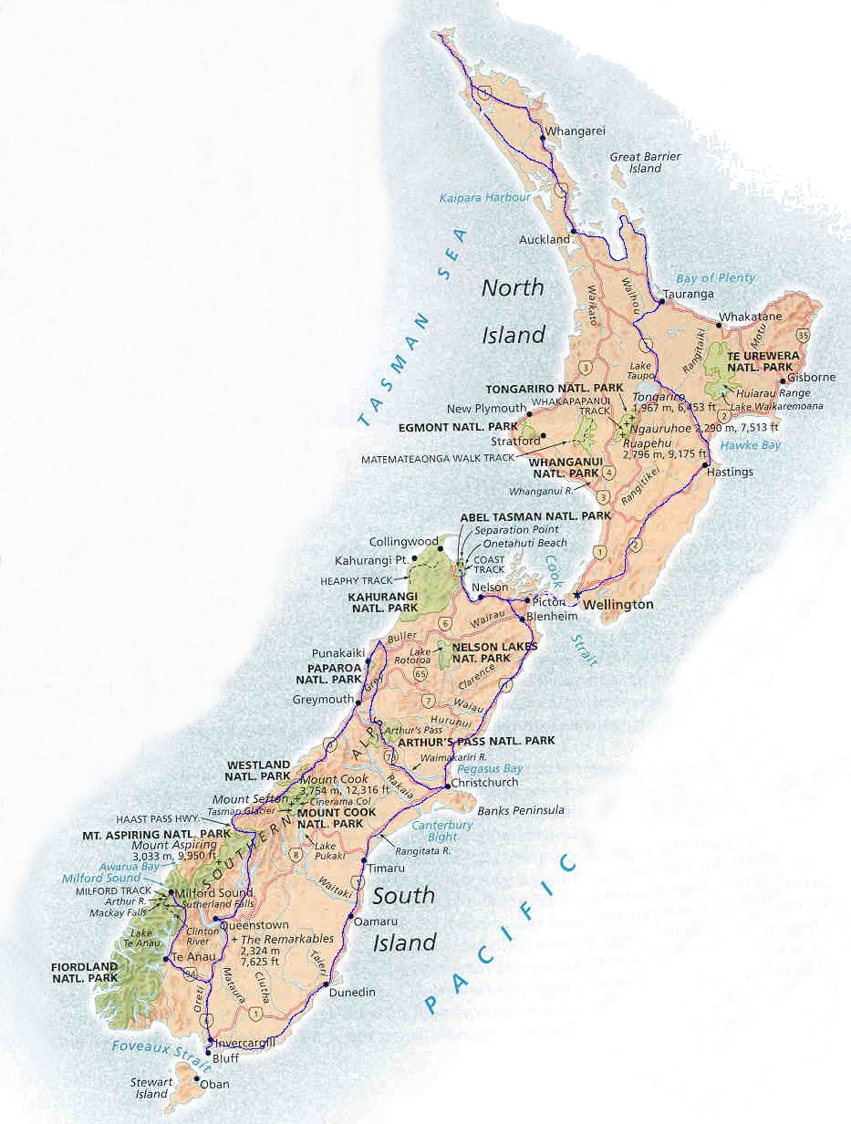
From the ultra-modern, high-rise edifices of sparkling chrome and glass of windy Wellington I travelled north by air-conditioned coach through rolling, verdant, but sparsely populated countryside, dominated by the snow-capped, multi-summited, semi-active volcano of Mt. Ruapehu, and over the "Desert Road" through the bleak, barren wasteland formed in its rain-shadow, to the small, rural town of Turangi. Early next morning a local mini-bus service took me across the "Saddle" through mist-enshrouded hills and up the winding, mountain road to the camping grounds sheltered amid giant tree-ferns at Whakapapa at the centre of the Tongariro National Park - an embodiment of all New Zealand's varied landscapes.
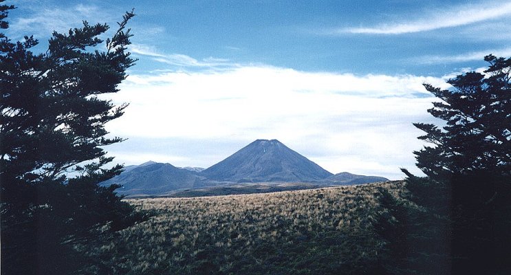 Mt. Ngauruhoe from Whakapapa in Tongariro National Park |
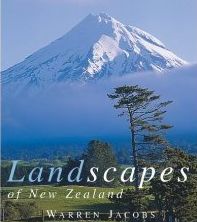
A few days later, after exploring the picturesque lakes and waterfalls of the scenic park and an interesting ascent of the glaciated Ruapehu, I retraced my route across the "Saddle" and branched off up to the roadhead in the Mangatepopo Valley - the starting point for the “Tongariro Traverse" - claimed by many to be the best one day walk in New Zealand. Leaving the road the trail follows alongside a meandering stream through alpine scrub and across old lava flows to a wide, flat amphitheatre at the head of the valley. A zig-zag route up the head-wall then gains a col at the base of the scoria-scree slopes fanning down from Mt Ngauruhoe - another of the North Island's trinity of volcanic summits. ( Mt. Egmont, a look-a-like for Japan's Mt. Fuji, is the third ).
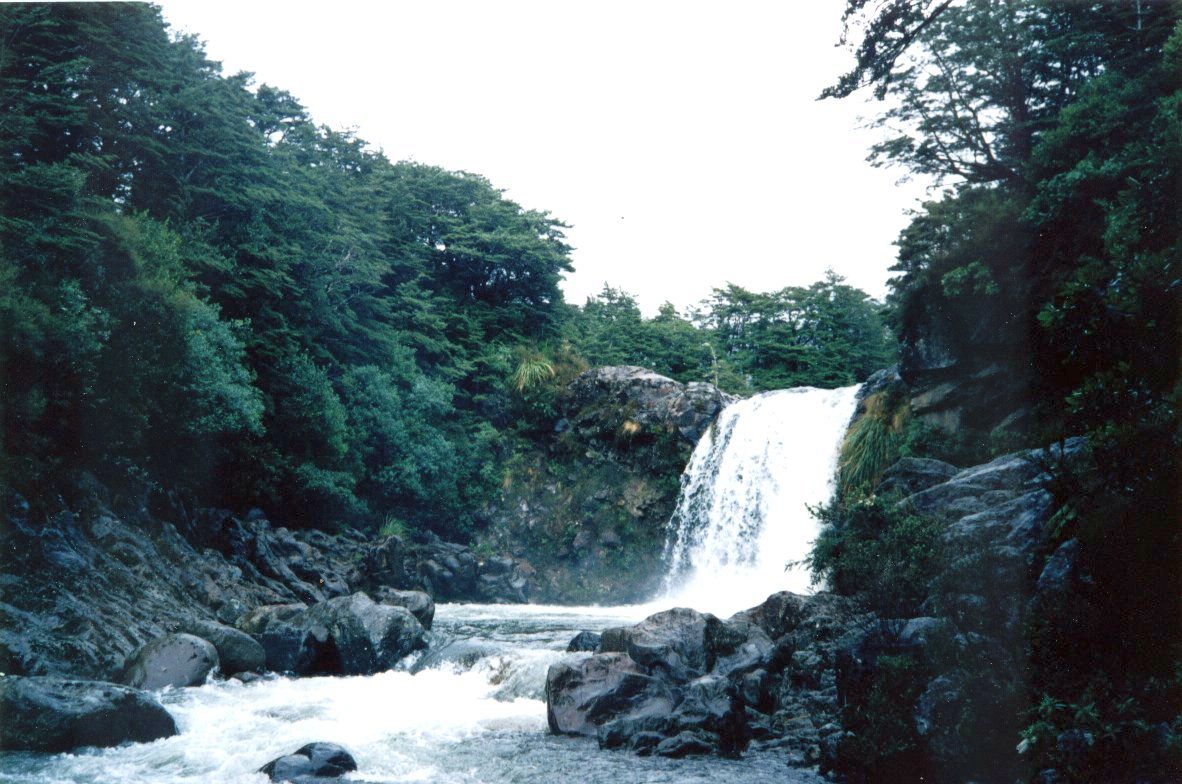 Tawhai Falls in Tongariro National Park |
Outcrops of solid rock protrude from the scree and the recommended technique is to utilize these as much as possible on the long, steep climb to the crater rim. Unfortunately some patches of the soft, loose gravel are unavoidable and render upward progress both difficult and exhausting. Clouds shrouded the top but a rough trail led round the rugged rim of the outer, older crater to the highest point of the 7,500 foot volcano. I was enjoying my packed lunch when the swirling mist cleared to yield a spectacular view of the nearby, snow-covered peaks of Mt. Ruapehu - the highest of the North Island's mountains. Thankfully it was to be some time after my visit that Ruapehu caused a major surprise by blowing its top.
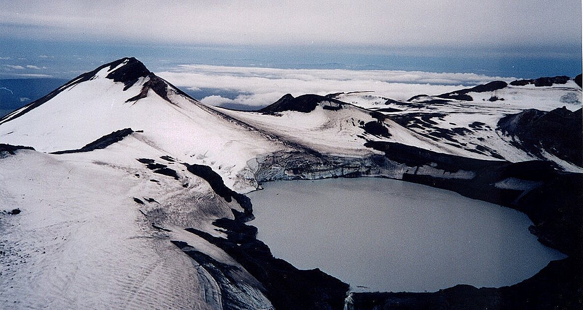 Summit snowfields and Crater Lake of Mt. Ruapehu |
Moving further round onto the completely-circular rim of the newer, smaller, inner crater I peered down into the awesome depths where plumes of nauseous, sulphurous fumes hissed ominously from numerous fumeroles. The scree slopes , previously a handicap on the ascent, now provide an exhilarating and rapid means of descent - known as the "Ngauruhoe Express" - to regain the col at the base of the volcano where a poled route leads down into and across the wide, flat expanse of the extinct South Crater - a veritable lunar landscape with its encircling high, barren, jagged escarpment.
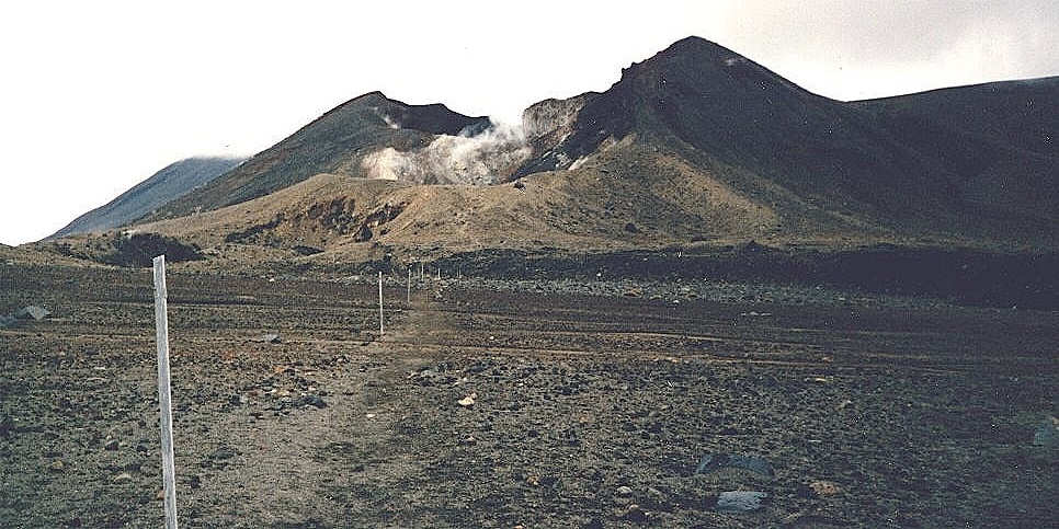 Poled route across South Crater |
On the far side, a short climb to another col gains a splendid outlook over the austere beauty of the Rangipo Desert formed in the rain shadow area between Ruapehu and Ngauruhoe. Climbing higher I reached the rounded hilltop above the smouldering, sensational Red Crater - the steep inner sides are partly jet black and partly deep crimson - the colour contrast emphasized by a separating band of pure-white rock.
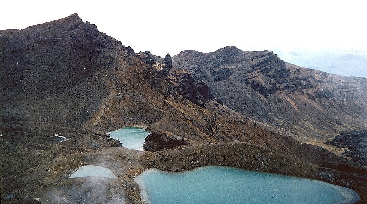 Emerald Lakes |
Onwards one plunges down through soft, powdery ash to a set of emerald-green lochans and across the level expanse of the dormant Central Crater to skirt the banks of the tranquil Blue Lake. Continuing round the lower slopes of the North Crater the trail emerges from the harsh volcanic landscape into grassy scrubland.
Further down I was intrigued by a vast cloud of smoke billowing from the hillside. On approaching I discovered it was issuing from a set of thermal springs boiling and gurgling like an immense, witch's cauldron. Patches of bright, multi-coloured sediments, akin to an artist's palette, surround the scaldingly-hot waters gushing from the fissured earth.
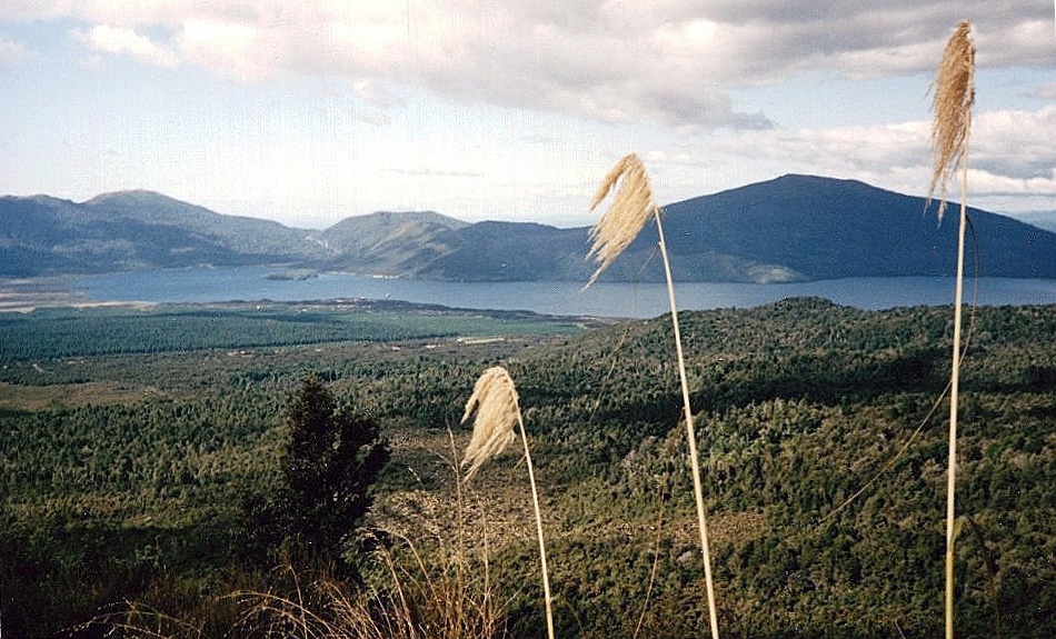 Lake Taupo on descent from Ketehahi |
Descending from the Hot Springs of Ketehahi through the rough tussock-grass a picturesque panorama unfolds of the brilliant, blue waters of Lake Rotoira and Lake Taupo in vivid contrast with the dark bottle-greens of the surrounding, conifer forests. A pleasant walk through the woods leads to the minibus pick-up point on the Rangipo Road to complete the continually interesting and justly renowned crossing of Tongariro National Park - more demanding than a day’s outing on Mt.Kosciusko.
(The Commentator, The (Glasgow) HERALD, Saturday 11th September 1999)
References:-
Queenstown: The adventure capital of the world
New Zealand: Denis Heirendt
Tramping in New Zealand: Glenn G.Larsson
New Zealand Adventure: Scott Yost
South Island Photo Gallery :: North Island Photo Gallery
Site Index :: Adventure Travel :: Worldwide Mountaineering


