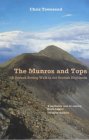
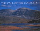
The Corbetts - SMC Scottish Highlands Hillwalking Guide

 Southern Scotland


White Coomb
The High Mountains of Britain & Ireland The Islands

 Photographs of a circuit of the Corbett White Coomb

near Moffat

in the Borders Region of Scotland


The Town of Moffat in the Borders Region of Southern Scotland

The Town of Moffat

Moffat is on the 
Southern Upland Way

- a long distance walk

across the Borders Region of Scotland


The Grey Mare's Tail Waterfall on ascent to White Coomb

The "Grey Mare's Tail" Waterfall

 on ascent to White Coomb

Grey Mare's Tail is a 60 metre ( 200ft )

 
hanging-valley waterfall.

 The fall is produced by the Tail Burn

 flowing from Loch Skeen

Waterfalls Gallery


Tail Burn on ascent to White Coomb

Tail Burn

 on ascent to White Coomb


Tail Burn on trail to Loch Skeen

Tail Burn

 on trail to Loch Skeen


White Coomb ( 2694ft, 821m ) from Tail Burn on trail to Loch Skeen

White Coomb ( 2694ft, 821m )

 from Tail Burn

 on trail to Loch Skeen


Tail Burn on trail to Loch Skeen

Tail Burn

 on trail to Loch Skeen


Tail Burn exit from Loch Skeen

Tail Burn

 exit from Loch Skeen


Lochcraig Head from Loch Skeen

Lochcraig Head

 from Loch Skeen


White Coomb above Loch Skeen from Lochcraig Head

White Coomb

 above Loch Skeen

 from Lochcraig Head


Loch Skeen

Loch Skeen


Loch Skeen on traverse of ridge from Lochcraig Head to White Coomb

Loch Skeen

 on traverse of ridge

 from Lochcraig Head

 to White Coomb


Lochcraig Head from Loch Skeen

Hart Fell Ridge

from Firthhope Rig

 on traverse from Lochcraig Head

 to White Coomb


Lochcraig Head and Loch Skeen on descent from White Coomb

 Lochcraig Head and Loch Skeen

 on descent from White Coomb


White Coomb on descent to Tail Burn

White Coomb

on descent to Tail Burn


White Coomb ascent route

White Coomb

 ascent route


The Grey Mare's Tail Waterfall on ascent to White Coomb

The "Grey Mare's Tail" Waterfall

Waterfalls Gallery


The Grey Mare's Tail Waterfall on ascent to White Coomb

The "Grey Mare's Tail" Waterfall

Waterfalls Gallery


Moffatdale

Moffatdale


Moffatdale

Moffatdale


Map of White Coomb

Map of White Coomb


Map of a Circular Walk to the Grey Mare's Tail Waterfall

Map of a Circular Walk

 to the Grey Mare's Tail Waterfall


GREY MARE'S TAIL WATERFALL - ROUTE DESCRIPTION:

Location: Moffatdale
Map: 0S Landranger 78 ( GR 186146 )
Distance: 4.5 miles ( 7km )
Time: 3hours
Terrain: Paths and pathless hillside

This varied walk takes in two scenic waterfalls. an obscure hilltop and one of the finest and highest lochs in the Southern Uplands. Start from the National Trust car park at the foot of the Grey Mares Tail waterfall. Walk out of the car park then head north-east up the road crossing the bridges over the Tail Burn and the infant Moffat Water before following sheep tracks up the narrow valley floor between the burn and the road. Deb's Linn. a geological site known for its fossils. lies ahead. At the entrance to the Linn, either ascend its right side then continue along the rim, or follow the burn into the narrow gorge where it will be necessary to cross back and forwards. when the burn forks it is possible to go a short distance up the left fork for a closer look at the main burn cascading into the Linn; a tricky step requires care. Return to the right fork and pass beneath the branches of a small tree then continue uphill. It soon becomes possible to escape up the slope on the right but it is perhaps better to continue for a short distance and exit as for the bum to the side of its final small cascade. A rough hill track can now be followed up the hillside just out from a fence and although the immediate terrain is bleak. there are fine views as height is gained. When the track swings left, head straight up to rejoin the fence and gain the top of Watch Knowe (605m). Descend towards Loch Skeen. almost immediately stepping over the fence to cross a flat, very boggy section. When the fence veers away from the loch. cross rough ground to gain the outflow from the loch. A good engineered path now descends alongside the Tail Burn then down and across the steep slope towards the foot of the Grey Mare 's Tail waterfall.


Map of Moffatdale Walk

Map of Moffatdale Walk


MOFFATDALE WALK - ROUTE DESCRIPTION:

Location: Dumfries and Galloway
Maps: OS Landranger 73 and 79
Distance: About 10 miles (16km)
Time: 7-9 hours
Grade: Serious hill walk

Gaelic place names are wonderfully descriptive. Someone once coined this little rhyme:

"A mountain’s a mountain in England, but when the climbers in Scotland
 it may be a bheirm, a creag or a meall, a spidean, a sgor, a cam
 or a monadh, a stuc or a torr"

These lines serve to illustrate how precise the Gaelic language is. A sgurr, for example, is a separate mountain, like a bheinn but more rocky. Creag means a rock, usually an outlying spur and a meall is a lumpy sort of hill.
But just occasionally the English language comes up trumps and no more so than in the Borders. We had left Tibbie Shiels Inn with the intention of traversing the skyline tops that run along the north side of Moffatdale as far the Carrifran Glen.
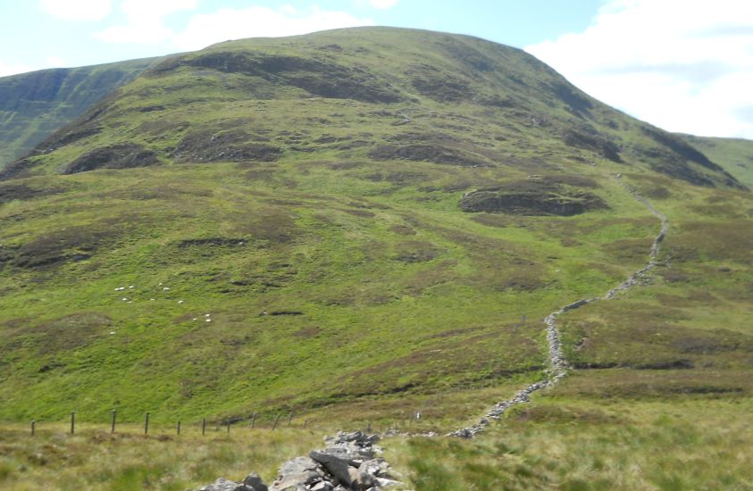
We passed the monument to James Hogg, the Ettrick Shepherd, and plodded up the steep grassy slopes of Oxcleuch Rig. After days of rain the ground squelched under our boots and as we crossed a large expanse of waterlogged ground on the summit of Shielhope Hill we couldn’t help notice the name of the neighbouring hill, Drowning Dubs said it all.
We were encouraged by the sight of the sheep-cropped grass ridges of Lochcraig Rig and White Coomb ahead of us but first we had to drop into the valley of the Winterhope Burn. These hills of Dumfries and Galloway can be incredibly steep-sided, and this one, Muckle Knees, was no exception. We immediately nicknamed it Knackered Knees because ours were by the time we limped to the bottom of the slope.
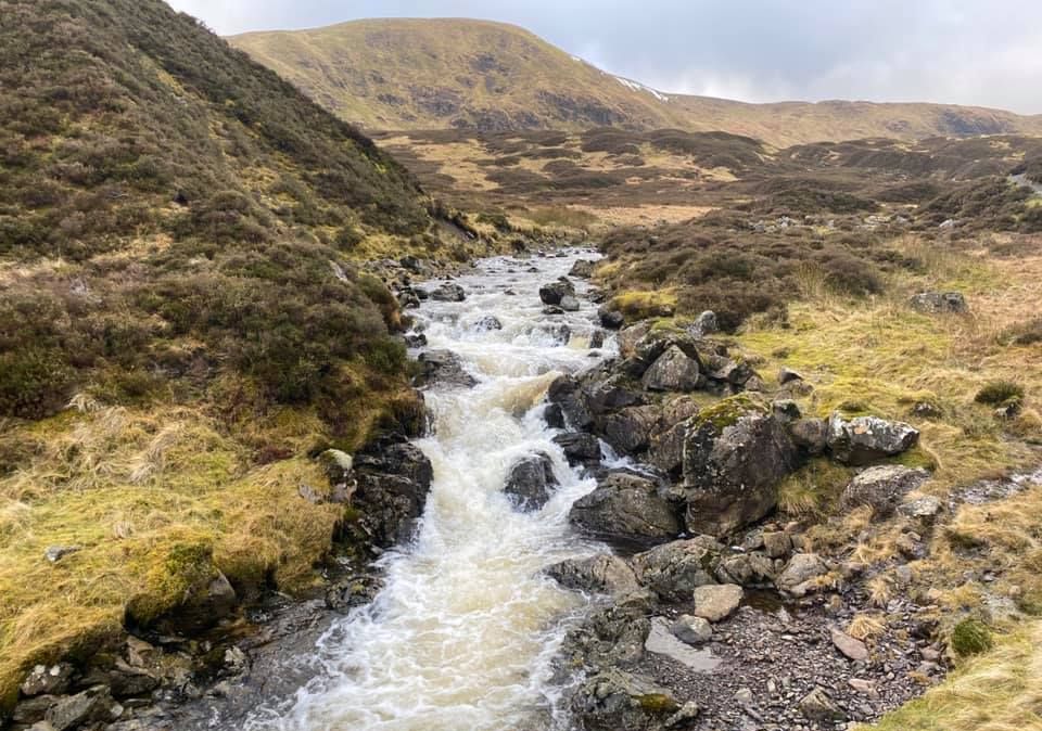
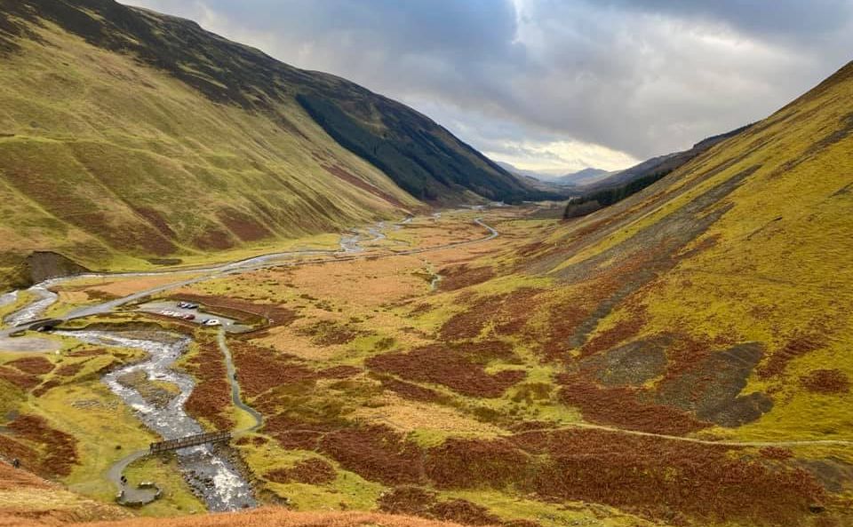
The Winterhope Glen, with its empty buildings, sheep fanks and snaking burn, was a poignant reminder that even here in the glens of the Borders depopulation is almost as big a problem as it is in the Highlands.
Few people, particularly younger folk, want to live in such relative isolation nowadays. If we had found it difficult accessing the Winterhope Glen from Muckle Knees, it was even harder work getting out of it. A long and grinding pull dragged us up Lochcraig Rig to the summit of Lochcraig 
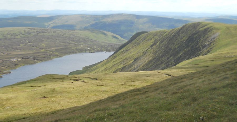
Head at 800 metres, high above Loch Skeen. From here, the south Tweedsmuir hills cut an empty, desolate quarter of the Scottish Borders.
Like Drowning Dubs and Muckle Knees, other place-names, such as Rotten Bottom ( between White Coomb and Hart Fell ) or Dead for Cauld ( south-west of the Megget Reservoir ) leave little to the imagination. 
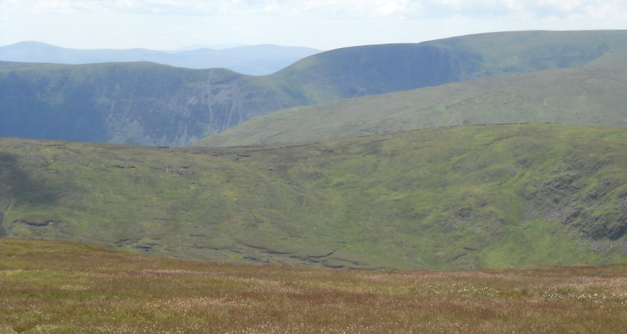
The air of desolation and the vastness of the views from the summit of nearby White Coomb at 2696ft / 822m are fitting for this is the highest hill in Dumfries-shire.
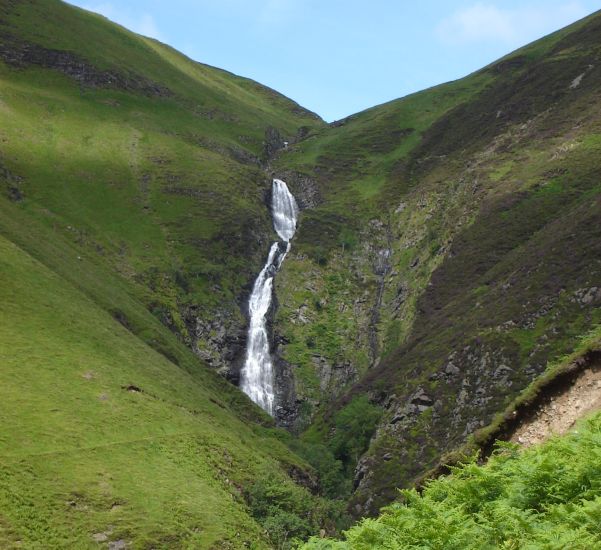
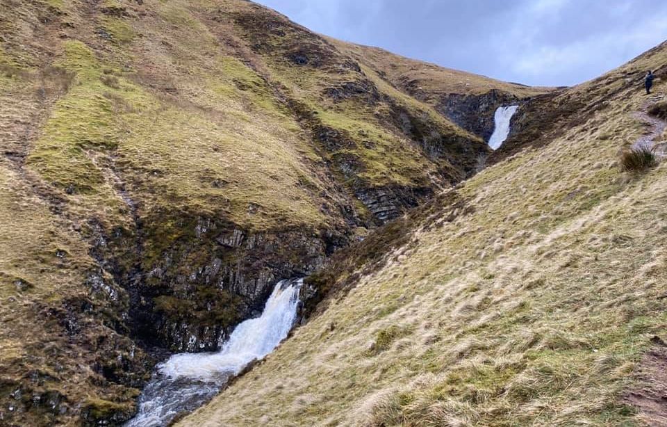
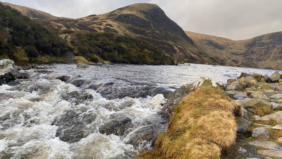
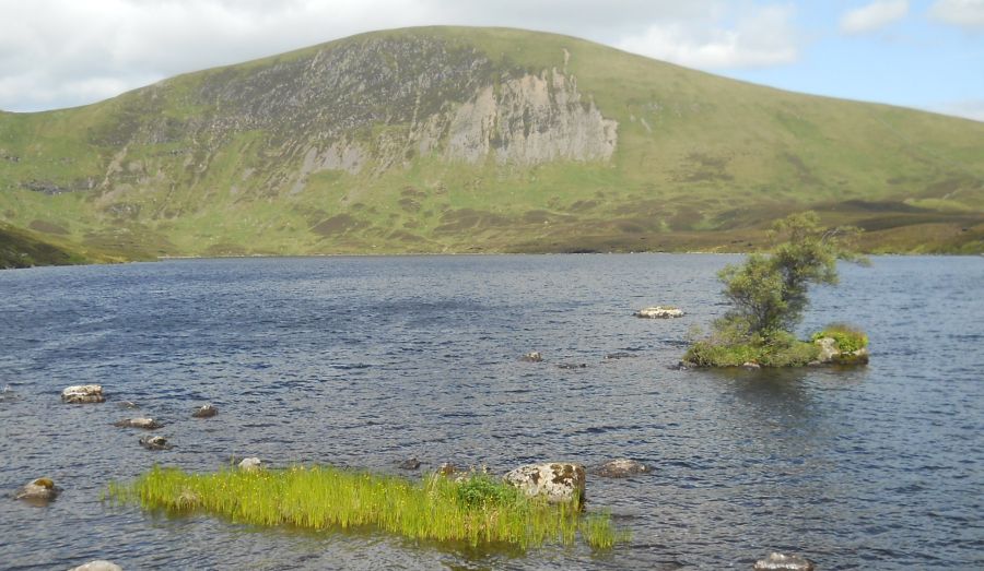
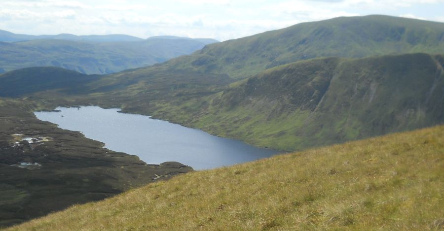
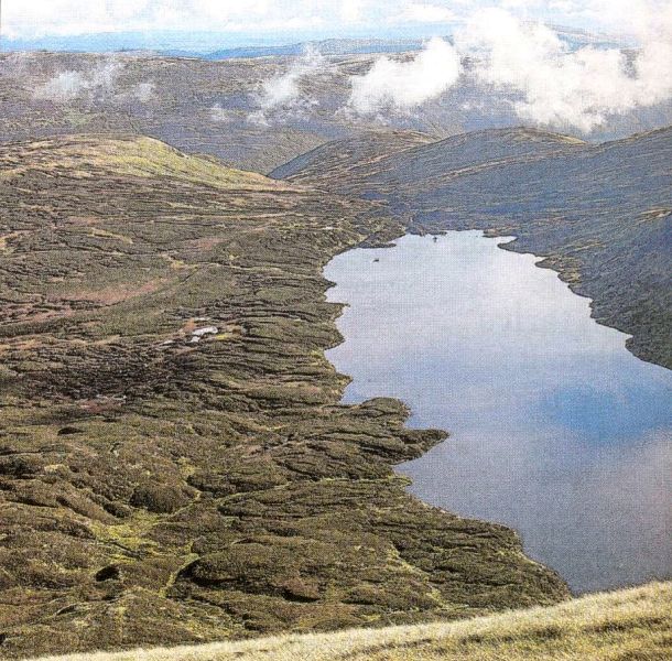
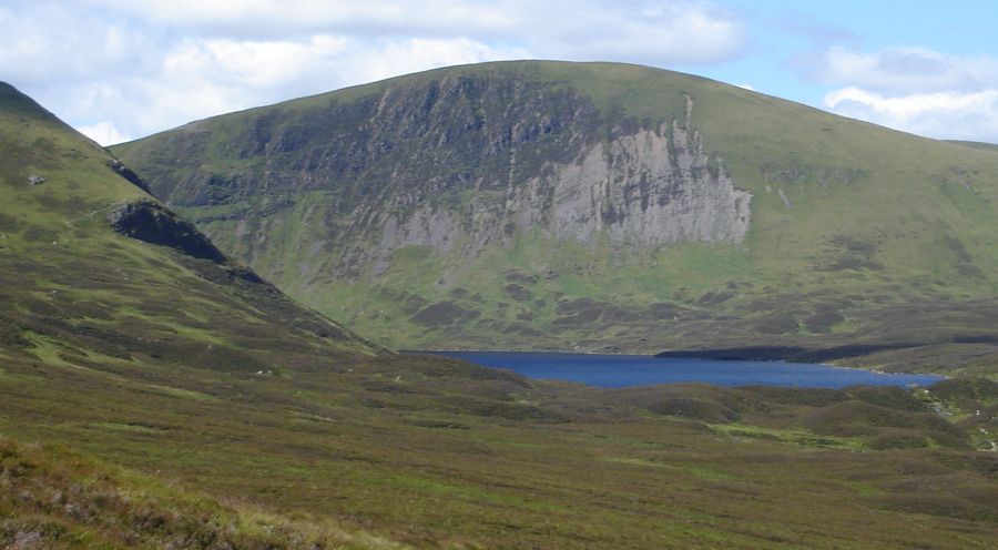
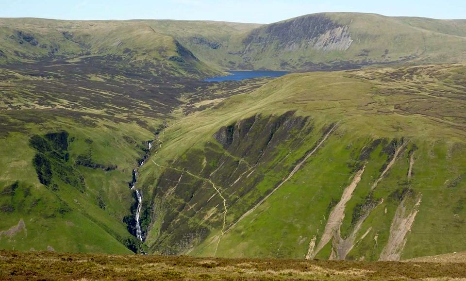
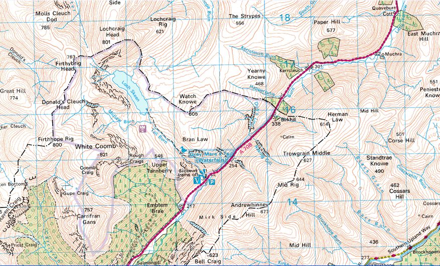
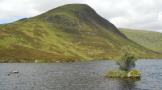
Loch Skeen was described by an 1891 Scottish Mountaineering Club hill walking party as: “a lovely little loch, lying in a veritable cradle of bare stony slopes topped by precipitous crags”. Loch Skeen is one of the jewels of the area but we were going to stay above it on the high level rigs ( ridges ) that connect Firthybrig Head, Donald’s Cleuch Head and 
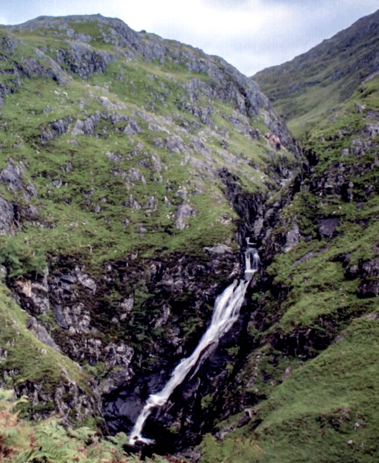
Firthhope Rig before dropping down to the aptly named Rotten Bottom.
Some years ago, ecologists found pollen trapped in the peat here and from it discovered that the area was once densely wooded with birch, rowan, larch and holly. Today, the Borders Woodland Trust, working with the ]ohn Muir Trust, has planted the Carrifran Glen with all these native species. In 20 years time, these new trees will represent what this glen was like several hundred years ago.
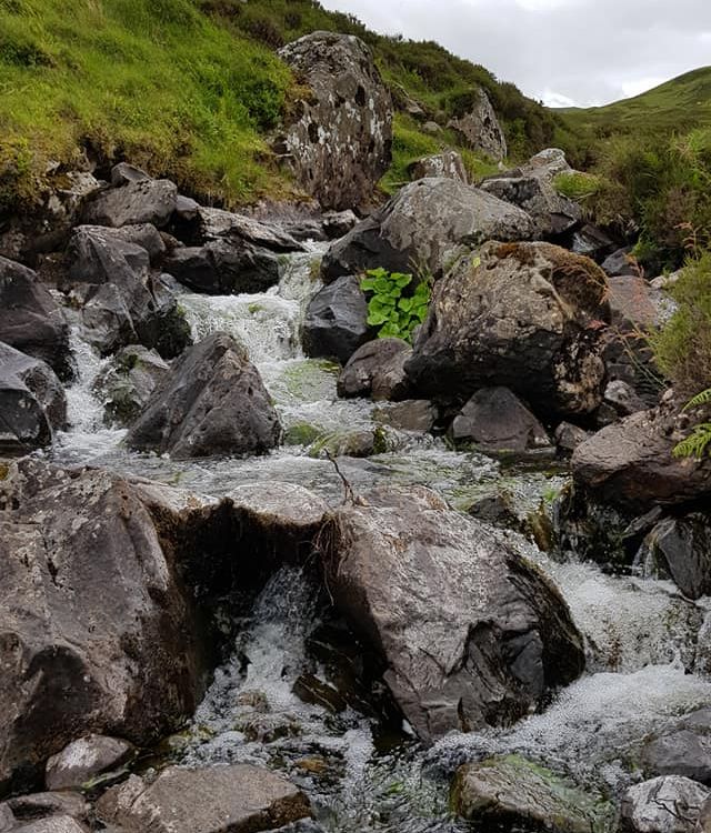
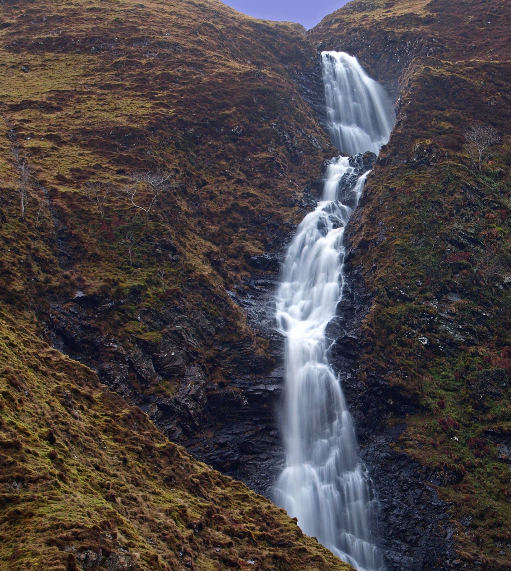
We dropped steeply down into the glen and as we reached the roadside at Carrifran calculated we had only walked about 10 miles. It felt like double that. These hills of Dumfries and Galloway can be as tough as anything the Rough Bounds of Knoydart can throw at you, and are often just as wet.


Route:
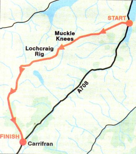
Start at Tibbie Shiels Inn ( GR: NT242205 ).
Pass the monument to James Hogg and climb the track that runs on to Oxcleuch Rig.
Climb the ridge towards Ratlin Side and Shielhope Hill and traverse these tops to Muckle Knees.
Descend steeply into the Winterhope Glen.
Cross the burn and ascend the long ridge of Lochcraig Rig to Lochcraig Head.
Descend W then climb to Firthybrig Head and follow the ridge to Donald's Cleuch Head and Firthhope Rig.
Descend SW to the edge of Rotten Bottom then steeply into the Carrifran Glen.
Follow the burn down the glen to Carrifran ( GR: NT162116 ) on the A708.
You'll need two cars or someone to collect you at the end. It's an eight-mile walk by road back to Tibbie Shiels Inn.


White Coomb Gallery
Photo Gallery

<< BackSouthern Highlands : Next >>


Scotland Index :: The Scottish Peaks

Isle of Skye :: Isle of Arran

Knoydart :: Glencoe :: Ben Nevis :: NW Highlands :: Eastern Highlands :: Central Highlands


Worldwide Mountaineering :: Adventure Travel :: Site Index

fb icon  google+ icon Linkedin icon  twitter


Guide Books & Maps - Scotland:-


Arrochar Alps - Map Glasgow Popular Hills - Map West Highland Way - Map Loch Lomond North - Tyndrum, Crianlarich, Arrochar - OS Explorer Map Loch Lomond and Inverary OS Landranger Map

Isle of Arran OS Explorer Map Isle of Arran OS Landranger Map Arran - Official Tourist MapIona & Mull MapWestern Scotland & the Western Isles OS Road Map Northern Scotland OS Road MapSouthern Scotland OS Road Map


The Islands  The Isle of Arran Hill Walking on the Isle of Arran Island Walks - Southern Hebrides and Arran Ayrshire & Arran - 25 Walks

The Scottish IslandsAn Island Odyssey IslayScotland from the AirScotland's Coast

The High Mountains of Britain & Ireland  Munros Tables SMC  The Munros - Scotland's Highest Mountains  Scotland - Lonely Planet  NW Highlands - SMC Guide  Exploring the Far NW of Scotland  Guide to Walks in NW Highlands

Walking in Scotland - Lonely Planet Mountain: Exploring Britain's High Places  National 3 Peaks Walk Scottish Highlands Hillwalking Guide The Scottish Islands Bouldering in Scotland

Central Highlands: Six Long Distance Walks West Highland Way: Official GuideWest Highland Way: Rucksac ReadersWest Highland Way: TrailblazerThe West Highland WayWest Highland Way: Footprint MapWest Highland Way - Map West Highland Way - Map 100 Hillwalks around Glasgow

Pathfinder Guide: Fort William and Glen Coe Walks Rambler's Guide: Ben Nevis and Glen CoeGlencoe Rock & Ice Climbing The Munros: Scottish Mountaineering Club The Munros and Tops The Corbetts - SMC Munros & Corbetts Chart The High Mountains of Britain and Ireland Munro Almanac

The Munros - Scotland's highest mountains Call of the Corbetts Magic of the Munros Hamish's Mountain WalkThe Munros in WinterMy Scotland by Hamish MacInnes

Scottish Mountains - 50 Classic Routes50 More Routes on Scottish Mountains The High Mountains of Britain and Ireland Scotlands 100 Best Walks Scottish Mountains - 100 Best RoutesBig Walks of Great Britain Classic Walks in Britain & Ireland

Scottish Hill & Mountain Names Classic Mountain Scrambles in Scotland Classic Climbs - Central & Southern Highlands Mountaineering in Scotland and Undiscovered Scotland by W.H.MurrayMore Wilderness Walks Wilderness Walks Wilderness Walks 2 - Video Ski Mountaineering in Scotland

Ski Touring in ScotlandScrambles in Lochaber Rock Climbing in Scotland Rock Climbing SkillsThe FACE: Six Great Climbing Adventures Ben Nevis: Rock & Ice ClimbsGreat Snow & Ice Climbs of the British Isles100 Best Routes on Scottish Mountains One Man's Mountains - Tom Patey

A Mountaineer's Tale - W.H.MurrayDougal Haston: Philosophy of RiskThe Glens of Rannoch Southern Highlands - MapNorthern Highlands Central Highlands West Highlands Central Highlands SMCNW Highlands SMC

Scotland - Lonely PlanetScotland's Highlands & Islands - Lonley Planet Scotland's Highlands & Islands - Rough Guide Highlands & Islands of Scotland - Hidden Places Rough Guide ScotlandScottish Highlands & Islands - Rough Guide Rough Guide: Scotland Lonely Planet, Walking in ScotlandLonely Planet - Walking in Britain

50 Walks in the Scottish Highlands & Islands 100 Walks in ScotlandVisit Scotland - Touring Guide Scotland: Where to Stay - Hotels & Guest Houses Scotland: Where to Stay - Bed & Breakfast Hillwalker: The MunrosHillwalker: The Corbetts

Weather for Hillwakers & Climbers Mountain Weather Guide to the Weather Weather: Collins Gem Hillwalking Handbook for Mountain Leaders Hillwalkers Manual Hillwalkers Guide to Mountaineering First Aid on Mountains


Google Analytics


Google Analytics 

extremetracking
 eXTReMe Tracker


extremetracking
Sitelock caingram.com
SiteLock
Sitelock
Sitelock caingram.info
SiteLock
Sitelock