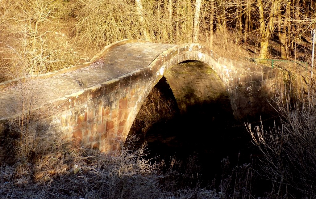
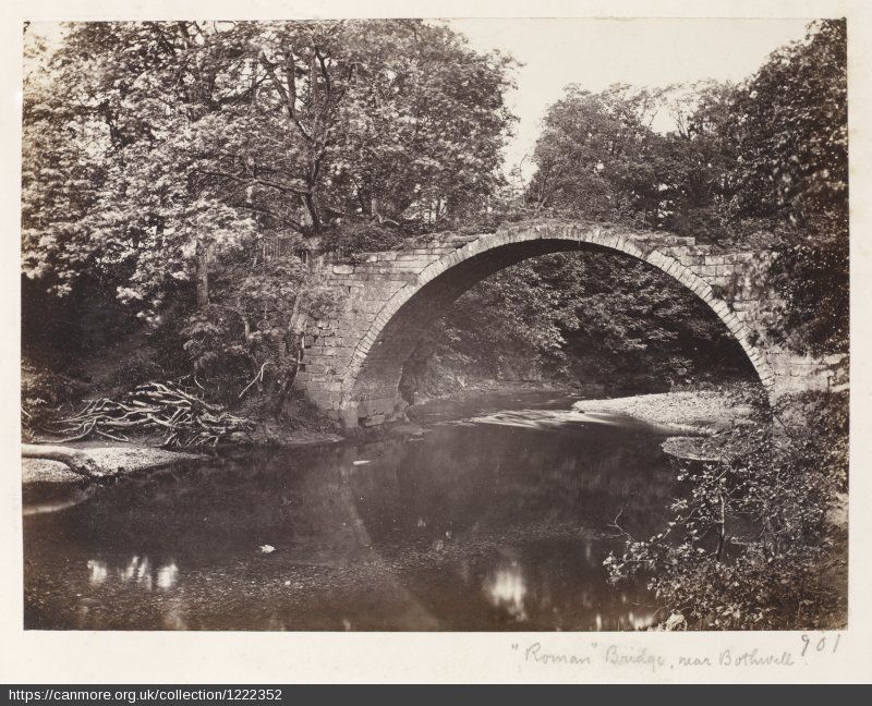
'The
Roman Bridge' - This bridge on the South Calder consists of a
single arch of 20 feet span.
It is undoubtedly of great antiquity and derives its name from
its being supposed to have been built by the Romans.
'The
Roman Bridge' - This bridge on the South Calder consists of a
single arch of 20 feet span.
It is undoubtedly of great antiquity and derives its name from
its being supposed to have been built by the Romans.
'The
Roman Bridge' - This bridge on the South Calder consists of a
single arch of 20 feet span.
It is undoubtedly of great antiquity and derives its name from
its being supposed to have been built by the Romans.
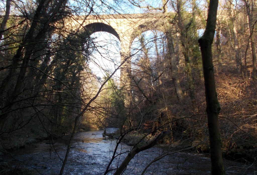
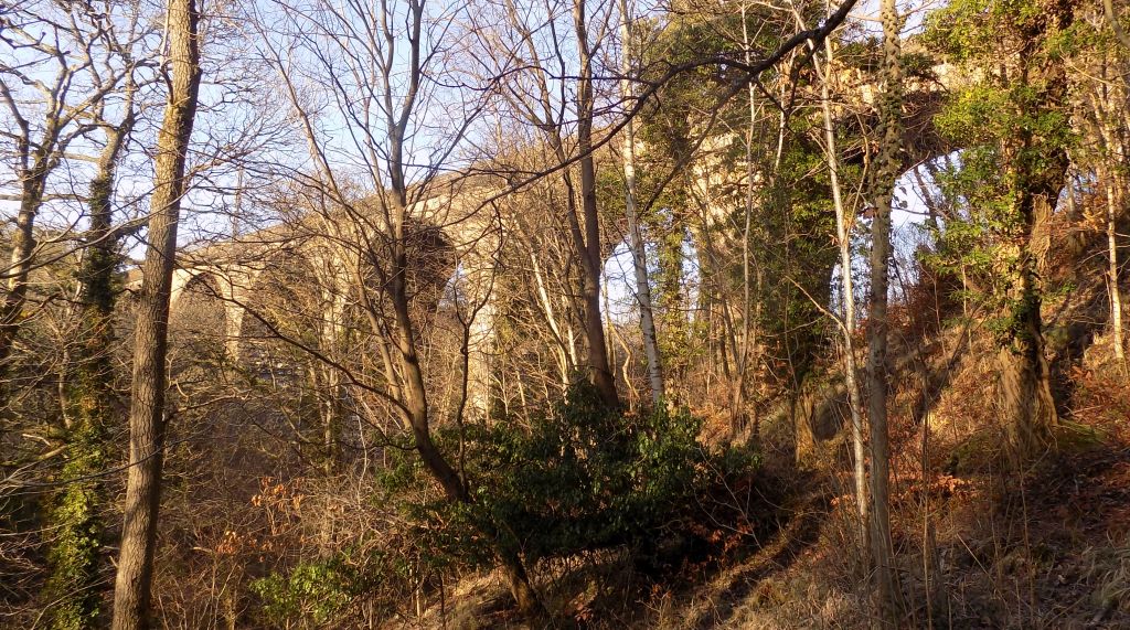
Railway
Viaduct over South Calder
Water in Strathclyde Country
Park
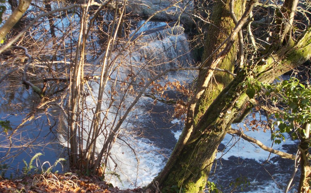
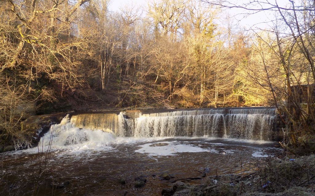
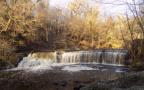
Wier in
South Calder Water in Strathclyde
Country Park
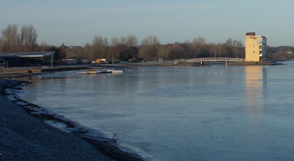
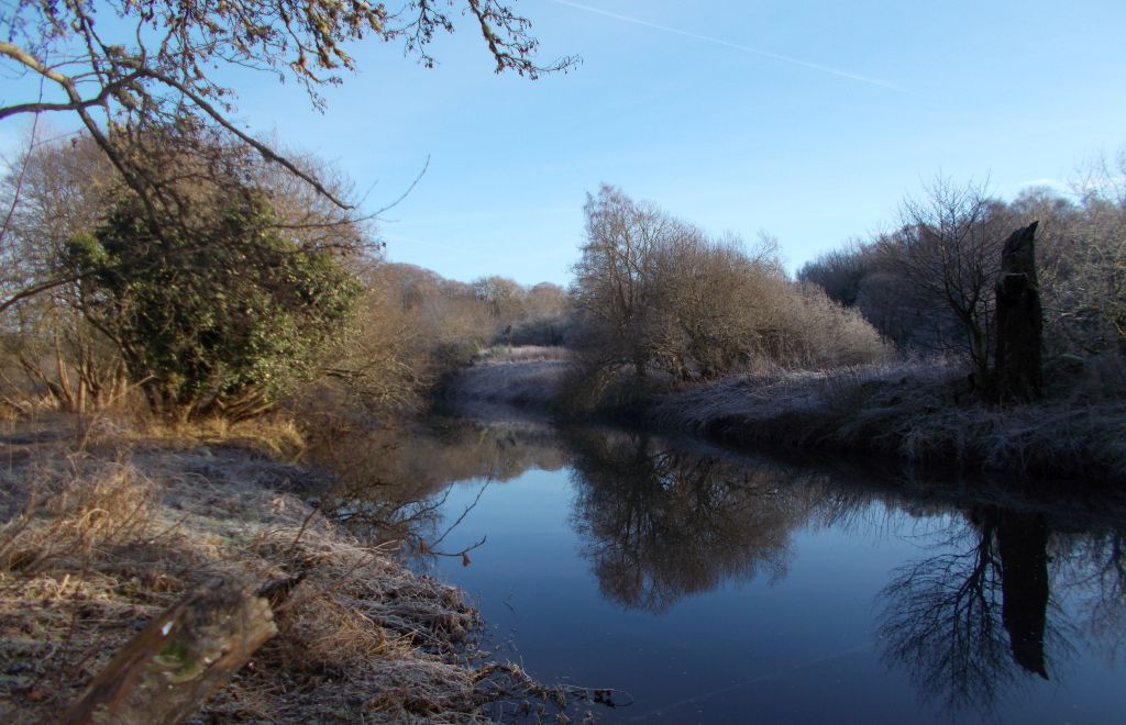
South
Calder Water in Strathclyde
Country Park
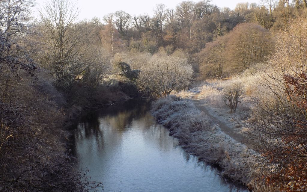
South
Calder Water in Strathclyde
Country Park
Wier in
South Calder Water in Strathclyde
Country Park
Railway
Viaduct over South Calder
Water in Strathclyde Country
Park
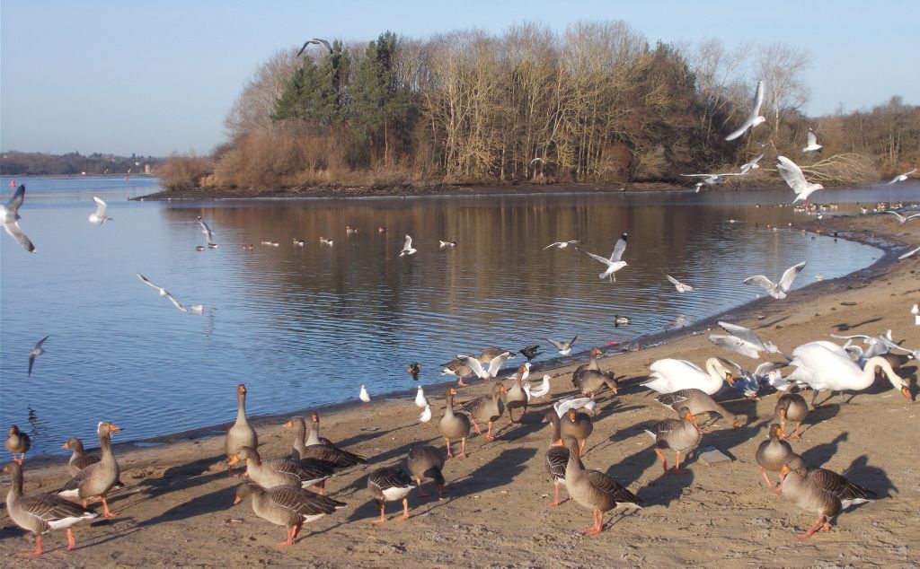
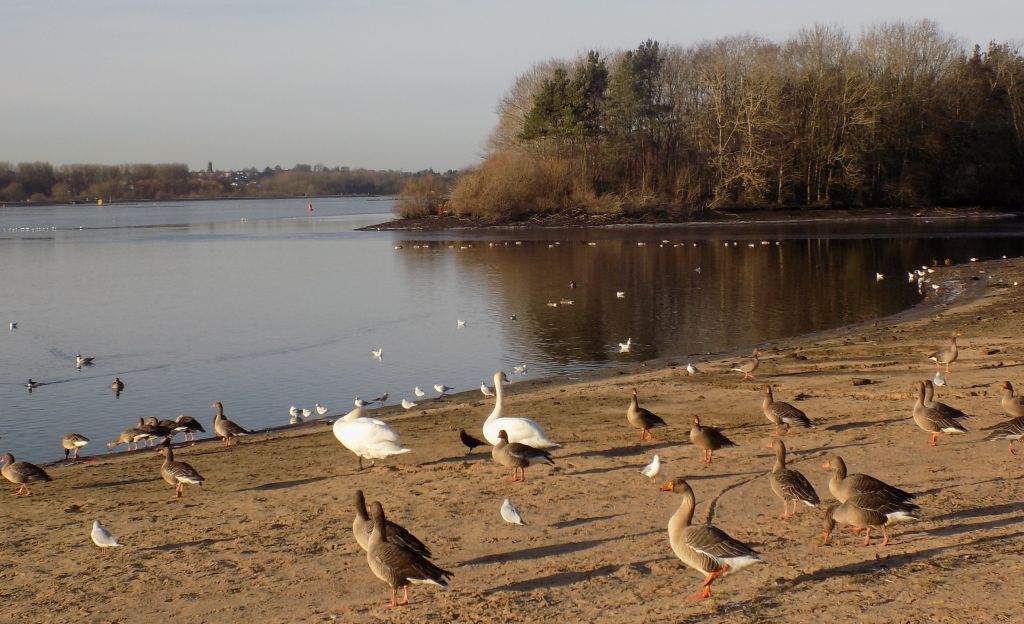
Birds
at Strathclyde
Country Park Loch
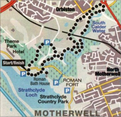
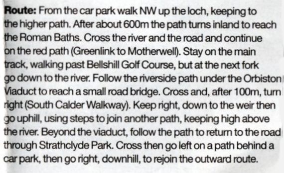
Route
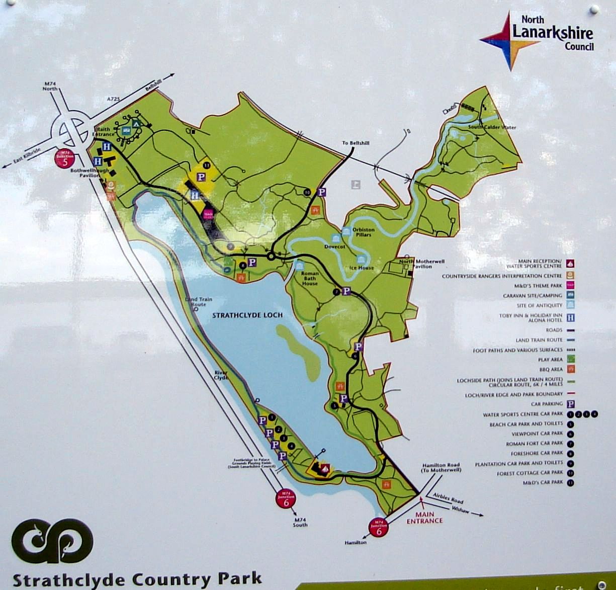
Map for South Calder Water Walk
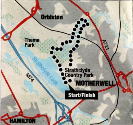
SOUTH CALDER
WATER WALK - ROUTE DESCRIPTION:
Location:
Strathclyde Park, North Lanarkshire
Map: OS Landranger 64 ( GR 726 579 )
Distance: 4 miles (6.5km )
Time: 2hours
Terrain: tracks and paths The
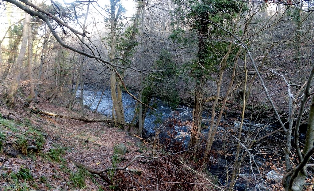
wooded glen of the South Calder Water to the north of Strathclyde Loch
on the Clyde between Motherwell and Hamilton offers a pleasant family
walk for this time of year. The glen is deep and crossed by the
impressive Orbiston railway viaduct. The paths are in good nick but
sections are muddy and good footwear is recommended.
Start from the foreshore car park beyond M&D's Theme Park. Go down
to the loch and turn left, following the path round the shore to a
junction. Turn left and follow the path straight up towards the road.
Just before the road turn right and cross the river bridge, then go
right again to view the mins of Bothwellhaugh Roman Baths. These served
the
Antonina-period fort nearby and were moved when the area was flooded to
form Strathclyde Loch in the early 19705.
Go back over the bridge to the road, cross over to a gravel path and
follow it through woodland to a junction in open parkland. Turn right
following signs to Motherwell and right again past children ’s swings
to the edge of Bellshill golf course and a junction at a pair of
pillars, the sole remains of Orbiston House.
The path on the right leads down to the South Calder Water. Continue
left following the track to where it divides, then descend rightwards
to the South Calder Water and continue below the sandstone crags above
the
river.
Pass the weir at the old Fairways mill and the mill pond on the left,
and go through a more open section of river bank, then swing left and
up to join the old road.
Follow the road left to a signpost and tarmac path leading leh uphill
over grass to a residential area. Turn left past Bellshill golf course
clubhouse to railings and an entrance signposted for Strathclyde
Country Park.
The gravel track leads down through woodland dividing the golf course,
crosses over the railway and joins the outward route. Follow this back
past the Orbiston pillars to the junction beyond the children's swings
and veer right here to cross Bothwellhaugh Road and through a car park
into Bothwellhaugh Plantation.
Turn left at the first obvious turning and descend steadily through the
forest on a wide path to a four-way junction. Cross slightly left.
then straight ahead and over a bridge. Continue straight ahead at the
three-way junction just after this to emerge opposite the foreshore car
park.
Map
and Route Description of Orbiston Walk
ORBISTON WALK -
ROUTE DESCRIPTION:
Location: North
Lanarkshire
Map: OS Explorer
343
Distance: 5miles
( 8km )
Time: 2-3 hours
Terrain: good
paths
Orbiston, now mainly
a suburb of Bellshill, was once
an estate owned by the Hamiltons and in the 1820s was
the scene of a failed attempt at a co-operative working
community along the lines of New Lanark. Locals
sarcastically dubbed the scheme Babylon and
nothing of it now remains All that can be seen of
the grand Orbiston House are three stone pillars.
but the name survives on the impressive viaduct
carrying the main railway line across the South
Calder Water.
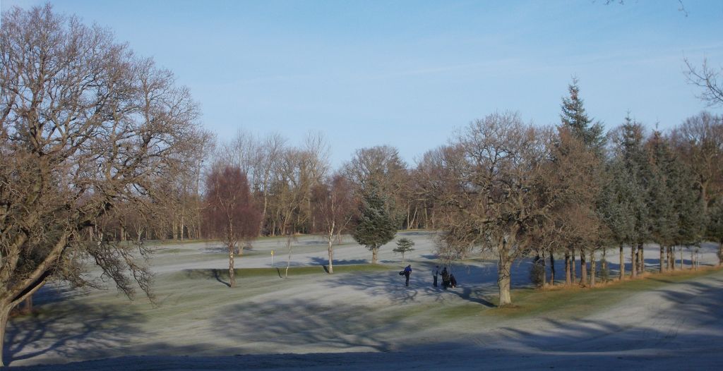
Although this walk starts and ends in the ever-busy Strathclyde Park, much of it is in a
more
secluded area, through mature woodland and along
the South Calder. The main feature of Strathclyde
Park is its large artificial loch, which was used for
events at the Commonwealth Rowing
Championships last month. The loch attracts a
good variety of birdlife and at the start point for
this walk there are always ducks, swans and geese
eager to be fed.
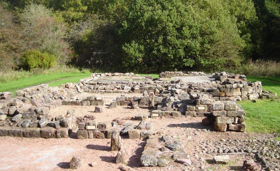
The walk also passes a Roman bath-house,
discovered in the 19705 and moved to its current site
in 1980 in order to preserve it. The site is thought to
date from about l40AD and interpretation panels
show the impressive range of facilities available to
bathers There is also a “Roman bridge" which is
actually an old packhorse bridge.
In the glen of the South Calder there are various
habitats to enjoy, including woodland and wetland,
before you cross the river on a lovely old bridge, now
hardly used but at one time on the principal route
between Motherwell and Bellshill.
The return walk: mostly stays high above the
river, overtopping Corby Craig ( corby or corbie is a Scots word for a
crow ) then re-entering the main
part of the park for the final section. This walk
provides an ideal short outing at any time of year
“and is a reminder of how much decent countryside
we have around our major towns and cities.


 ::
Strathclyde
Park Gallery
::
Strathclyde
Park Gallery 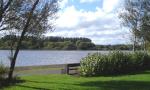 ::
Clyde River
Walkway
::
Clyde River
Walkway 


