  |
The Scottish HighlandsSgor na h-Ulaidh
|
  |
| |
The Scottish HighlandsSgor na h-Ulaidh
|
|
 |
 |
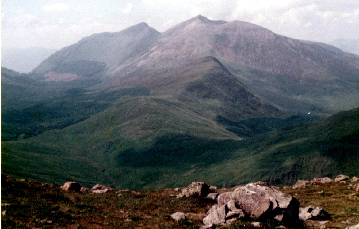
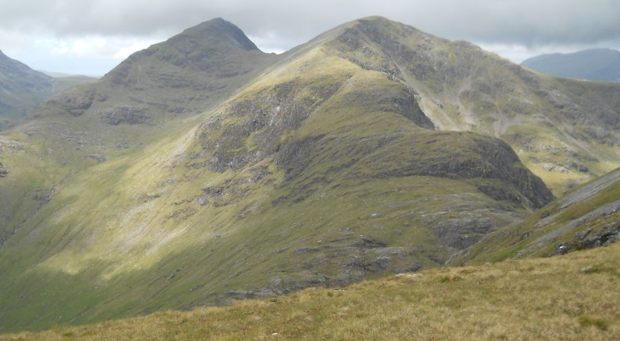
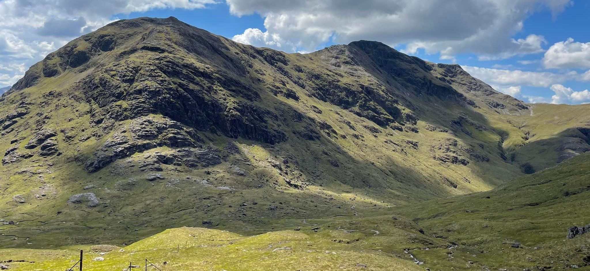
 Bidean
nam Bian from Sgorr na h-Ulaidh
|
 |
 |
 |
 |
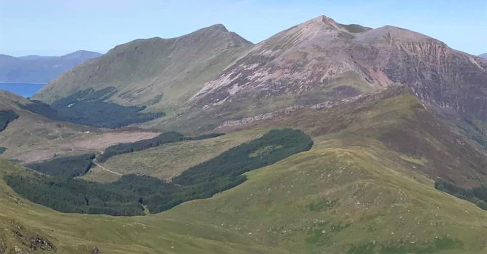
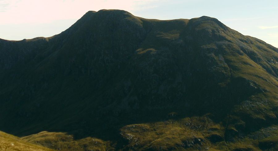
 Sgor na
h-Ulaidh ( 3258ft )
|
|
 Sgorr na h-Ulaidh ( 3258ft )on ascent of Stob Dubh |
|
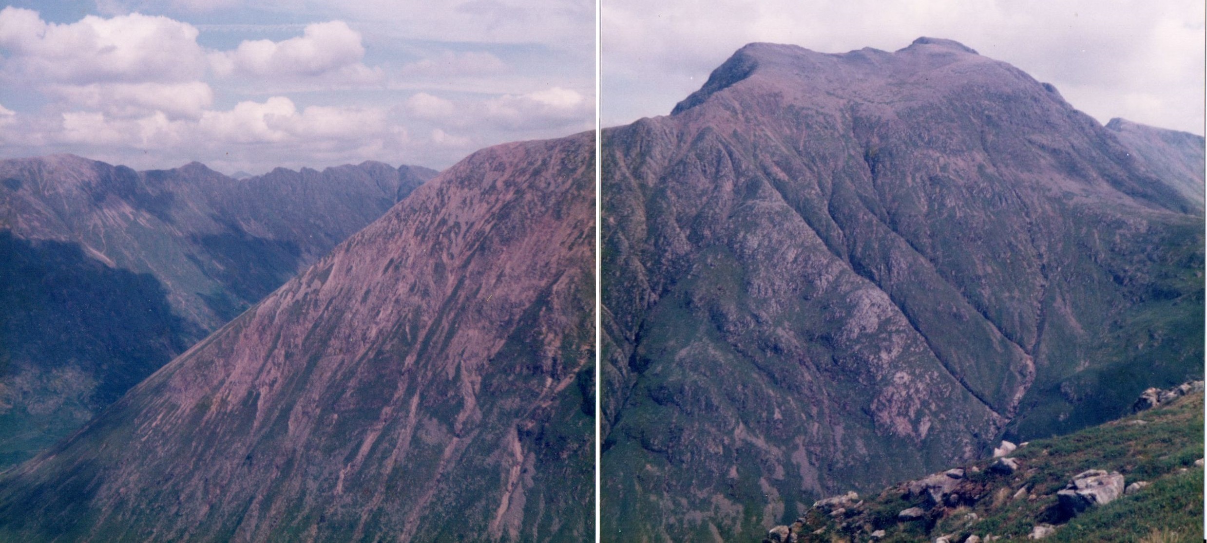
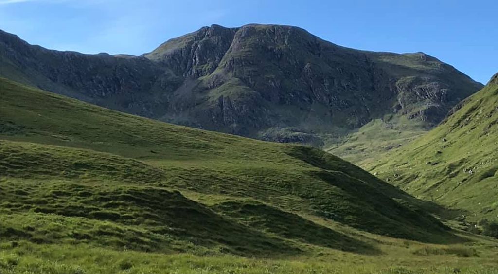
 Sgor na
h-Ulaidht
from Meall Ligiche |
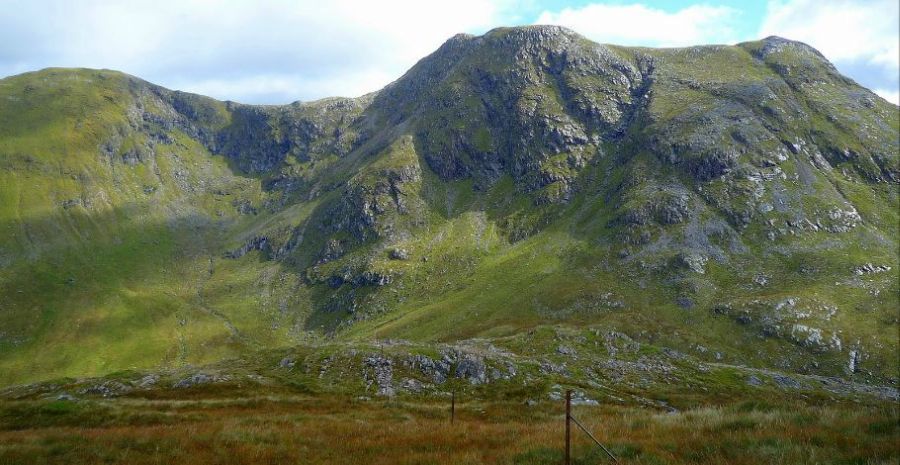
 Sgor na
h-Ulaidh
on the approach to Creag Bhan |
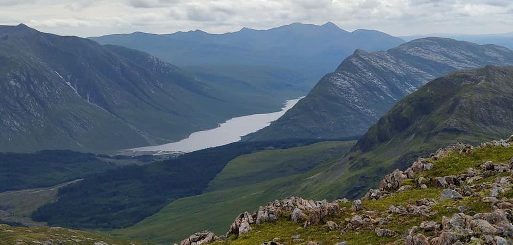
 Sgor na
h-Ulaidh
|
 Sgor na
h-Ulaidh
|
 Sgor na
h-Ulaidh
|
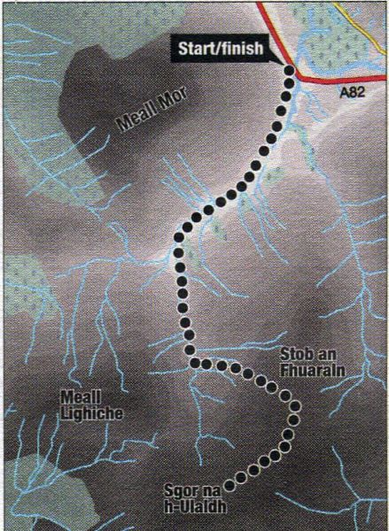
 Route
Map of Sgor na
h-Ulaidht
|
 Map
of Sgor na
h-Ulaidht
|
 Map
of Sgor na
h-Ulaidht
|
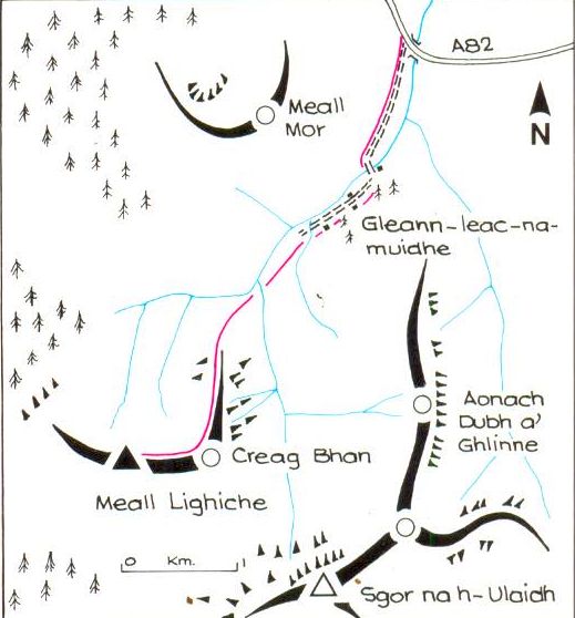
ROUTE DESCRIPTION FOR SGOR na h-ULAIDHT:
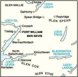
Location: Glen Coe
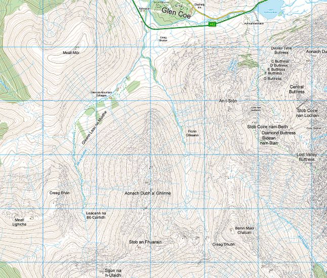
Map:OSLandranger41, (GR 111518)
Distance: 10 miles (16km)
Time: 6 hours 30 minutes
Terrain: tracks and paths
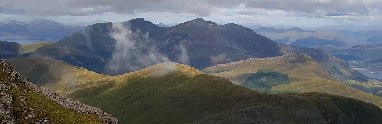
Sgor na h-U1aidh lies on the south-western fringes of Glen Coe and is visible from only a short stretch of the main road at the glens’s very western end.
It doesn’t have the grandeur of the glen’s giants, but it offers new perspectives on surrounding peaks.
The route starts from the track signposted Glencoe Mountain Cottages and Gleann Leac na Muidhe at the glen’s western end, where the road
bends right for the long straight past the visitor centre. Parking is possible below sheep pens on the right before the right bend.
Walk down the road and across the bridge over the Allt na Muidhe to gain the track and follow it south up the Gleann Leac-na Muidhe.
Almost immediately, an impressive craggy face fills the upper glen, but this is Creag Bhan, an outlier of the Corbett Meall Lighiche.
Sgor na h-Ulaidh is hidden behind.
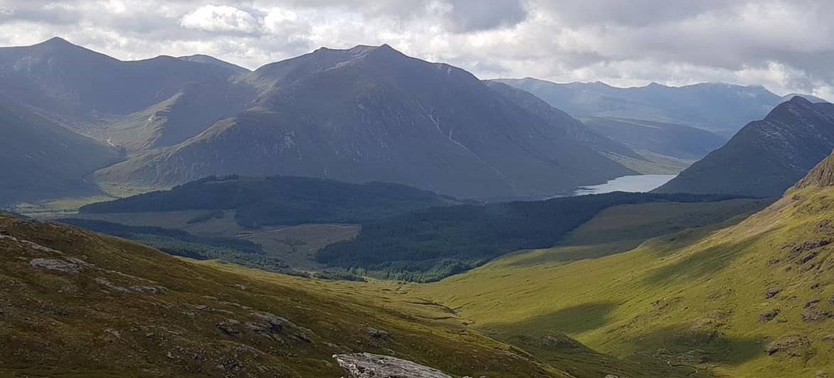
However the finest view is east up Glen Coe, revealing the Aonach Eagach in all its notched glory.
Shortly after crossing the bridge to the south side of the river, a sign requests you make a diversion to a path on the left.
This avoids passing through holiday chalets but it is fairly muddy. If the mire gets too deep you would be better on the track.
The diversion regains the track beyond, which is followed past a byre to where it ends at a conifer plantation.
A path leads up beside the Allt na Muidhe into the narrow glen, passing below Creag Bhan to reveal the north corrie of Sgor na h-Ulaidh
and Stob an Fhuarain to its east.
These two peaks present a steep face with no obvious path, but the hillside leading to the col immediately north of Stob
an Fhuarain is grassy and is the line of ascent.
Follow the path to where it fades, then gain the hillside and follow it to the col.
The route climbs over Stob an Fhuarain then ascends the steep rocky east ridge of Sgor na h-Ulaidh to the summit.
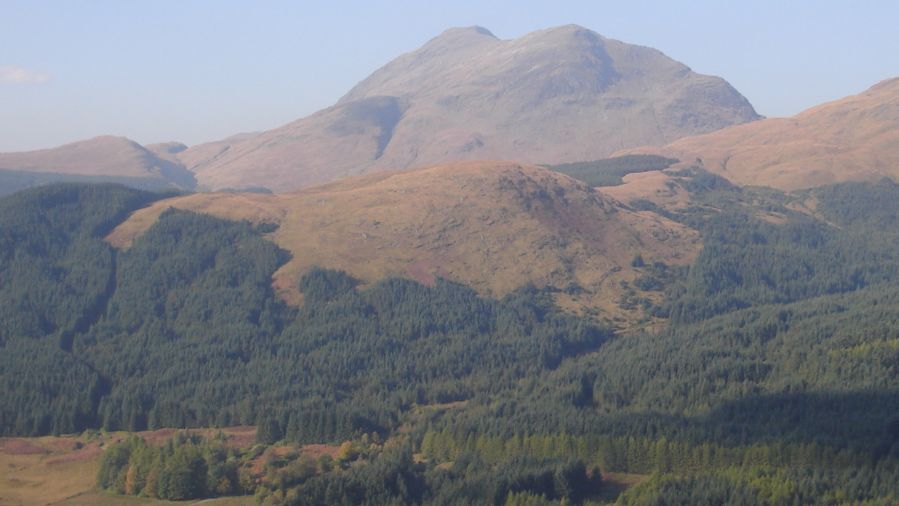
Ben Nevis is clear to the north, Bidean nam Bian dominates the view to the east, while the view south offers a magnificent
landscape past Beinn Fionnlaidh to the high peaks of Loch Etive and Cruachan.
The view west reveals the extent of the summit ridge of Beinn a’ Bheithir.
Some guidebooks suggest continuing over Corr na Beinn to the south-west and descending its north face to the col below
Meall Lighiche, but this cannot be recommended as the best route is difficult to find and the terrain steep and rocky.
The best descent is the line of ascent.
Glencoe | Ben Nevis | Knoydart | Isle of Skye | Isle of Arran | The West Highland Way
The Eastern Highlands | The Central Highlands | The Southern Highlands | The NW Highlands