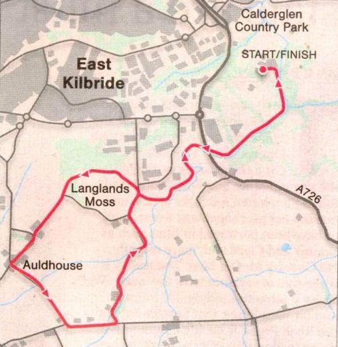
Glasgow Guide Glasgow Visitor Guide - Colin Baxter

 City of Glasgow

 Langlands Moss
Scotland's Highlands & Islands - Rough Guide Scotland - Rough Guide


Photographs and map of the walk from Calderglen Country Park

to Langlands Moss Nature Reserve

on the outskirts of East Kilbride

 to the South of Glasgow

Map of Calderglen Country Park

Map of Calderglen Country Park

( Note: Click here or on above for large format copy )


The Rotten Calder Water from the South Trail to Langlands Moss

The Rotten Calder Water

from the South Trail to Langlands Moss 


The South Bridge across the Rotten Calder Water on the South Trail to Langlands Moss

The South Bridge

 across the Rotten Calder Water


on the South Trail to Langlands Moss


Flatt Linn ( waterfalls ) in the Rotten Calder Water on the trail to Langlands Moss

Flatt Linn ( waterfalls )

 in the Rotten Calder Water


 on the trail to Langlands Moss


Woodlands on the trail to Langlands Moss

Woodlands

 
on the trail to Langlands Moss


The Rotten Calder Water from the trail to Langlands Moss

The Rotten Calder Water

 from
the trail to Langlands Moss


Map of Langlands Moss Nature Reserve near Calderglen Country Park

Map of Langlands Moss Nature Reserve

( Note: Click here or on above for large format copy )


Raised Bog in Langlands Moss Nature Reserve

Raised Bog

 in 
Langlands Moss Nature Reserve

Raised bogs are peatlands,

the oldest of which date back to the last Ice Age


Information Board in Langlands Moss Nature Reserve

Information Board

 in 
Langlands Moss Nature Reserve

( Note: Click here or on above for large format copy )


Langlands Golf Course adjacent to Langland Moss

Langlands Golf Course

 adjacent to Langland Moss


Map of Langlands Moss at Calderglen Country Park

Map of Langlands Moss

at Calderglen
Country Park


Route Description for Langlands Moss at Calderglen Country Park


Location: South Lanarkshire
Map: OS Landranger 64 or Explorer 334
Distance: 8 miles  / 14km
Time: 4-5 hours
Terrain: 
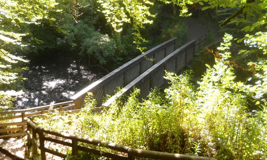
Riverside paths and boardwalk
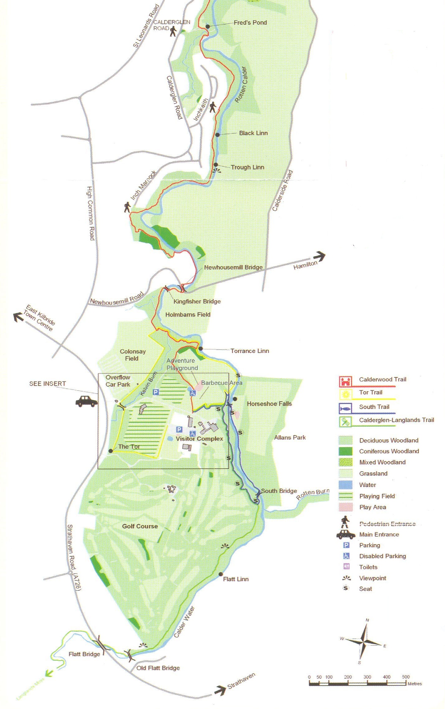
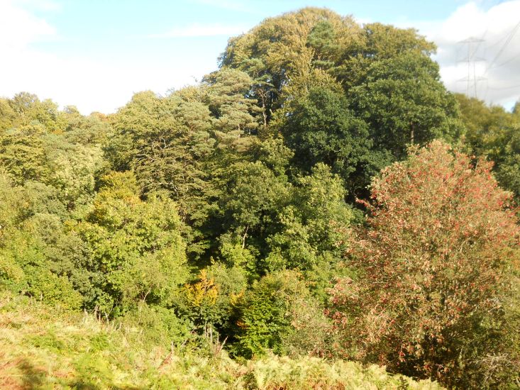

The main feature of Calderglen Country Park on the outskirts of East Kilbride is an attractive gorge carved out by the Rotten Calder river.
The network of paths in the park naturally concentrates on this gorge, but it's extended at either end and by following the southern extension you can walk to the village of Aulclhouse. Prom the park centre ( which includes a small zoo where the meerkats are a star 
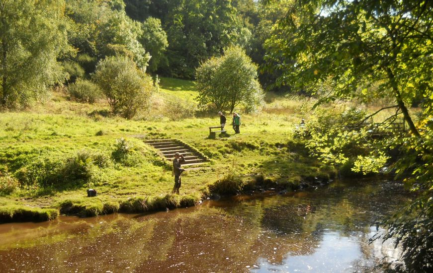
attraction ) follow the path high above the river. The sides of the gorge are cut by ferny recesses sparkling with water at this time of year.
Take care with children
and dogs here as there are steep drops to the river.
At a junction keep straight ahead ( signpost for Auldhouse ) and continue with the path, with the river below and Torrance House golf course to the right. There are many mature trees - and looking back these frame the gorge very prettily.
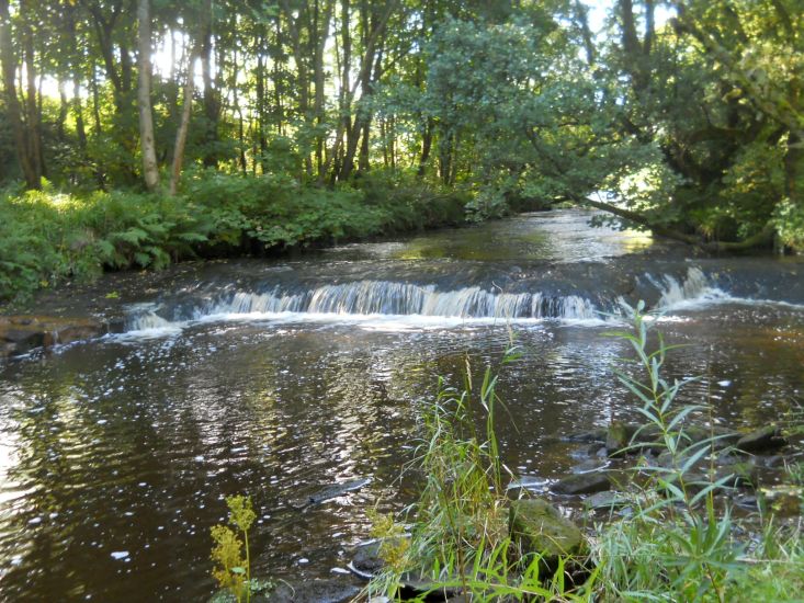
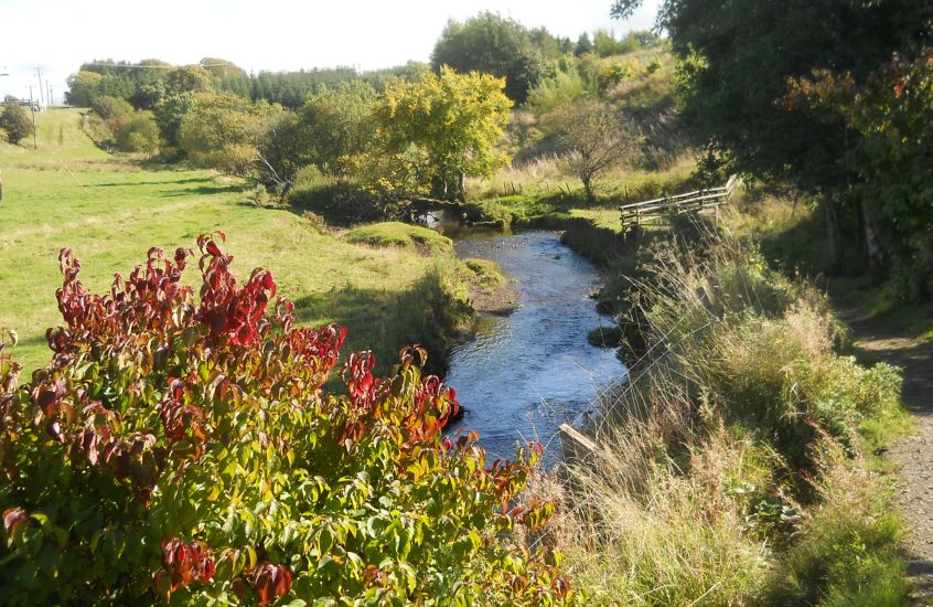
In time the path passes under two road bridges ( one of them defunct ) and the character of the river changes totally, becoming a meandering stream with no hint of its turbulent nature further down. The path winds around many bends before finally arriving at a road.
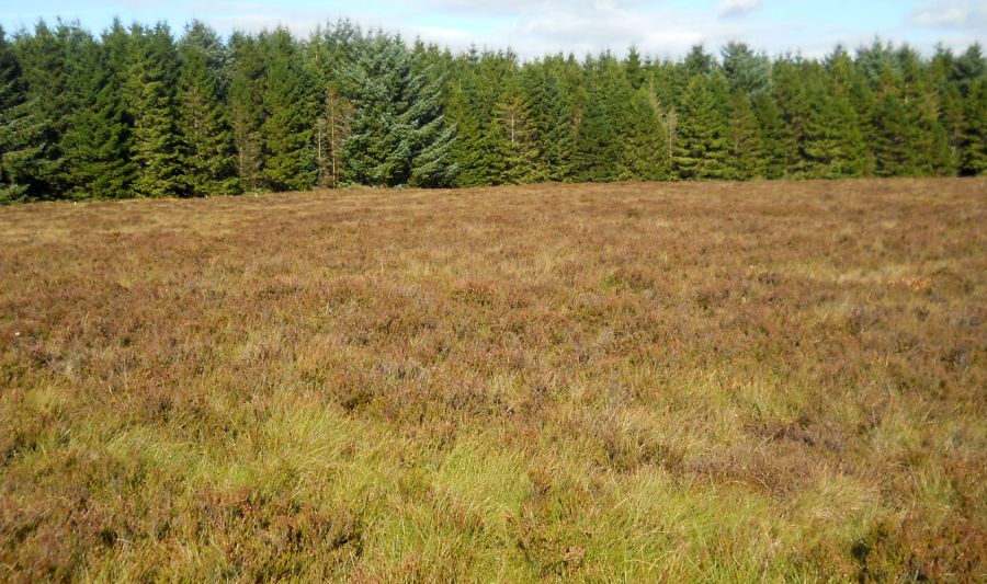
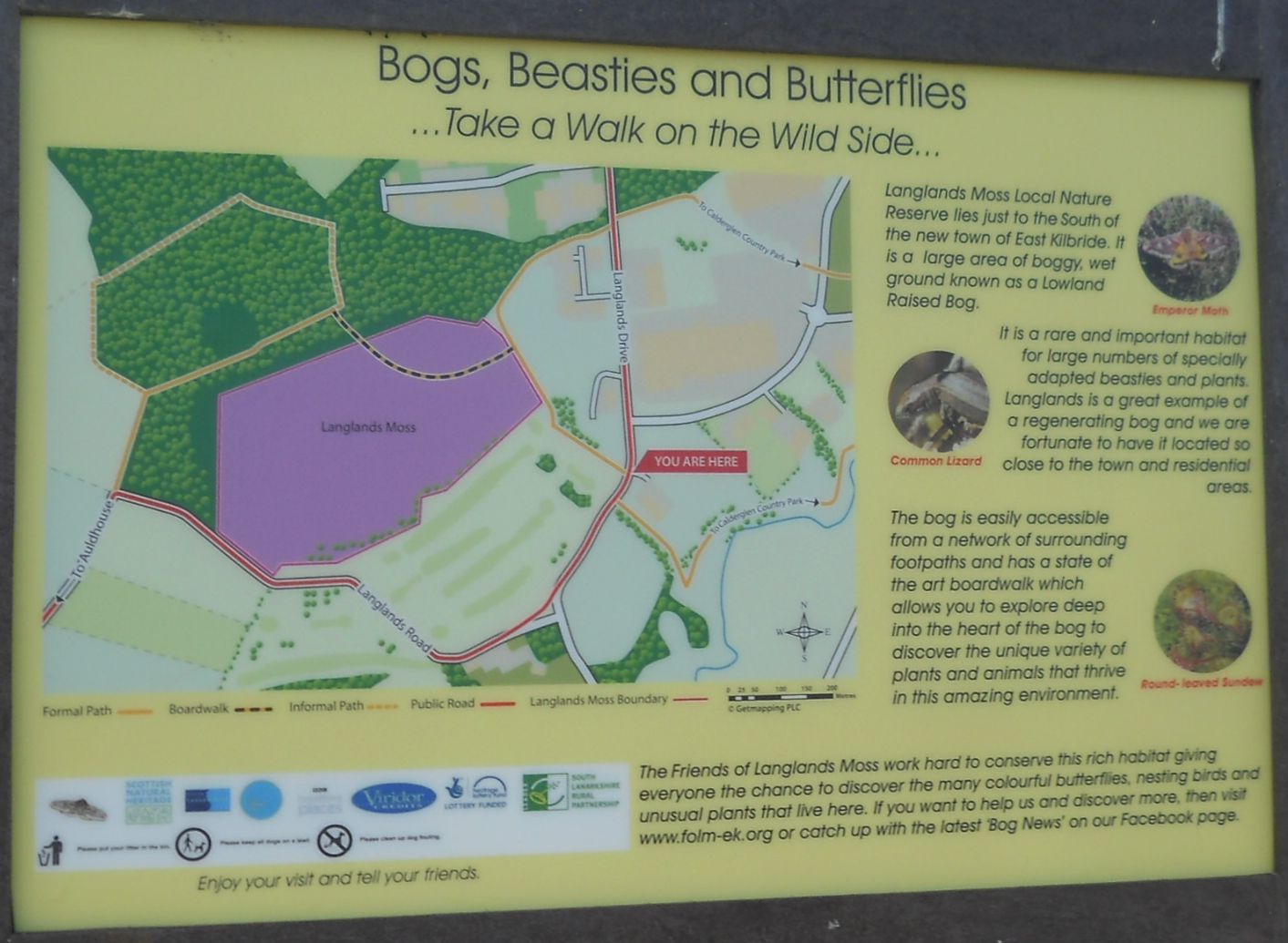
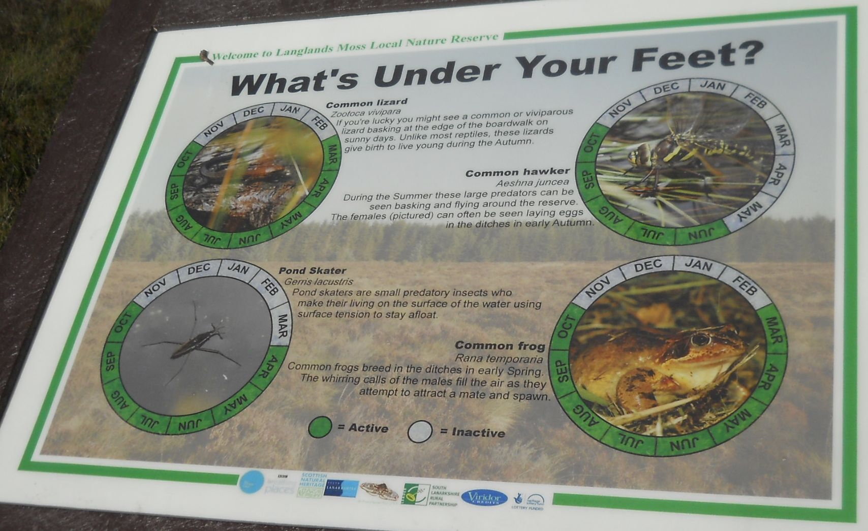
The next section of the walk is across Langlands Moss, a fine example of a raised bog, almost unique in this part of Scotland.
A solid boardwalk
has been constructed across the Moss and excellent interpretation is provided regarding the special plants found here. Once across the Moss, the path leads back into more woodland then exits to a minor road for the final short walk to Auldhouse.
The village
has a vigorous community who fought a notable battle not just to keep their primary school but to get new buildings for it too.
Walk to the Auldhouse Inn, a bar and restaurant 
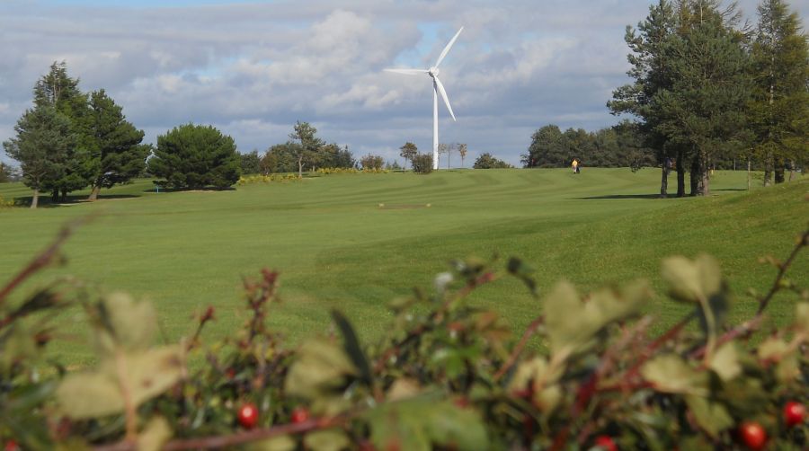
that’s well worth a stop. A possible onward loop offers views of the countryside ( and the Whitelees windfarm ) and returns to the Rotten Calder for the walk back to Calderglen.


Route:
From the Country Park car park
walk past the conservatory and continue across grass to start of Nature Trail.
TR
and stay on higher path.
Keep R at fork and follow path by river for 2km to road.
Cross road, TR and in 100m TL on path.
TL on boardwalk across LangtandsMoss.
TL on track then follow road to Aufdhouse.
Return by same route 
or
for longer walk,
TL from Auldhouse, at
T-junction TL
and at next junction also
TL past Langlands golf course.
Pass junction and in 250m pick up outward route on R.


Calderglen Park & Langlands Moss Gallery Photo Gallery

<< Back : Glasgow Parks : Next >>


Glasgow Index :: Scotland Index :: Scotland Walks

Glencoe | Ben Nevis | Knoydart | Isle of Skye | Isle of Arran | The West Highland Way

The Eastern Highlands | The Central Highlands | The Southern Highlands | The NW Highlands


Adventure Travel : Worldwide Mountaineering : Site Index

fb icon  google+ icon  Linkedin icon  twitter


Guide Books & Maps - Scotland:-


Western Scotland & the Western Isles OS Road Map Northern Scotland OS Road MapSouthern Scotland OS Road Map Glasgow Popular Hills - Map


Glasgow - A Portrait  Wee Book of Glasgow  Glasgow from the Air  Glasgow - No Mean City  Lost Glasgow  Glasgow - The Real Gorbals Story    

Glasgow Visitor Guide - Colin Baxter Itchy Insider's Guide to Glasgow Glasgow Footprint Pocket Guide Glasgow Insight Pocket Guide Glasgow Guide Pub Companion Glasgow Scotland's Highlands & Islands - Rough Guide Scotland - Rough Guide

Glasgow Insight Pocket GuideCollins Street Map of GlasgowGlasgow: Then & NowThey belonged to Glasgow Phillips Street Atlas of Glasgow & West Central Scotland Glasgow: The Photographic Atlas100 Hillwalks around Glasgow 50 Walks in Glasgow & SW Scotland

Visit Scotland - Touring Guide Scotland: Where to Stay - Hotels & Guest Houses Scotland: Where to Stay - Bed & Breakfast Rough Guide ScotlandScottish Highlands & Islands - Rough Guide Scotland - Lonely PlanetScotland's Highlands & Islands - Lonley Planet Great Glasgow StoriesGlasgow & Surroundings - Insight Guide

West Highland Way: Official GuideWest Highland Way: Rucksac ReadersWest Highland Way: TrailblazerThe West Highland WayWest Highland Way: Footprint MapWest Highland Way - Map West Highland Way - Map West Highland Way Wet Highland Way - Official Guide

Munro Almanac The High Mountains of Britain and Ireland The Munros: Scottish Mountaineering Club The Isle of Skye The Isle of Arran Wilderness Walks Ski Mountaineering in Scotland

More Wilderness Walks 50 Best Routes on Skye and Raasay Skye - W.A.PoucherMagic of the Munros Mountaineering in Scotland and Undiscovered Scotland by W.H.MurrayA Long Walk on the Isle of Skye

Classic Climbs - Central & Southern Highlands The Isle of Arran Lonely Planet, Walking in ScotlandPathfinder Guide: Skye and NW Highlands WalksPathfinder Guide: Fort William and Glen Coe Walks Rambler's Guide: Ben Nevis and Glen Coe50 Best Routes on Skye and Raasay - Chris Townsend


Google Analytics


Google Analytics

extremetracking
 eXTReMe Tracker


extremetracking
Sitelock caingram.com
SiteLock
Sitelock
Sitelock caingram.info
SiteLock
Sitelock