100 Hillwalks around Glasgow The Corbetts - SMC

 The West Highland Way


Beinn Uird
The High Mountains of Britain & Ireland West Highland Way: Trailblazer

Photographs of an ascent of Beinn Uird

above the West Highland Way

and Loch Lomond


Luss Hills from Sallochy Bay on Loch Lomond

Luss Hills

from Sallochy Bay

 on Loch Lomond


Sallochy Forest above Loch Lomond

Sallochy Forest

above 
Loch Lomond


Quarry Lochan in Sallochy Forest

Quarry Lochan

in Sallochy Forest


Creag Mor on Beinn Uird

Creag Mor

on Beinn Uird


Luss Hills on ascent of Beinn Uird

  Luss Hills

on ascent of Beinn Uird


The Cobbler ( Ben Arthur ) and Arrochar Alps above Loch Lomond

The Cobbler ( Ben Arthur )

 and Arrochar Alps

above 
Loch Lomond


River Clyde and Loch Lomond from Beinn Uird

Firth of Clyde and Loch Lomond

from Beinn Uird


Ben Lomond from Beinn Uird

Ben Lomond

from Beinn Uird


Loch Ard from Beinn Uird

Loch Ard

from Beinn Uird


Beinn Bhreac from Beinn Uird

Beinn Bhreac

from Beinn Uird


Map of Beinn Uird

Map of Beinn Uird 


Map of West Highland Way and Beinn Uird

Map of West Highland Way

and Beinn Uird 


SALLOCHY WALK - ROUTE DESCRIPTION:

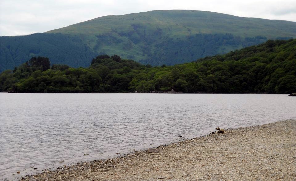
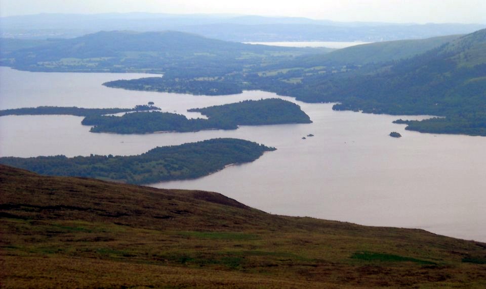
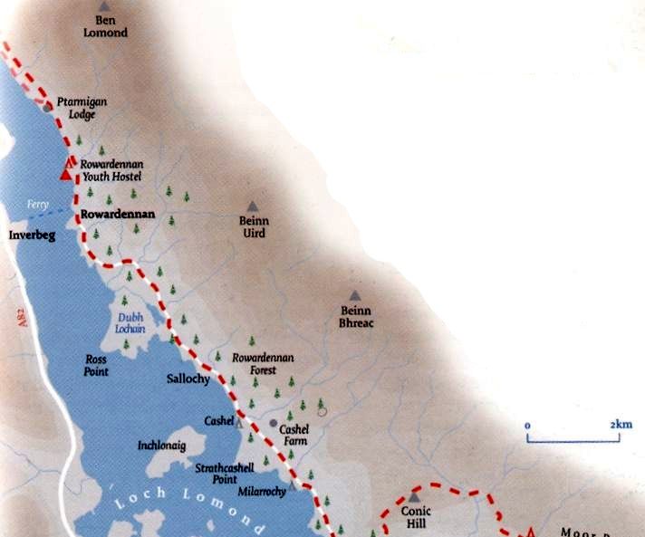
This beautiful walk starts at the Forestry Commission’s car park at Sallochy on Loch Lomond and is three miles in total.
It involves some moderately steep slopes, but there is a mixture of narrow paths and some broad, firm tracks as well.
Sallochy Bay is a camp site and picnic spot some 20 miles north of Milngavie, on the east side of Loch Lomond between Balmaha 
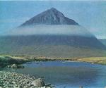
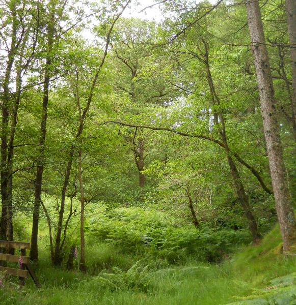
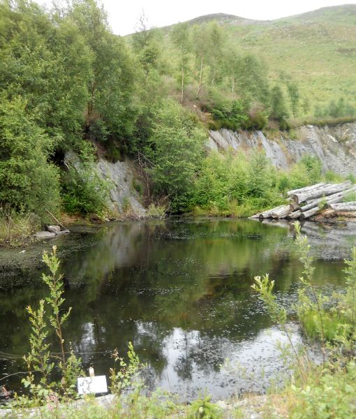
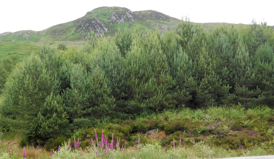
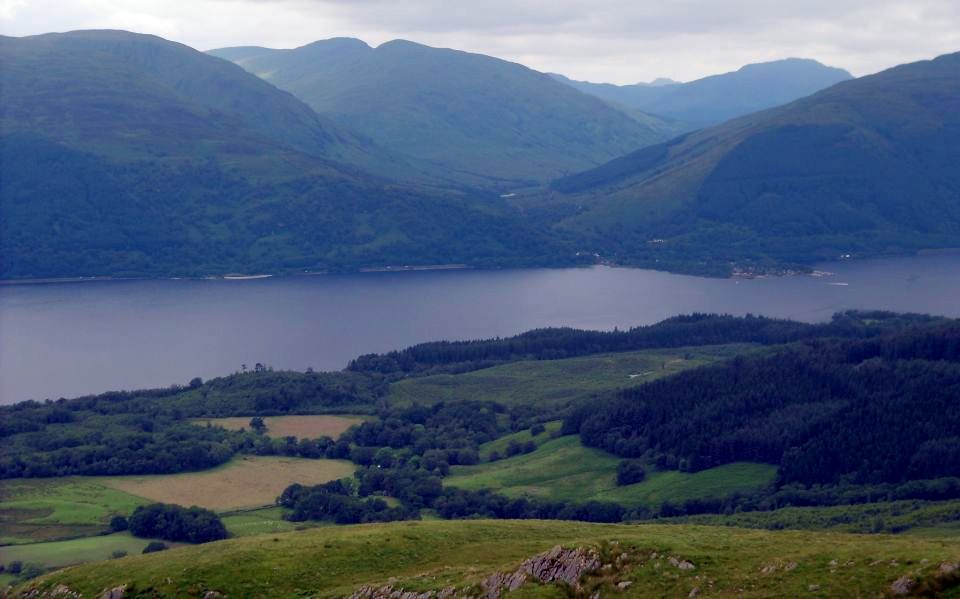
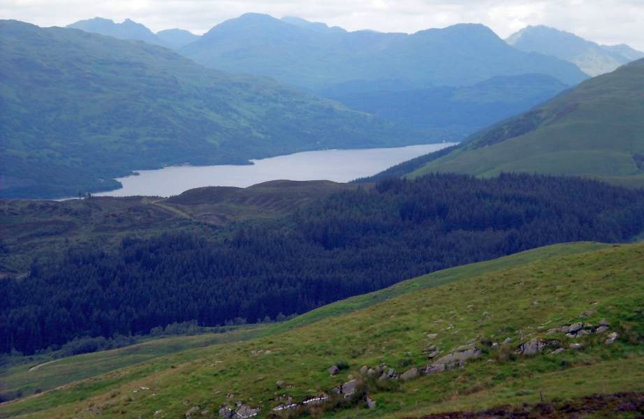
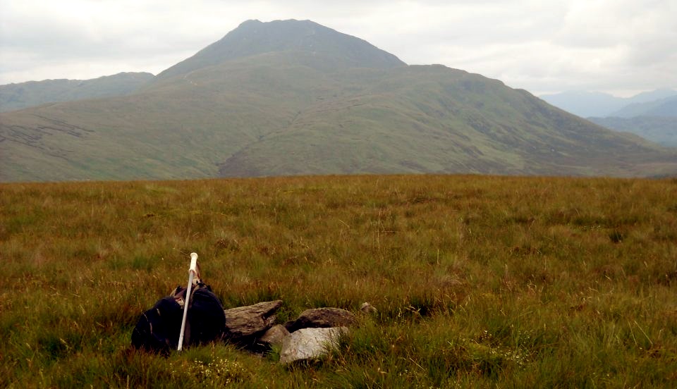
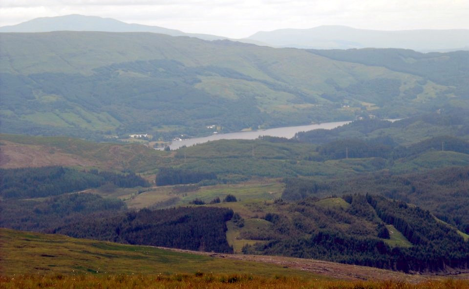
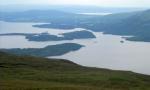
and Rowardennan.
On a fine day you will find families playing on its beach with a few braver souls splashing in the Loch. It really is an entrancing spot and on a fine day the waters sparkle in the sunlight.
The circular walk is well sign posted with the usual Forestry Commission waymarks — wooden posts with blue, red and combined blue and red bands.From the car park make your way back to the main road. Cross it to a set of wooden posts and follow the path. Around 50 yards on at a fork in the path you can choose the blue or the combined blue and red waymarks.
The blue path is quite narrow and is the muddier of the two, but easily walkable. You follow the bank of a tumbling burn, with its many small waterfalls and crystal clear water. The Forestry Commission is clearing most of the non-indigenous young conifer trees leaving the indigenous oaks and birches on the slopes on each side of the path to restore the original environment.
After about a mile you reach a metalled track; turn left following the red posts that curve uphill for about 300 yards. After the track curves round to the right look for a path on the right. There is a final steep but brief climb to the sumnit of Dun Maoil from where there is a wonderful view of Loch Lomond and of Ben Vorlich and the Arrochar Alps.
Retrace your steps to the main track following it downhill past the turn-off to the blue path. You are now following the posts with the combined blue and red bands. Carry on downhill and just beyond a pair of yellow goal posts to warn of overhead power lines take the waymarked path to your right.
This descends past a desolate cluster of ruined cottages, Wester Sallochy on the OS map, descending to the main road and thence to the Sallochy car park. A further short walk is two miles north at Rowardennan. Park by the lochside and a short gravelled path leads to the war memorial to those
who died in the two world wars. Unfortunately, the memorial plaque has been wrenched from its stone base. Fortunately, the vandals were unable to remove a boulder nearby which is inscribed “The land rising from the shore of the Loch to the summit of Ben Lomond was dedicated in 1996 as the Ben Lomond National Memorial Park to be held in perpetuity as a tribute to those who gave their lives in the service of their country".


Beinn Uird Gallery Photo Gallery :: West Highland Way Photo Gallery

 << Back : Southern Highlands Index : Next >>


Scotland Index :: Scotland Walks

Glencoe | Ben Nevis | Knoydart | Isle of Skye | Isle of Arran

The Eastern Highlands | The Central Highlands | The Southern Highlands | The NW Highlands


Adventure Travel : Worldwide Mountaineering : Site Index

fb icon  google+ icon Linkedin icon  twitter


Guide Books & Maps - Scotland:-


West Highland Way: Footprint MapWest Highland Way - Map West Highland Way - Map Western Scotland & the Western Isles OS Road Map Northern Scotland OS Road MapSouthern Scotland OS Road Map Glasgow Popular Hills - Map

Loch Lomond North - Tyndrum, Crianlarich, Arrochar - OS Explorer Map Loch Lomond and Inverary OS Landranger Map  Loch Lomond South OS Explorer Map  Loch Lomond North OS Explorer Map


The High Mountains of Britain & Ireland  Munros Tables SMC  The Munros - Scotland's Highest Mountains  Scotland - Lonely Planet  NW Highlands - SMC Guide  Exploring the Far NW of Scotland  Guide to Walks in NW Highlands

Walking in Scotland - Lonely Planet Mountain: Exploring Britain's High Places  National 3 Peaks Walk Scottish Highlands Hillwalking Guide The Scottish Islands Bouldering in Scotland

Glasgow Visitor Guide - Colin Baxter Itchy Insider's Guide to Glasgow Glasgow Footprint Pocket Guide Glasgow Insight Pocket Guide Glasgow Guide Pub Companion Glasgow Scotland's Highlands & Islands - Rough Guide Scotland - Rough Guide

Glasgow Insight Pocket GuideCollins Street Map of GlasgowGlasgow: Then & NowThey belonged to Glasgow Phillips Street Atlas of Glasgow & West Central Scotland Glasgow: The Photographic Atlas100 Hillwalks around Glasgow 50 Walks in Glasgow & SW Scotland

Visit Scotland - Touring Guide Scotland: Where to Stay - Hotels & Guest Houses Scotland: Where to Stay - Bed & Breakfast Rough Guide ScotlandScottish Highlands & Islands - Rough Guide Scotland - Lonely PlanetScotland's Highlands & Islands - Lonley Planet Great Glasgow StoriesGlasgow & Surroundings - Insight Guide

West Highland Way: Official GuideWest Highland Way: Rucksac ReadersWest Highland Way: Trailblazer The West Highland WayWest Highland Way: Footprint MapWest Highland Way - Map West Highland Way - Map West Highland Way Wet Highland Way - Official Guide

Munro Almanac The High Mountains of Britain and Ireland The Munros: Scottish Mountaineering Club The Isle of Skye The Isle of Arran Wilderness Walks Ski Mountaineering in Scotland

More Wilderness Walks 50 Best Routes on Skye and Raasay Skye - W.A.PoucherMagic of the Munros Mountaineering in Scotland and Undiscovered Scotland by W.H.MurrayA Long Walk on the Isle of Skye

Classic Climbs - Central & Southern Highlands The Isle of Arran Lonely Planet, Walking in ScotlandPathfinder Guide: Skye and NW Highlands WalksPathfinder Guide: Fort William and Glen Coe Walks Rambler's Guide: Ben Nevis and Glen Coe 50 Best Routes on Skye and Raasay - Chris Townsend


Loch Lomond


Loch Lomond

Google Analytics


Google Analytics

extremetracking
 eXTReMe Tracker


extremetracking
Sitelock caingram.com
SiteLock
Sitelock
Sitelock caingram.info
SiteLock
Sitelock