  |
The Scottish HighlandsThe Mamores
Ring of Steall |
  |
| |
The Scottish HighlandsThe Mamores
Ring of Steall |
|
|
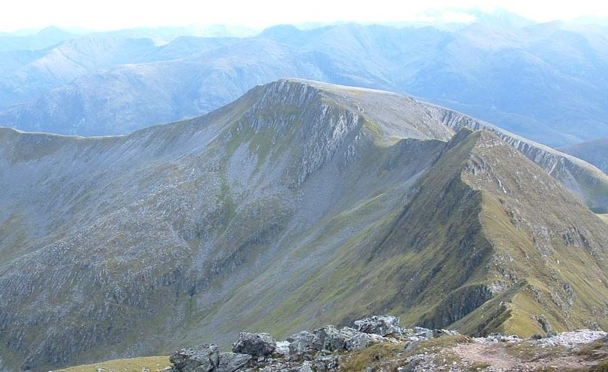
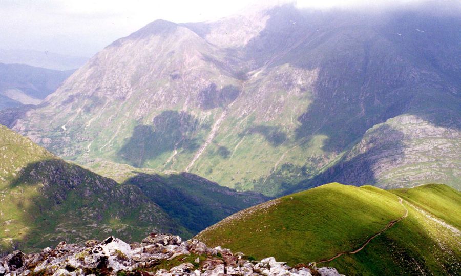
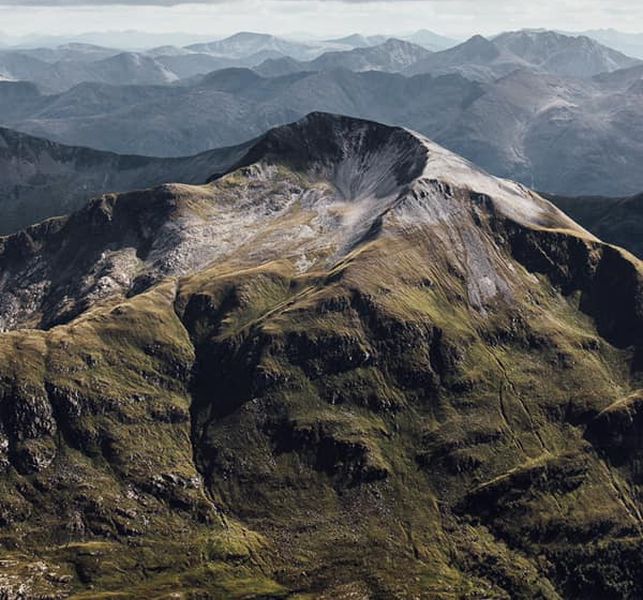
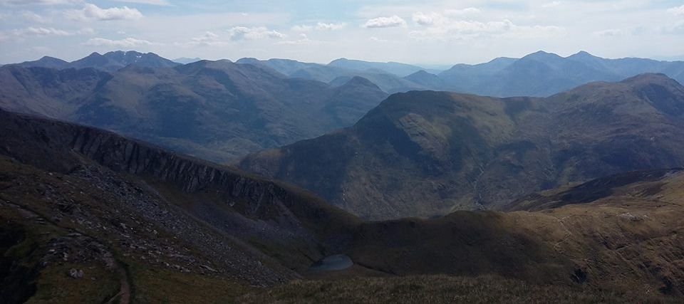
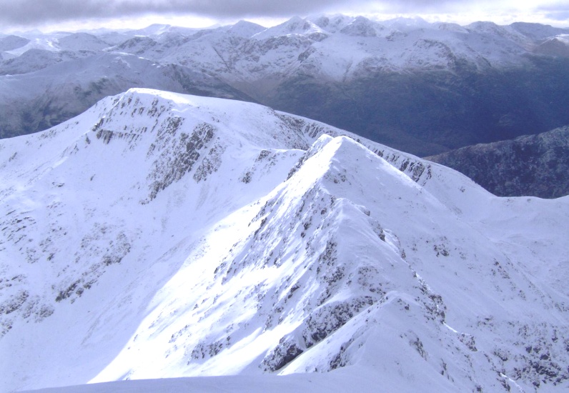
The Ring of Steall in the Mamores |
|
"Ring of Steall" in the Mamores The
"Ring of Steall"
is a classic route
traversing narrow, rocky ridges and four Munros:- An Gearanach, Stob Choire a Chairn, Am Bodach and the Devils Ridge to Sgurr a'Mhaim. |
|
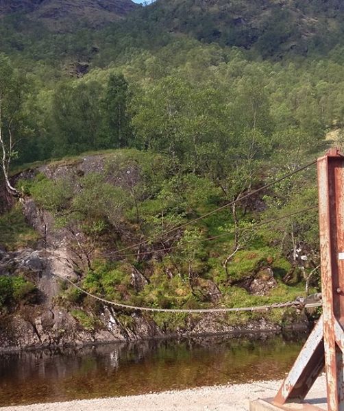
Steall Bridge |
|
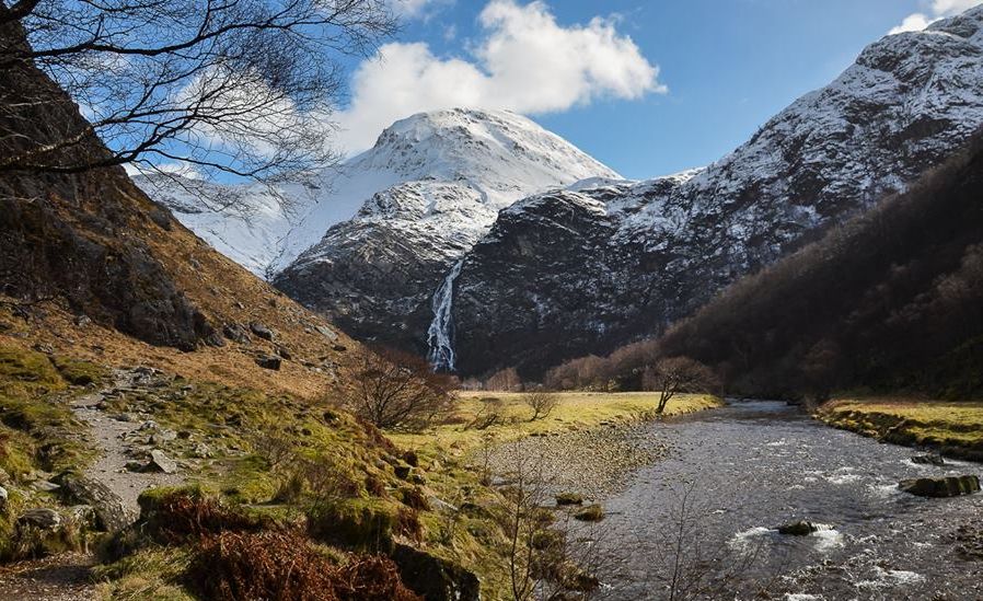
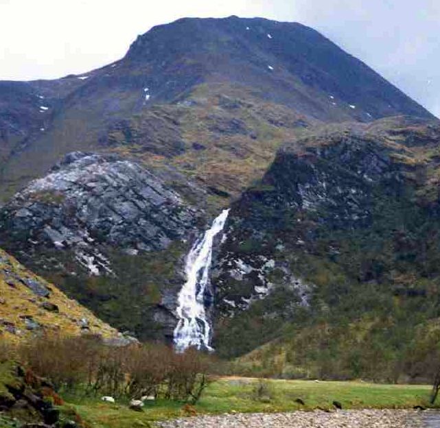
Steall
waterfall in Glen
Nevis beneath An Gearanach |
|
Steall
waterfall in Glen
Nevis beneath An Gearanach Steall waterfall is
Britain's second highest waterfall
with a sheer drop of 120 metres. An Steall Bàn means "The White Spout". Waterfalls Gallery |
|
Glen Nevis from An Gearanach |
|
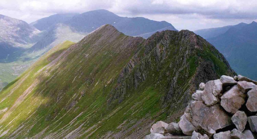
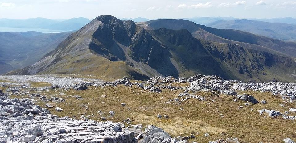
An
Gearanach ( 3222ft, 982m ) from Stob Coire a' Chairn |
|
An
Gearanach ( 3222ft, 982m ) from Stob Coire a' Chairn |
|
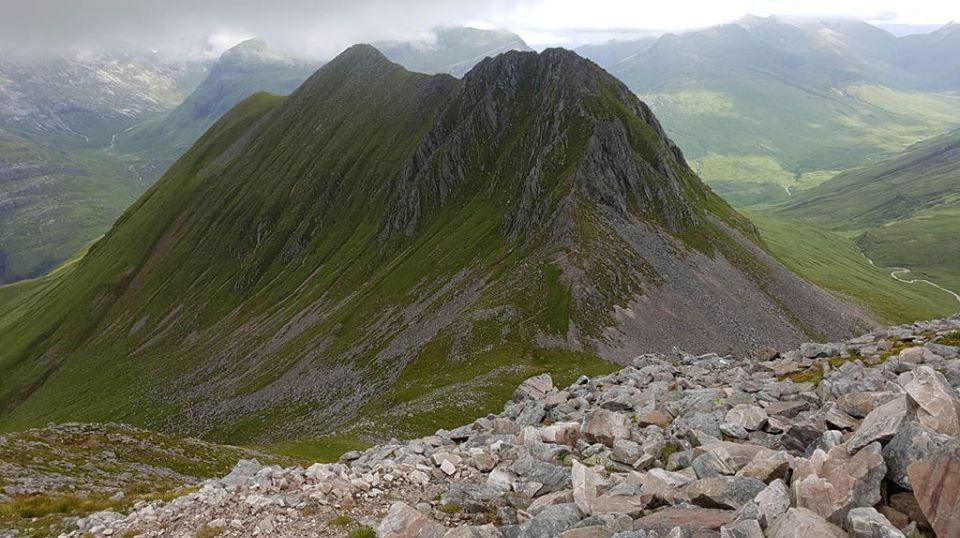
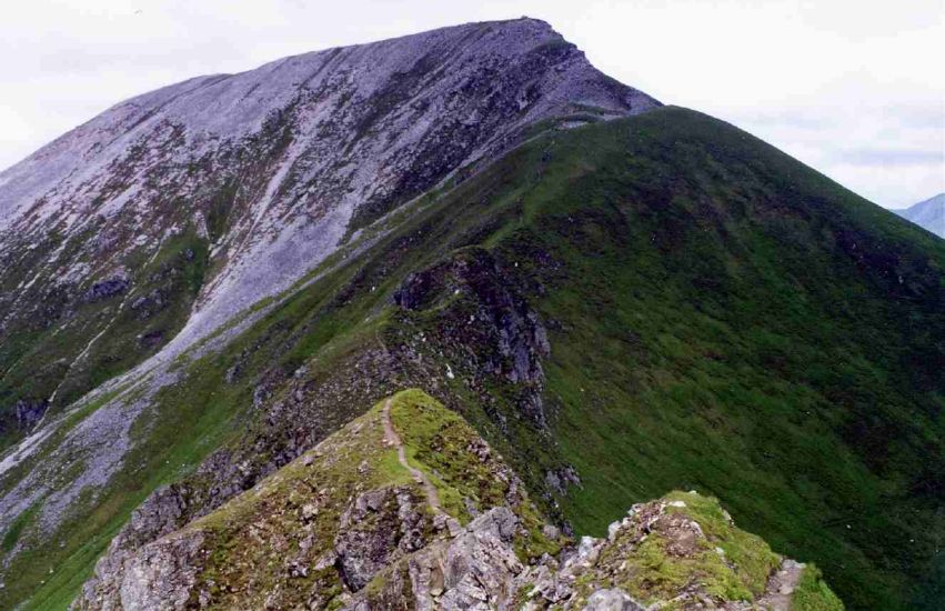
Stob Coire a' Chairn ( 3219m, 981m ) from An Gearanach ( Am Bodach in background ) |
|
Stob
Coire a' Chairn ( 3219m, 981m ) from An Gearanach Na Gruagaichean Am Bodach |
|
Stob Coire a' Chairn |
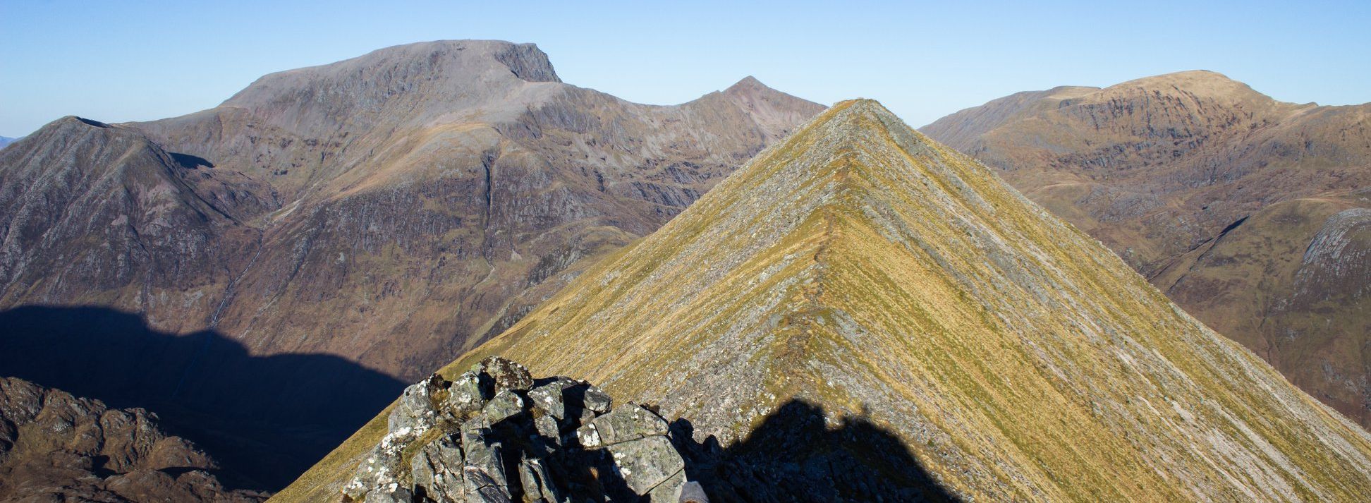
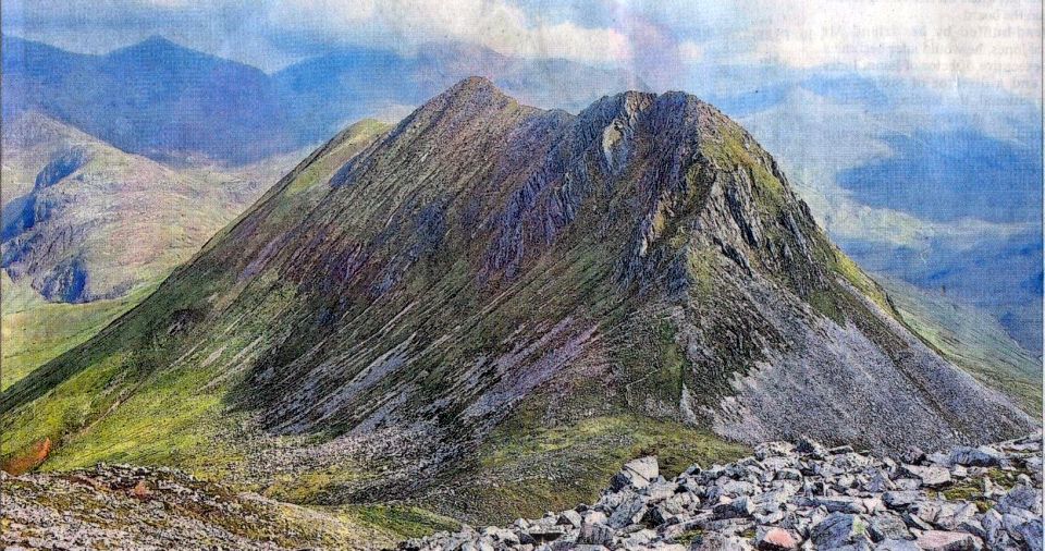
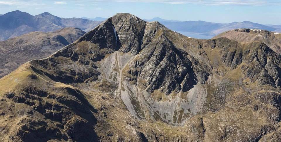
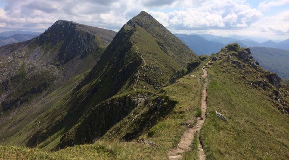
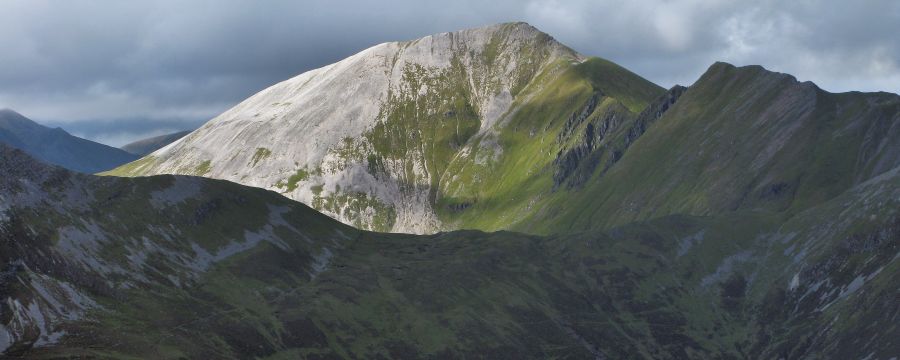
Sgurr
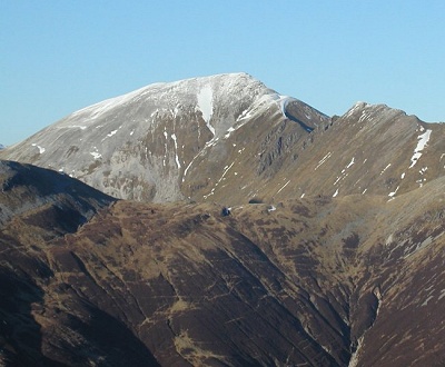
a' Mhaim ( 3606ft, 1099m ) from the Devil's Ridge Sgurr
a’ Mhàim is the second highest summit
in the Mamores. |
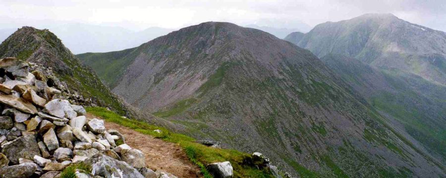
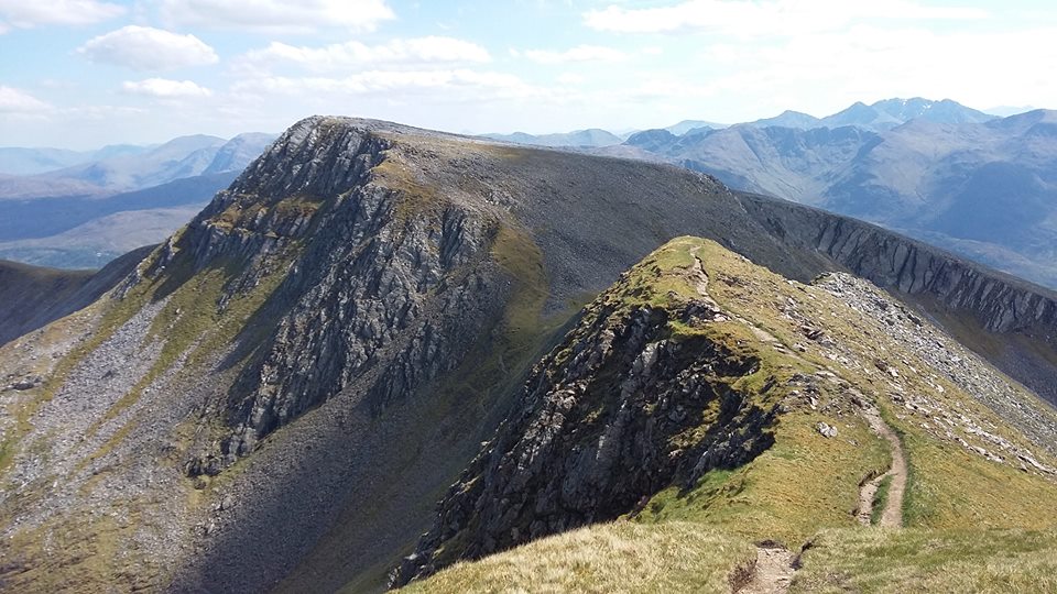
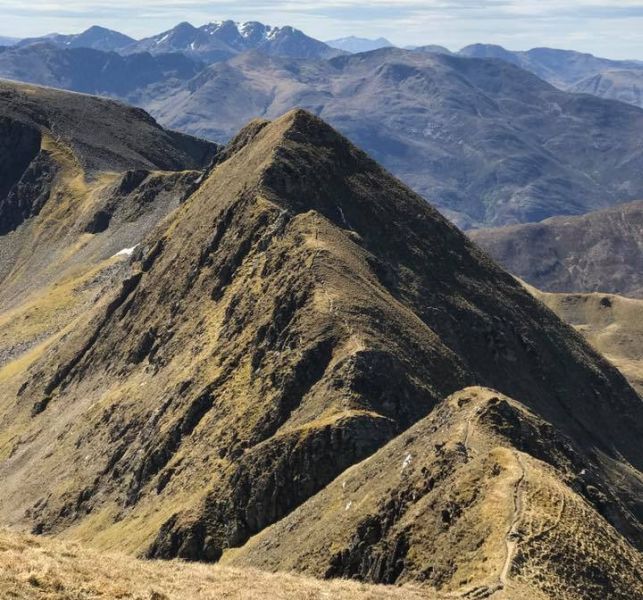
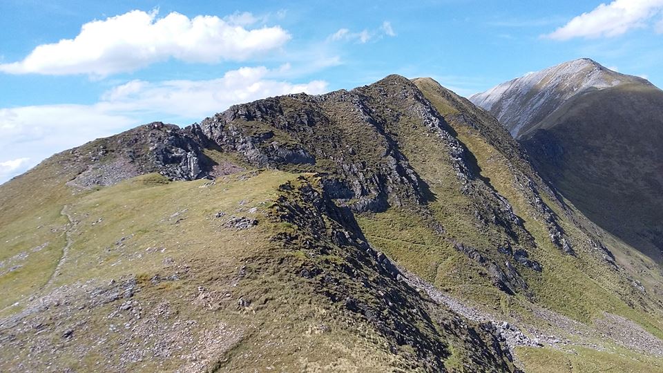
Devil's Ridge |
|
Sgurr
a'Mhaim in the Mamores above Glen Nevis. It consists of schist with quartzite on top yielding the distinctive light colouring. |
|
Sgurr a'Mhaim ( 3606ft, 1099m ) in the Mamores |
|
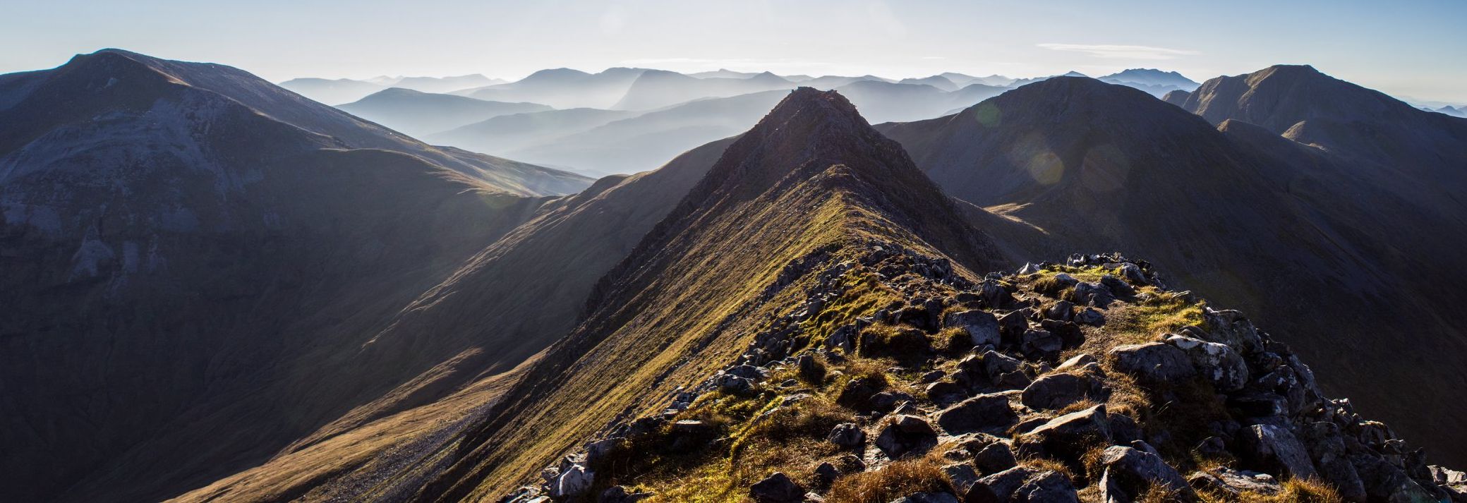
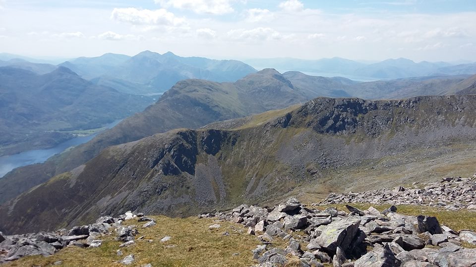
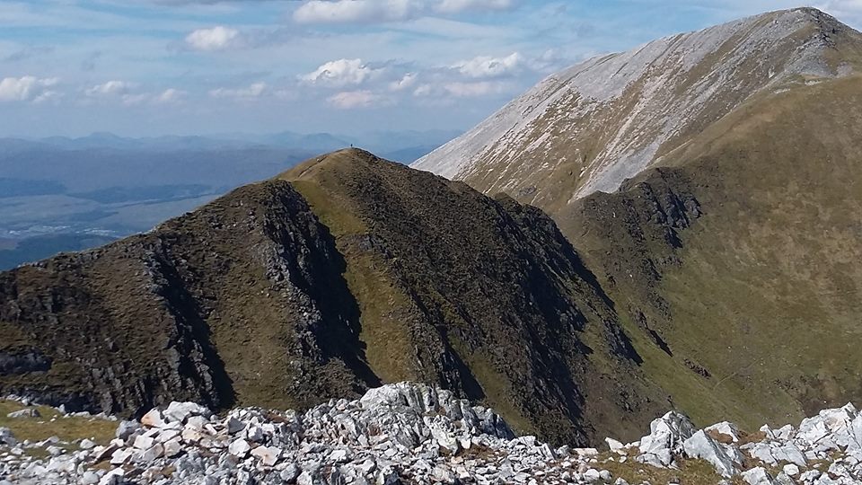
"Ring of Steall" in the Mamores |
|
"Ring of Steall" in the Mamores |
|
"Ring of Steall" in the Mamores |
|
"Ring of Steall" in the Mamores |
|
"Ring of Steall" in the Mamores |
|
"Ring of Steall" in the Mamores |
|
"Ring of Steall" in the Mamores |
|
"Ring of Steall" in the Mamores |
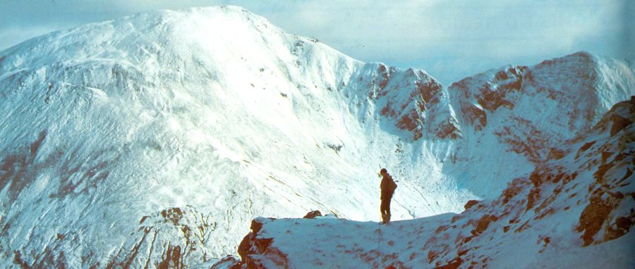
Devil's Ridge in winter |
Sgurr
a’ Mhàim from Beinn na Caillich |
|
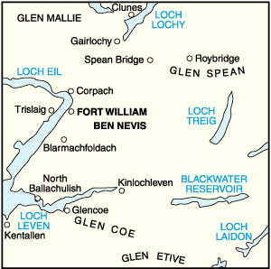
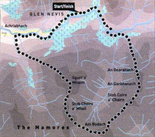
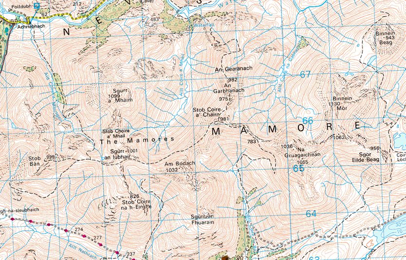
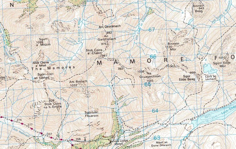
Map of the Mamores |
|
Map of the Mamores |
|
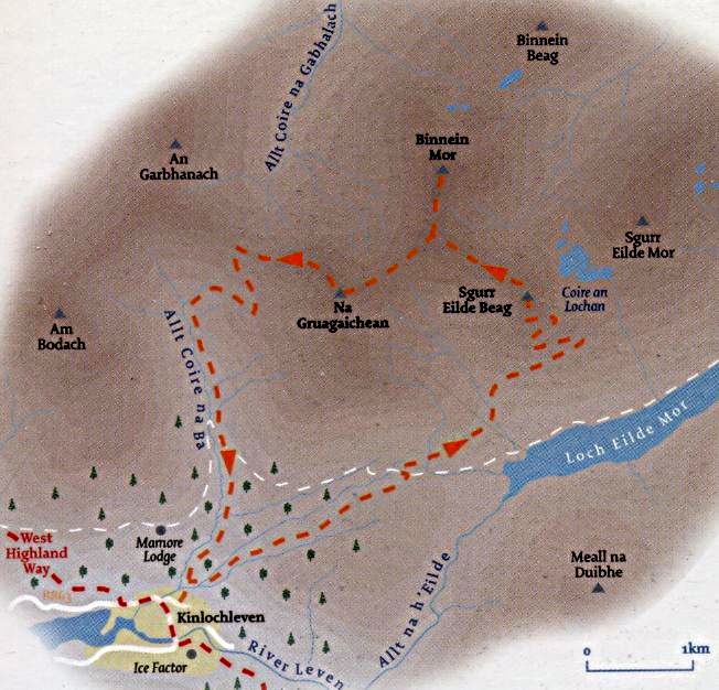
Route Map of the Mamores from Kinlochleven on the West Highland Way |
|
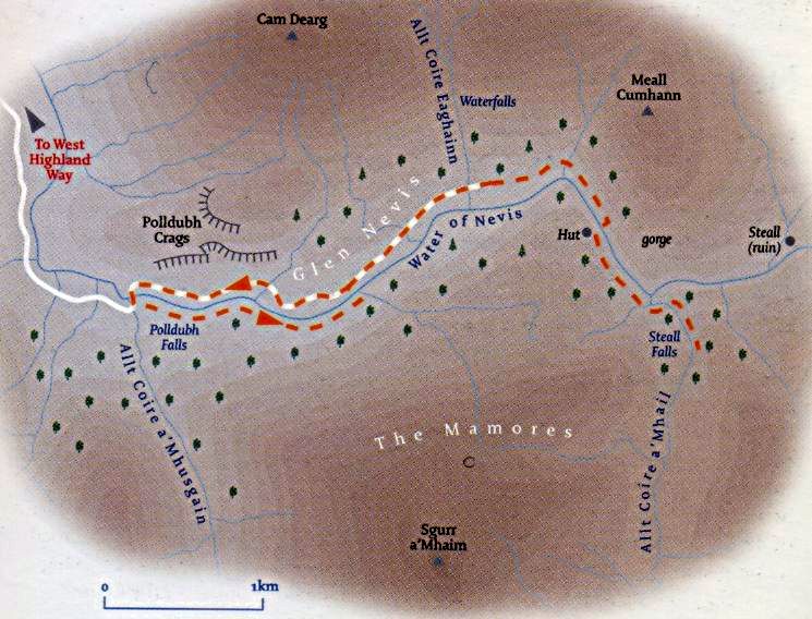
Route Map for Steall Falls from Glen Nevis |
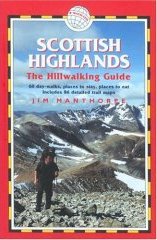
RING of STEALL - ROUTE DESCRIPTION:
Facing Ben Nevis from the south side of Glen Nevis the so-called Ring of Steall offers a classic round of the four Munros and three tops forming the central section of the Mamores.
It's a demanding outing with its fair share of quarzite boulders sharp ascents to stretch the calf muscles and a steep descent to strain the knees.
It's a varied route though, with two tight ridges offering some pleasant scrambling and given a good day the views stretch from the Paps of Jura to Schiehallion.
A clockwise approach from the car park at the head of Glen Nevis is best, reducing the amount of ascent necessary to the summit of An Gearanach at the start
and leaving the tough descent to a lower point in the glen from the summit of Sgurr a‘ Mhaim until last.
This means ascending back up the glen by the river and on the road but this is preferable to a long and gruelling ascent of Sgurr a‘ Mhaim.
From the car park, follow the path up the wooded glen and through the narrows to Steall meadows facing the Steall waterfall below An Gearanach.
Keep right where the path divides and cross the wire bridge across the Water of Nevis.
Continue past Steall hut and through an extensive area of marshy ground to cross the wide burn below the waterfall and gain the hillside beyond.
Zig-zag up the hillside into the small corrie on an increasingly obvious path which swings right to gain the north-west ridge and the summit.
A fine rocky ridge leads south to An Gearanach ( 982m ) and offers entertaining scrambling if taken direct followed by a steep descent to a col from
where the north ridge of Stob Coire a‘ Chairn leads steeply to the summit of the second Munro of the day ( 981m ). The route then leads over a rocky
unnamed top before another steep and rocky ascent to the summit of Am Bodach (1032m).
The next lop of Sgorr an Iubhair ( l001m ) is gained with much less effort before turning north to the Devil's Ridge. This offers an exposed but technically
straightforward rocky and grassy ridge with a bit of scrambling before a short ascent over the boulderfield of quartz blocks forming the summit of Sgurr a‘ Mhaim,
at l099m the highest point on the walk.
Gain the north-west ridge and descend through quartzite to a long sleep and wearisome zig-zag descent into Glen Nevis. Turn right before the road
and follow the path along the south side of Water of Nevis to a footbridge from where the road leads gently uphill back to the car park.
Ben Nevis | Knoydart | Isle of Skye | Isle of Arran | The West Highland Way
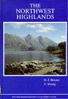
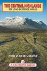
The Eastern Highlands | The Central Highlands | The Southern Highlands | The NW Highlands