The shortest and
simplest route to the
Langtang Valley to the North of Kathmandu requires a mere
three days to reach the gompa ( Buddhist monastery ) at Kyanjin
cradled amongst huge boulders at
the foot of the great glacier tumbling from the mighty snow-pyramid
of the majestic, 7000metre
Langtang Lirung - the reigning peak of this himalayan hillwalking
and mountaineering paradise.
A 12-hour uphill crawl
in a dilapidated,
over-crowded, over-loaded local bus from Kathmandu through
the market town of Trisuli Bazaar to the roadhead at Syabru Besi
is followed by two days hard
walking through the deep, dark gorge of the Langtang Khola, lined
with ancient,
moss-and-lichen-covered forests, before one emerges onto the open
moorland of the broad, U-shaped
valley flanked by an imposing avenue of high, snow-capped peaks.
The more usual route
takes only an extra
day starting from the previous roadhead at Dhunche and
climbing through forests of chir pine to the Tamang village of
Syabru, perched high on the crest
of a ridge. On approaching Syabru superb views unfold across the
Trisuli River Valley and barren,
rugged foothills to the jagged white teeth of the Ganesh Himal
ranged along the northern frontier
with Tibet. A steep descent from Syabru through terraced
hillsides and across rough landslips joins
the path from Syabru Besi in the depths of the gorge. A tragic
accident occured on this stretch
when a Dutch trekker lost her footing and fell to her death.
For those
unacclimatized to high altitudes
a rest day in Langtang village may be necessary before
proceeding to the cluster of lodges surrounding the gompa at
Kyanjin. Easily accessible hilltops
above provide fine views of the spectacular, himalayan valley.
On the second of my
three visits to the
valley I was in the company of two Nima Sherpas:- Nima
Lakpa Sherpa, my cook, veteran of five previous treks with me,
and Nima Gyaltzen Sherpa, an
agricultural graduate but working as a trekking sirdar. However
as Sherpas, and Sherpanis, are by
custom named after the day on which they are born it is not
surprising to have several Sherpas in a
trekking group with the same name. ( Nima - Sun, Sunday )
From Kyanjin it is a
long but pleasant half-day
in magnificent, mountain scenery to the stone-built
shelters at the yak pastures of Yala high on the northern valley-side.
Above Yala wind-swept
tundra and a broken
rock-face leads to a short ice-wall below the summit
snowfield of Yala Peak. A final knife-edged arete, requiring
strong nerves and steady feet, gains
the rocky top ( c5500metres ) of this permit-free, alpine-standard
peak for a superb 360degree
panorama.
From the tremendous
white pyramid of the
Langtang Lirung a great barrier sweeps round the northern
horizon encompassing the rocky spire of Kimshung and the huge
cliffs of Shalbachum. Close nearby
are the summits of Langshisa Ri and the beautiful, ice-fluted
Ganchenpo. Beyond stretch the serried
summits of the Jugal Himal with the prominent twin-tops of Dorje
Lakpa.
Starting at the yak
pastures of Langshisa
Kharka at the head of the Langtang Valley a remote and
hazardous route crosses the glaciated Tilman's Pass beneath
Ganshempo into the Jugal Himal. With
Nima Lakpa as guide I had a perilous crossing of this route when
we were lucky to escape with our
lives.
To the South, across
the valley, a high,
snow-covered plateau stretching between Pangen Dopku and
Naya Kanga ( one of the so-called "trekking peaks"
requiring a $200 climbing permit ) is breached
by the Ganja La - a possible exit route from the Langtang Valley
into the Helambu district.
From Kyanjin the route
crosses the
sparkling waters of the Langtang Khola and climbs through mixed
pine and rhododendron forests to a campsite on a small terrace
high on the southern flank with a
splendid outlook into the glaciated upper Langtang valley with
its imposing peaks of Langshisa Ri
and Dome Blanc.
Our attempt at
crossing the Ganja La was
thwarted by a snow-covered boulder field. Although we
could see the prayer flags fluttering on the col only a few
hundred metres ahead it was not possible
to make further progress. Every step was a lottery - an insecure
foothold on an ice-glazed boulder
or an abrupt, potentially leg-breaking, plunge into a void
between boulders.
Disappointment at
having to retrace our
steps was tempered by the tremendous vista across the
Langtang Valley of the huge glaciers and giant scree fans
sweeping down from the great peaks of the
Langtang Lirung and Shalbachum. ( A second subsequent attempt had
also to be abandoned after losing
our cooking stoves on our descent from Tilman's Pass. )
The normal return
route from the Langtang
Valley to Kathmandu is from Syabru via the sacred lakes
at Gosaikund and across the Laurebina Pass. It was on this route
that an Australian backpacker lost
his way, easily done with the multiplicity of paths that criss-cross
the forested Nepalese
hillsides, and, incredibly, survived for 40 days in uninhabited
wilderness before being found by the final
helicopter sweep-search of the area.
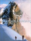
DETAILED ACCOUNT:
LANGTANG
1. Dhunche to Kyanjin:
It was cold and bleak with a steady drizzle falling as we unloaded our
gear from the bus at Dhunche and encamped on a dirty terrace above the
road. Clouds still enveloped the nountains in the morning when we set
off up the Trisuli valley. At Bharku we branched off and climbed
steeply through pine forests before contouring round to Syabru with its
wooden houses built along the crest of a ridge above terraced hillsides.
Clear skies at breakfast revealed the jagged summits of the Ganesh
Himal on the western horizon and a view down to the Langtang Khola in
its deep dark gorge between high, rugged, cloud-covered, mountains.
From Syabru we descended through the grain fields, contoured around a
side-valley, then dropped steeply down through bamboo jungle and across
a rough, raw landslip to reach the banks of the turbulent Langtang
Khola. For the rest of the day we toiled uphill through damp, gloomy
forests alongside the raging waters as they cascaded down over huge
polished boulders. Rain was falling again in late afternoon when we
reached the clearing at Lama Hotel with its cluster of lodges.
Next morning the path continued to climb steeply through the dark
forests between high, enclosing hillsides with occasional glimpses of
snow-capped peaks. After about an hour the path levelled off and
emerged from the gorge into open, boulder-strewn moorland. It was now a
long but pleasant walk through the U-shaped valley past the police
checkpost at Ghora Tabela to the stone-built houses of Langtang village
and onwards to the flat, grassy fields beneath the gompa ( Buddhist
monastery ) at Kyanjin. Inmediately overhead towered the vast icy wall
of the Lirung - the highest peak in the Langtang Himal at 7245m (
23,765ft ).
2. Kyanjin to Yala Kharka:
Leaving Pasang to look after our food supplies I set off with the two
Nimas ( another Nima, Nima Gyalzen Sherpa, was my guide for this trek ),
Kadke and Hem Bahadur. It was a fine winter's day with perfectly clear
blue skies as we walked along the level floor of the valley beneath the
snow-plastered ridge ef the Ganja La Himal towards the graceful
Ganchempo ( Tilman's Fluted Peak ) at the valleyhead.
Shortly our route began to climb the steep, grassy slopes on the
northern flanks of the valley. Tremendous views unfolded as we gained
altitude. Behind us was the massive white wedge of the Lirung and its
smaller, jagged, outlier Kimshun. Across the valley Naya Kanga, one
of the so-called "trekking peaks ", rose abeve the Ganja La, a high
snow pass from the Langtang valley into the Helambu region.
Above some stone huts, abandoned for the winter, the path contoured
along the steep hillside. Ahead was a breathtaking view of Ganchempo
with its elegant ridges and sheer icy faces. It was then only a short
haul up to the deserted stone huts at Yala Kharka.
3. Yala Peak:
Early next morning I plodded slowly up the slopes above the huts. The
two Nimas were to follow bringing a packed lunch which they and
Khadke were still preparing. It was bitterly cold beneath crystal clear
skies as I crossed an undulating plateau with large snow patches.
From a high point at some rocky pinnacles there was a short drop to a
boulder field beyond which arose Yala Peak.
In a spectacular setting amidst a prefound silence I waited for the two
Nimas before starting to scramble up the rocky hillside above the
boulder field. It was easy going made difficult only by the altitude.
We angled across the rough, awkward slope and climbed a short gully to
a shoulder on a ridge from where it was not far to the foot of the
ice-cap. Here we roped up and put on crampons. An initial steep climb
over hard, broken ice led to a gentle
snow slope sweeping up to a knife-edged summit ridge. Carefully we
inched our way along the last 20ft to the rocky pinnacle to command
a superb himalayan panorama.
Frem the huge white triangle of the Lirung a mighty ridge swept round
to the jagged Kimshun and onwards to the sheer rock walls of Shalbachum
rising above us only a short distance away. Further round to the East
were the 6,000m summits of Pemthang ( Dome Blane ), Langshisa Ri and
the ice-fluted Ganchempo. Across the valley the long sweep of the Ganja
La Himal was dominated by Naya Kanga.
On our leisurely descent frequent stops were made to examine the
snow-covered approach to the Ganja La - our next objective.
4. Ganja La:
I had hoped to return to Kathmandu by crossing the Ganja La high pass
but it was evident from our trip to Yala that the route was under heavy
snow cover. We also learned that another party had recently found the
crossing te be impassable. We therefore decided only to make an attempt
to reach the pass and return to Kyanjin.
Before breakfast next morning I climbed to the ridgetop immediately
above Kyanjin for a spectacular close-up view of the Lirung and Kimshun.
Again leaving Pasang with our surplus equipment and food I set off with
the two Nimas and Khadke. From Kyanjin we crossed the
Langtang Khola and climbed through snow-drifted rhodedendron forest.
Emerging onto open slopes we continued on a rising traverse past
same ruined huts and up to the crest of a spur. A tricky descent over
large boulders brought us to a superb campsite on a level terrace with
a magnificent outlock. Across the valley, surmounting sheer walls of
rock and ice, stretched the mighty ridge of the Langtang Himal:- the
Lirung, Kimshun, and Shalbachum. Huge ice-falls and glaciers tumbled
between moraines and great fans of scree. Further over there was a
splendid view into
the remote, upper Langtang valley flanked by Mts. Pemthang and
Langshisa Ri.
That night Cassiopea and Orion cartwheeled across a star-spangled sky
disappearing ‘stage left’ as the Plough entered ’stage right‘.
Only Nima Gyaltzen was accompanying me on the attempt to reach the
pass. Traversing round from our campsite we crossed an ice-bound
gully then cramponned up a long, easy, snow-slope. Eventually the
gradient slackened as we reached a large cairn. An extensive boulder
field stretched ahead into a long, wide cwn. Overhead the sun shone
wanly through a veil of thin, high cloud. At first we made good
progress over the moraine but the conditions underfoot became more and
more awkward due to the soft snow covering the boulders. Every step had
to be probed but there were still many slips into crevices. Slowly we
struggled along the cwn. On our left soared high rock walls with
snow-covered ledges. On our right towered Naya Kanga with a prominent
nose on its ice-bound NE ridge - the normal route to the summit.
After a short drop a steeper snow slope led up into an upper cwm. Atop
a low wall we could see the prayer flags marking the pass. The
distance to be covered was not great but the conditions had become
impracticable - it was taking too much time and effort to make progress
in the deep soft snow. We rested on a large boulder for a final
appreciation of the magnificent mountain wilderness surrounding us
before reluctantly
heading downwards. Many pauses were made to admire the peaks of the
Langtang Himal extending across the northern horizon directly in front
of us:- we seemed to be even higher than Kimshun and Shalbachun.
Although disappointed at not having reached Ganja La it had been a good
day in the mountains.
5. Kyanjin.Ri
We awoke to clear blue skies and made a leisurely descent to Kyanjin.
With days to spare through not having crossed Ganja La, I stayed one
more day in the Langtang valley and made a re-ascent of Kyanjin Ri
which I had previously clinbed on my first visit to Langtang a few
years before.
This time Pasang was happy to escape his guard duties and to join Nima
Gyaltzen far the excursion to the nearby hilltop. From the
snow-capped summit a splendid panorama of peaks swept round the skyline
from Yala via Shalbachun and Kimshun to the Lirung. Across the valley
we could retrace our route up the snow-bound mountainside to our
campsite and onwards to the Ganja La - a small gap in a lonq high ridge
of peaks and neves.
Two days later we were back at the roadhead at Syabru Bensi and the
follewing day in Kathmandu - the noisy, crowded streets a marked
contrast to the serene silence and empty spaces of the Langtang Himal.