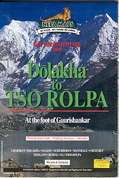
An alternative more sporting approach to the Everest region is through the remote and mysterious Rolwaling Valley - described in Tom Weir's book " East of Kathmandu " and also visited by ( Sir ) Chris Bonington on an abortive expedition in search of the legendary yeti.
It was at the trailhead at Charicot that I first met Nima when he was recruited by our sirdar Lal Bahadur as a porter on his very first trek. I watched in disbelief as the two huge kitbags of Horst and his wife Ursula tottered off on a pair of spindly brown legs. However Nima was to accompany me for 32 days all the way to Gokyo and back to the roadhead at Jiri.
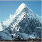
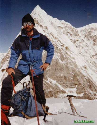
From Charicot we headed up the scenic, steep-sided valley of the Tamba Khosi. High waterfalls cascaded from the heights and rudimentary bridges crossed the many side-streams. Ahead, the twin summits of Gauri Shanker, once thought to be the world's highest mountain, provided a prominent landmark.
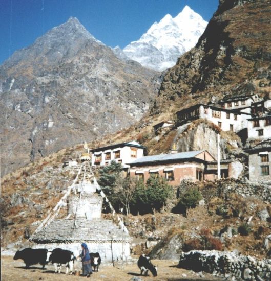
Beyond Nima's home village of Tashinam we walked for two days on faint, little-used paths through dark, gloomy forests before reaching the Rolwaling Valley and Beding, the main village of the local community of Sherpas with its large chorten ( Buddhist shrine ), gompa, and stone-built houses with their fluttering prayer flags.
 Gauri
Shankar from Beding Village
in the Rolwaling Valley |
The gompa serves as the birth control centre - when the population of the isolated valley starts to exceed the available food supply more young men are put into the gompa to become lamas ( Buddhist monks ).
Lal Bahadur had been left behind at the police post at Semigaon to sort out problems with our climbing permits and had not been seen for three days. Nuru,our cook, was worried. "Much danger in forest - bears - tigers". A search party was dispatched but shortly afterwards Lal Bahadur turned up safely - despite having walked all night through the forests.
High in a side-valley, above the summer settlement of Na with its yak pastures and stone-walled potato fields, we encamped in a wide snow-basin enclosed by the ice-bound Chugimago and Yalung Ri. A magnificent outlook extended across the Rolwaling Valley to the imposing Chobutse and Kang Nachugo lining the northern border with Tibet.
 Chobutse
on ascent to High Camp for Ramdung Go
|
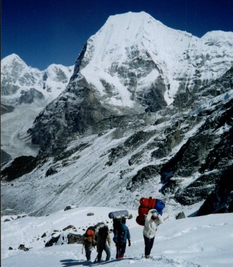
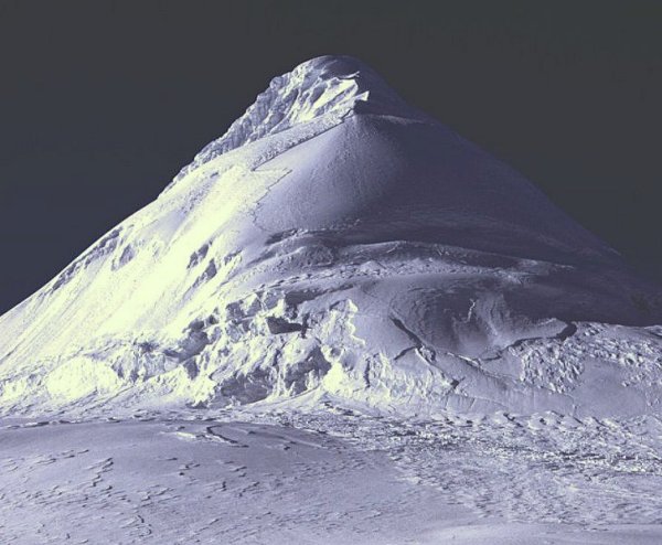
At our high camp Horst was suffering from a slight touch of altitude sickness and I set off with Lal Bahadur for Ramdung Go - the first of our two climbing objectives. Successfully negotiating a verglassed boulder field we gained the broad, easy-angled neve of the upper glacier but our efforts were then frustrated by the recent snowfall of deep, soft snow. We pushed on to reach a rocky prominence ( c5600m ) to enjoy our packed lunch encircled by a tremendous himalayan landscape: Gauri Shankar, Kang Nachugo, Chobutse and Chugimago all resplendent in dazzling marble-white against an azure sky. Only a short distance away the steep prow of Ramdung soared above the glacier but we had run out of time - a further high camp would have been necessary and this was outwith our schedule.
 Ramdung
|
|
Two days later we left Na to continue our journey up the Rolwaling Valley to encamp in a grassy ablation valley ensconced beneath the large Tsho Rolpa lake at the terminus of the Trakarding Glacier. Scrambling up the loose, rough scree of the moraine wall next morning we gained a dramatic view the length of the lake to the huge triangular east face of Kang Nachugo.
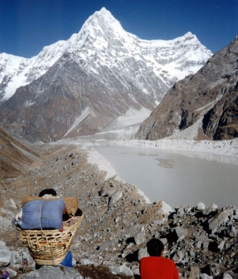 Kang
Nachugo above Tsho Rolpo glacier lake
|
In the opposite direction the white massif of Piphera Go Char and our second objective of Parchamo formed a great barrier sweeping up at the head of the glacier. A level walk along the crest of the moraine soon came to an abrupt end and we dropped down to pursue a tortuous and hazardous route across narrow ice-bridges between huge, yawning crevasses splitting the corrugated surface of the glacier. Clearing the zone of continuous stonefall cascading from the rotten cliffs of Chobutse we climbed above the glacier to pitch our tents on a set of small platforms levelled out by previous groups.
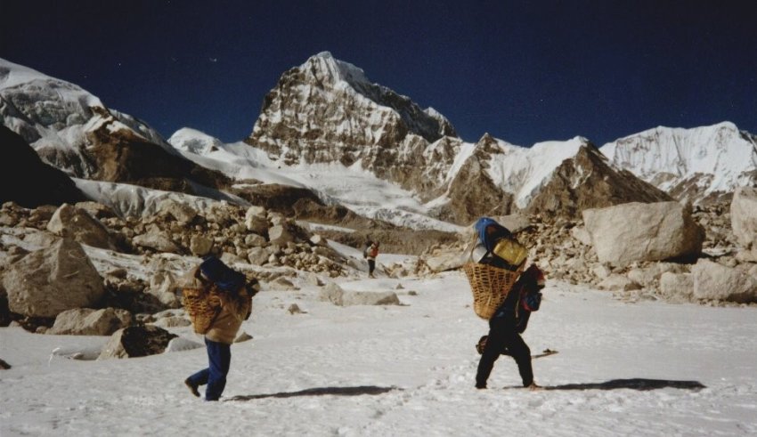 Mt. Takargo on ascent of Upper
Drolamboa Glacier to Trashe Labtse
|
An easy rock buttress and ice-bound couloir by-passed the foot of the ice-fall tumbling from the Drolamboa Glacier but ropes were then required to negotiate a short ice-wall before we emerged onto the gentle gradient of the upper snowfields between an avenue of magnificent peaks. An arduous ascent of a steep, hard-snow slope attained the 5,800m top of the Trashi Labtse sandwiched between Parchamo and the sheer rock precipices of the neighbouring Tengi Kagi Tau. Just below the col an overhang provided a shelterstone for our tents. Below us to the east the twin peaks of Thamserku and Kantaiga glowed a golden orange in the final rays of the setting sun.
 Pharchoma
from the Trashi Labtse
|
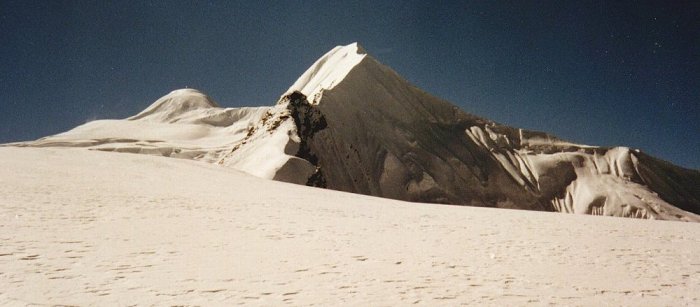
The steep, blue-ice taxed my nerve and cramponing ability to the limit but at last I stood with Lal Bahadur on the narrow, corniced, summit ridge of Parchamo. Far below snaked the lateral moraines and white-ice of the Drolamboa Glacier flanked by the avenue of great rock and snow peaks. Beyond the nearby Chobutse we could see Kang Nachugo and the twin summits of Gauri Shanker. To the east the tops of Everest, Lhotse and Makalu protruded like islands from a sea of lesser peaks. With difficulty we could distinguish Chamlang, Baruntse, Ama Dablam and also Kang Taiga and Thamserku the sentinels above Namche Bazaar. Across the pass loomed the unclimbed, spire of Tengi Kagi Tau.
 Tengi
Kagi Tau from summit ridge of Pharchoma
|
On the col our camp had already been vacated. Horst had again been suffering from the altitude and, with Ursula and the rest of our trekking crew, had descended into the valley of the Thame Khola.
Not until well after dark, leg weary and foot-sore after a 2000 metre descent and 14 hours on the go, did Lal Bahadur and I rejoin them in the village of Thame.
It was then only a half day downhill to Namche - and a further eight days hard walking across four passes to the roadhead at Jiri.
( From " Heavenly Pursuits ", Weekend Extra, Glasgow Herald, 17th August 1996 )
Upgrading of Route through Rolwaling Valley:
Dolakha - The 'Tasi Lapcha Pass' footpath, which is the only footpath to Everest, has been opened. The route to Mount Everest has been opened through Tasilapcha Pass through Rolwaling Valley. With the opening of this route, which is very difficult to go across the mountains, it will become an option for those who want to trek through the Rolwaling Valley to Mount Everest.
Although this 5,700 meter high trail was opened long ago, it was difficult for foreign tourists to travel due to lack of management. The movement of foreign tourists has also increased in the Rolwaling Valley after the Covid19 after the construction of the footpath under 'The Great Himalayan Trails'. The high Himalayan Everest-Rolwaling Tasilapcha trail is considered to be the main one under 'The Great Himalayan Trails' which includes the main 10 trails of the country. Guides consider the Tasilapcha trail very attractive to see the different languages, cultures, lifestyles of the Himalayan region. This year,1,135 foreign tourists from 39 countries have visited the Rolwaling area. Most of them are German citizens. Yangti Sherpa,tourism assistant of conservation area, said that a large number of foreign tourists have come to Rolwaling Valley after the Covid-19. "According to the data of the protected area, about 1200 foreign tourists have reached the Rolwaling area in 2022," she said. 'We have not kept the data of additional tourists who have received approval from the Department of Tourism. Half of those who came have gone to Everest after passing Tasilapcha.' The year when the corona epidemic started,the movement of foreign tourists in Rolwaling area was stopped. She said that with the construction of the Tasilapcha Pass footpath, more tourists will be expected to increase in 2023 after the construction of a place where tourists can stay. The Tasilapcha footpath passes through Chho-Rolpa Himtal and Dudhkund in the Rolwaling valley and connects to the base of Solukhumbu. The said footpath was constructed by the tourism department at a cost of 4 crores. Accommodation shelters with 10 waiting rooms have been built for tourists walking on the footpath. In the past,there were no places to stay on this trail.
Likewise, Dawachiring Sherpa, chairman of Tasilapcha Pathway Construction Committee, said that in the difficulty of making a footpath, iron ladders and soft wire ropes were cut out of stones. According to him, in the past, foreign tourists and local guides, porters used to cross the Tasilapcha pass and travel back and forth to the Khumbu region. Later,the facility of direct air travel from Kathmandu was added for the Khumbu region. It was dangerous to walk to Khumbu from Tasilapcha area. Tasilapcha became deserted due to the problem of living in the middle. He said that after the construction of Tasilapcha footpath, foreign tourists have increased. "From Beding through Chho-Rolpa, Dudhkund Thackering,this trail leads to the Khumbu area of Mount Everest," he said. It used to take 7 days to reach Thame.' He said that tourists who used to walk to Mount Everest through Jiri now use this footpath. Tourists who walk through this footpath crossing the mountains are attracted to Tasilapcha, he said, especially because they have to cross the Chho-Rolpa Himtal. The main attraction of foreign tourists who prefer to climb the mountains is the Rolwaling area. Tourists who walk on the footpath and climb the mountains go to Everest base camp through Tasilapcha.
The arrival of foreign tourists has increased in 2022 in Rolwaling Valley, which has been deserted for 2 years due to Covid. Hoteliers in Beding and Nama are excited with the increase in the number of foreign tourists. Daba, who is also a hotelier, said that after the opening of the Tasilapcha trail,the number of tourists going to Everest has also increased. "After the construction of a footpath in this desolate area, not only foreigners but also domestic tourists have increased," he said. However, he said that only foreign tourists walk through Tasilapcha Pass by footpath. Tourists who reach the area spend hundreds of dollars a day. Tourists who reach Tasilapcha pass also climb small mountains in Rolwaling area.
Climbing the 6,100-meter Farchhyamu / Parchermo Peak near Tasilapcha Pass has attracted foreign tourists. After climbing the peak, the next day they will pass through Tasilapcha and go to Khumbu Padmargi. Especially during the training of the Himalayan trekking guide,the peak is climbed. Sachindra Kumar Yadav, deputy secretary of the tourism department, said that Tasilapcha Pass is the center of attraction for foreign tourists. "In the first phase, shelters have been built in Apthara Bhir, stairs and some places on footpaths by soling," he said. An attractive 'bivouac' (hiker's shelter) has been built in stone in memory of David Lama, a climber who died at Tasilapcha Pass. Joseph Einwacker, a citizen of Austria, built the bivouac for hikers.
Himalaya Map - Nelles ( UK , USA )
Nepal Trail Map - Nelles ( UK , USA )
Everest Base Camp Map ( UK , USA )
Khumbu Region Map ( UK , USA )
Island Peak - Climbing Map ( UK , USA )